Niederleis (Niederleis)
- municipality in Austria
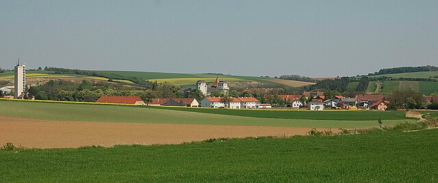
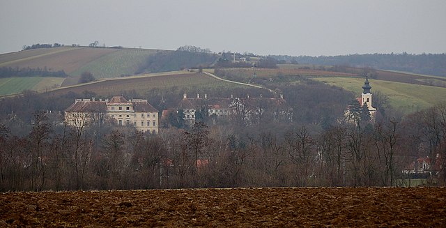
Niederleis is a charming village located in the Lower Austria region of Austria, and it serves as a great starting point for various hiking adventures. The surrounding area is characterized by beautiful landscapes, rolling hills, and vineyards, making it a picturesque destination for outdoor enthusiasts.
Hiking Trails:
-
Local Nature Trails: There are several marked trails in and around Niederleis that cater to different skill levels. These may vary in length and difficulty, which allows hikers to choose routes that suit their experience and fitness level.
-
Wine Hikes: Given the region's viticulture, you can find trails that take you through vineyards. These paths not only offer stunning views of the surrounding countryside but also provide opportunities to learn about local wine production.
-
Forest Walks: The nearby forested areas offer peaceful hikes where you can connect with nature. Birdwatching and spotting local wildlife are common activities in these woods.
Scenic Highlights:
- Panoramic Views: Many trails in the area offer breathtaking views of the Danube Valley and the surrounding vineyards.
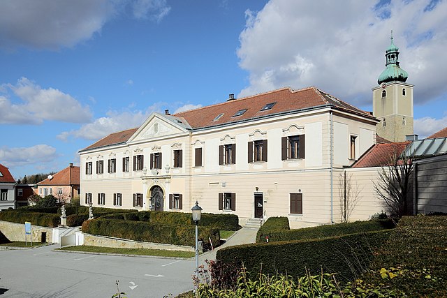
- Historical Sites: Some routes may lead to historical landmarks or quaint little churches, enhancing the hiking experience with a taste of local culture and history.
Tips for Hiking in Niederleis:
- Check Trail Conditions: Before heading out, it might be beneficial to check local maps and trail conditions. Some paths may be affected by weather or maintenance.
- Pack Accordingly: Ensure you carry enough water, snacks, and sun protection. In spring or fall, dressing in layers can help you adapt to changing temperatures.
- Local Regulations: Always respect nature by following local regulations and maintaining the area's clean and unspoiled beauty.
Getting There:
Niederleis is accessible by car and public transport, making it a convenient destination for day hikes or longer explorations of the natural beauty in Lower Austria.
Conclusion:
Hiking in Niederleis offers a wonderful way to experience the stunning landscapes and rich culture of the region. Whether you're an experienced hiker or a beginner, the trails around this village provide a variety of options to enjoy the outdoors. Always remember to plan ahead, respect the environment, and enjoy your adventure!
- Country:

- Postal Code: 2116
- Local Dialing Code: 02576
- Licence Plate Code: MI
- Coordinates: 48° 32' 59" N, 16° 23' 52" E


- GPS tracks (wikiloc): [Link]
- AboveSeaLevel: 253 м m
- Area: 19.52 sq km
- Population: 861
- Web site: http://www.niederleis.at/
- Wikipedia en: wiki(en)
- Wikipedia: wiki(de)
- Wikidata storage: Wikidata: Q665838
- Wikipedia Commons Category: [Link]
- Freebase ID: [/m/02qyhv3]
- GeoNames ID: Alt: [2770560]
- VIAF ID: Alt: [243212286]
- Austrian municipality key: [31636]
- Digital Atlas of the Roman Empire ID: [33406]
- Pleiades ID: [128468]
Shares border with regions:
Gnadendorf
- municipality in Austria
Gnadendorf is a picturesque area in Austria known for its beautiful landscapes and outdoor recreational opportunities, including hiking. Located in the Lower Austria region, Gnadendorf offers a variety of trails suitable for different skill levels, making it ideal for both novice and experienced hikers....
- Country:

- Postal Code: 2152
- Local Dialing Code: 02525
- Licence Plate Code: MI
- Coordinates: 48° 36' 57" N, 16° 23' 50" E


- GPS tracks (wikiloc): [Link]
- AboveSeaLevel: 272 м m
- Area: 48.26 sq km
- Population: 1127
- Web site: [Link]

Ernstbrunn
- municipality in Austria
Ernstbrunn is a charming municipality located in the Lower Austria region of Austria, known for its picturesque landscapes and outdoor activities, including hiking. Here are some highlights and tips for hiking in and around Ernstbrunn:...
- Country:

- Postal Code: 2115
- Local Dialing Code: 02576
- Licence Plate Code: KO
- Coordinates: 48° 31' 34" N, 16° 21' 41" E


- GPS tracks (wikiloc): [Link]
- AboveSeaLevel: 293 м m
- Area: 80.71 sq km
- Population: 3213
- Web site: [Link]

Asparn an der Zaya
- municipality in Austria
Asparn an der Zaya is a picturesque town in the Weinviertel region of Austria, known for its beautiful landscapes, vineyards, and rich history. The area offers several hiking opportunities that allow you to explore its natural beauty and experience the local culture. Here are some key points about hiking in and around Asparn an der Zaya:...
- Country:

- Postal Code: 2151
- Local Dialing Code: 02577
- Licence Plate Code: MI
- Coordinates: 48° 35' 14" N, 16° 29' 40" E


- GPS tracks (wikiloc): [Link]
- AboveSeaLevel: 222 м m
- Area: 40.49 sq km
- Population: 1865
- Web site: [Link]

Ladendorf
- municipality in Austria
Ladendorf, a charming village in Austria, offers a picturesque setting for hiking enthusiasts. Its location in the Lower Austria region provides access to beautiful landscapes, including rolling hills, vineyards, and forested areas....
- Country:

- Postal Code: 2126
- Local Dialing Code: 02575
- Licence Plate Code: MI
- Coordinates: 48° 32' 0" N, 16° 29' 0" E


- GPS tracks (wikiloc): [Link]
- AboveSeaLevel: 228 м m
- Area: 50.05 sq km
- Population: 2298
- Web site: [Link]

Großrußbach
- municipality in Austria
Großrußbach, a charming village in Lower Austria, is an excellent destination for hiking enthusiasts. Nestled in the picturesque landscapes of the Weinviertel region, it offers a mix of scenic trails, lovely vineyards, and an abundance of natural beauty....
- Country:

- Postal Code: 2114
- Local Dialing Code: 02263
- Licence Plate Code: KO
- Coordinates: 48° 28' 22" N, 16° 24' 55" E


- GPS tracks (wikiloc): [Link]
- AboveSeaLevel: 291 м m
- Area: 32.74 sq km
- Population: 2194
- Web site: [Link]
