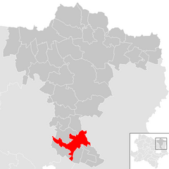
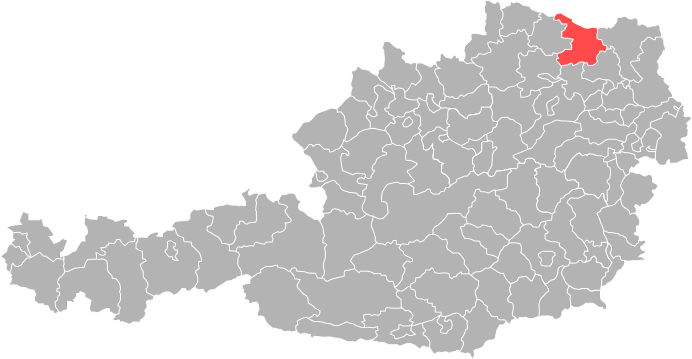
Mistelbach District (Bezirk Mistelbach)

- district of Austria
 Hiking in Mistelbach District
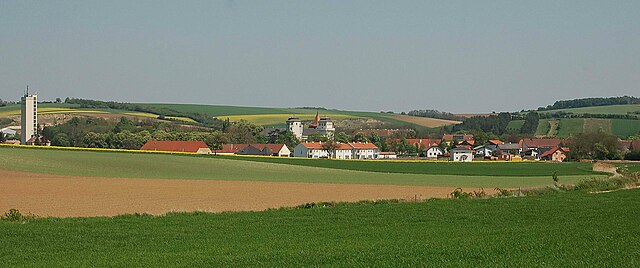
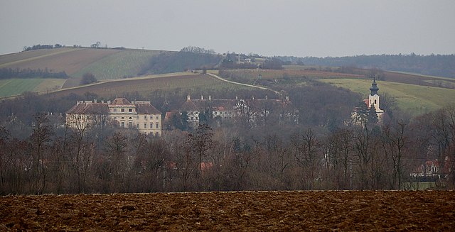
Mistelbach District, located in the northeastern part of Austria, offers a variety of beautiful hiking opportunities amidst its picturesque landscapes. The region is characterized by rolling hills, vineyards, and scenic views, making it a great destination for hikers of all levels.
Popular Hiking Areas:
-
Weinviertel Nature Park: This park offers numerous trails that wind through vineyards, forests, and along the hills. The landscapes are filled with charming villages and historical sites, giving hikers a chance to experience both nature and culture.
-
Dürnstein and Krems: The nearby Wachau Valley is famous for its stunning landscapes and wine culture. Trails along the Danube River provide breathtaking views and the chance to explore charming towns.
-
Poysdorf: Known as the “Wine Capital of Austria,” Poysdorf has several trails that meander through vineyards. There are opportunities for amalgamating hiking with wine tasting at local wineries.
-
Schönberg: This area has numerous hiking routes surrounded by lush green forests and scenic overlooks. You can find trails that suit short walks to more strenuous hikes.
Hiking Tips:
-
Trail Maps: Make sure to carry updated maps or a reliable GPS device. Many trails are well-marked, but having a map can help you stay on track.
-
Seasons: The best time for hiking in Mistelbach is during spring and autumn when the weather is mild, and the scenery is particularly beautiful with blooming flowers or changing leaves.
-
Local Information: Check in with local tourist offices for information on guided hikes, special events, or any trail conditions.
-
Equipment: Wear comfortable hiking boots and bring sufficient water, especially during warmer months. A small backpack for supplies is recommended.
-
Respect Nature: Follow Leave No Trace principles to keep the environment pristine for other hikers and wildlife.
Whether you're looking for a leisurely stroll through vineyards or a challenging hike in nature, Mistelbach District has options for you to enjoy the great outdoors!
- Country:

- Licence Plate Code: MI
- Coordinates: 48° 38' 38" N, 16° 30' 7" E


- GPS tracks (wikiloc): [Link]
- AboveSeaLevel: 220 м m
- Area: 1291.30 sq km
- Web site: http://www.noel.gv.at/service/bh/mi/bhmi.htm
- Wikipedia en: wiki(en)
- Wikipedia: wiki(de)
- Wikidata storage: Wikidata: Q257454
- Wikipedia Commons Category: [Link]
- Freebase ID: [/m/0flbhm]
- GeoNames ID: Alt: [2771556]
- VIAF ID: Alt: [312800606]
- OSM relation ID: [104883]
- GND ID: Alt: [4101034-6]
- archINFORM location ID: [14635]
Includes regions:


Großebersdorf
- municipality in Austria
Hiking in Großebersdorf
Großebersdorf is a small municipality in Austria, located northeast of Vienna. While it may not be as well-known as some of the more popular hiking destinations in the region, it offers potential for day hikes in a picturesque rural setting. Here are some points to consider for hiking in and around Großebersdorf:...
- Country:
- Postal Code: 2203
- Local Dialing Code: 02245
- Licence Plate Code: MI
- Coordinates: 48° 21' 44" N, 16° 28' 9" E
- GPS tracks (wikiloc): [Link]
- AboveSeaLevel: 193 м m
- Area: 18.03 sq km
- Population: 2236
- Web site: [Link]
Gnadendorf
- municipality in Austria
Hiking in Gnadendorf
Gnadendorf is a picturesque area in Austria known for its beautiful landscapes and outdoor recreational opportunities, including hiking. Located in the Lower Austria region, Gnadendorf offers a variety of trails suitable for different skill levels, making it ideal for both novice and experienced hikers....
- Country:
- Postal Code: 2152
- Local Dialing Code: 02525
- Licence Plate Code: MI
- Coordinates: 48° 36' 57" N, 16° 23' 50" E
- GPS tracks (wikiloc): [Link]
- AboveSeaLevel: 272 м m
- Area: 48.26 sq km
- Population: 1127
- Web site: [Link]
Fallbach
- municipality in Austria
Hiking in Fallbach
Fallbach, located near the village of Fallbach in the Austrian state of Carinthia, is known for its stunning natural landscapes, which include picturesque trails and beautiful waterfalls. Here’s an overview of what you might expect when hiking in and around Fallbach:...
- Country:
- Postal Code: 2133
- Local Dialing Code: 02524
- Licence Plate Code: MI
- Coordinates: 48° 39' 0" N, 16° 25' 0" E
- GPS tracks (wikiloc): [Link]
- AboveSeaLevel: 248 м m
- Area: 30.43 sq km
- Population: 819
- Web site: [Link]

Altlichtenwarth
- municipality in Austria
Hiking in Altlichtenwarth
Altlichtenwarth is a charming village located in the northeastern part of Austria near the border with the Czech Republic. It’s known for its scenic landscapes, peaceful ambiance, and opportunities for hiking and outdoor activities....
- Country:
- Postal Code: 2144
- Local Dialing Code: 02533
- Licence Plate Code: MI
- Coordinates: 48° 38' 52" N, 16° 47' 45" E
- GPS tracks (wikiloc): [Link]
- AboveSeaLevel: 231 м m
- Area: 20.46 sq km
- Population: 769
- Web site: [Link]

Kreuttal
- municipality in Austria
Hiking in Kreuttal
Kreuttal is a picturesque valley located in Austria, known for its stunning landscapes, diverse flora and fauna, and well-marked hiking trails. If you're considering a hiking trip in Kreuttal, here are some key points to keep in mind:...
- Country:
- Postal Code: 2123
- Local Dialing Code: 02245
- Licence Plate Code: MI
- Coordinates: 48° 26' 0" N, 16° 29' 0" E
- GPS tracks (wikiloc): [Link]
- AboveSeaLevel: 207 м m
- Area: 21.51 sq km
- Population: 1429
- Web site: [Link]

Rabensburg
- municipality in Austria
Hiking in Rabensburg
Rabensburg is a charming area located in Austria, known for its picturesque landscapes, rural charm, and access to hiking trails. While it may not be as famous as some larger hiking destinations, it offers a variety of outdoor activities for hiking enthusiasts....
- Country:
- Postal Code: 2274
- Local Dialing Code: 02535
- Licence Plate Code: MI
- Coordinates: 48° 38' 46" N, 16° 54' 12" E
- GPS tracks (wikiloc): [Link]
- AboveSeaLevel: 168 м m
- Area: 20.05 sq km
- Population: 1100
- Web site: [Link]

Stronsdorf
- municipality in Austria
Hiking in Stronsdorf
Stronsdorf is a small village located in Lower Austria, making it a charming destination for hiking enthusiasts. The region is characterized by its picturesque landscapes, vineyards, and rolling hills, providing a variety of scenic trails for hikers of all levels....
- Country:
- Postal Code: 2153
- Local Dialing Code: 02526
- Licence Plate Code: MI
- Coordinates: 48° 39' 10" N, 16° 17' 48" E
- GPS tracks (wikiloc): [Link]
- AboveSeaLevel: 211 м m
- Area: 48.17 sq km
- Population: 1584
- Web site: [Link]

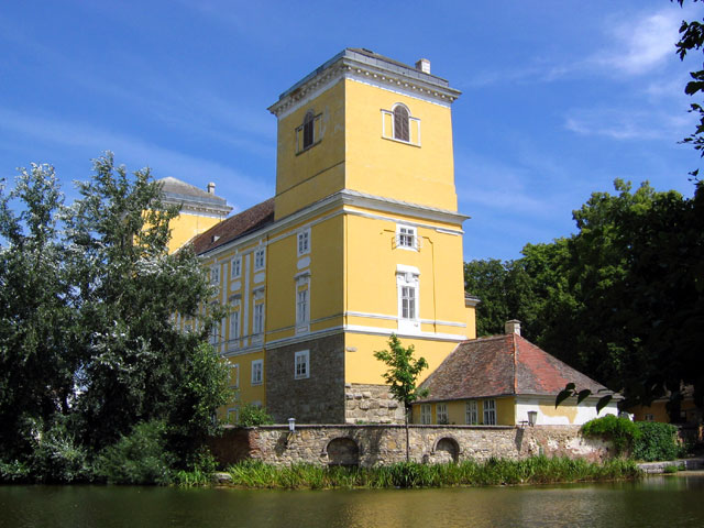
Mistelbach
- municipality in Austria
Hiking in Mistelbach
Mistelbach is a charming town located in the northeastern part of Austria, not far from the border with the Czech Republic. The surrounding area offers a variety of hiking opportunities that allow you to explore the picturesque landscapes of the region....
- Country:
- Postal Code: 2130
- Local Dialing Code: 02572
- Licence Plate Code: MI
- Coordinates: 48° 34' 0" N, 16° 34' 0" E
- GPS tracks (wikiloc): [Link]
- AboveSeaLevel: 190 м m
- Area: 131.44 sq km
- Population: 11559
- Web site: [Link]

Poysdorf
- municipality in Austria
Hiking in Poysdorf
Poysdorf is a charming town in Austria, located in the northeastern part of the country, not far from the Czech border. It's known for its beautiful landscapes, vineyards, and rolling hills, making it an excellent destination for hiking enthusiasts. Here are some key points about hiking in Poysdorf:...
- Country:
- Postal Code: 2170
- Local Dialing Code: 0 25 52
- Licence Plate Code: MI
- Coordinates: 48° 40' 0" N, 16° 38' 0" E
- GPS tracks (wikiloc): [Link]
- AboveSeaLevel: 225 м m
- Area: 97.26 sq km
- Population: 5527
- Web site: [Link]

Laa an der Thaya
- municipality in Austria
Hiking in Laa an der Thaya
Laa an der Thaya is a charming town located in Lower Austria, situated near the border with the Czech Republic. The area is known for its beautiful natural landscapes, making it an ideal location for hiking enthusiasts. Here are some key points to consider when planning a hiking trip in and around Laa an der Thaya:...
- Country:
- Postal Code: 2064, 2136
- Local Dialing Code: 02522
- Licence Plate Code: MI
- Coordinates: 48° 43' 0" N, 16° 23' 0" E
- GPS tracks (wikiloc): [Link]
- AboveSeaLevel: 183 м m
- Area: 72.91 sq km
- Population: 6280
- Web site: [Link]
Asparn an der Zaya
- municipality in Austria
Hiking in Asparn an der Zaya
Asparn an der Zaya is a picturesque town in the Weinviertel region of Austria, known for its beautiful landscapes, vineyards, and rich history. The area offers several hiking opportunities that allow you to explore its natural beauty and experience the local culture. Here are some key points about hiking in and around Asparn an der Zaya:...
- Country:
- Postal Code: 2151
- Local Dialing Code: 02577
- Licence Plate Code: MI
- Coordinates: 48° 35' 14" N, 16° 29' 40" E
- GPS tracks (wikiloc): [Link]
- AboveSeaLevel: 222 м m
- Area: 40.49 sq km
- Population: 1865
- Web site: [Link]

Kreuzstetten
- municipality in Austria
Hiking in Kreuzstetten
Kreuzstetten, located in Austria, offers a variety of scenic hiking opportunities for outdoor enthusiasts. While the area itself may not be as widely known as some of the alpine regions, it is surrounded by beautiful landscapes that provide a peaceful environment for hiking....
- Country:
- Postal Code: 2124
- Local Dialing Code: 02263
- Licence Plate Code: MI
- Coordinates: 48° 28' 0" N, 16° 28' 0" E
- GPS tracks (wikiloc): [Link]
- AboveSeaLevel: 224 м m
- Area: 24.33 sq km
- Population: 1541
- Web site: [Link]

Pillichsdorf
- municipality in Austria
Hiking in Pillichsdorf
Pillichsdorf is a small town located in Austria, nestled in the northeastern part of the country. While it may not be as widely known for hiking as some of the larger national parks or mountain areas in Austria, it offers some scenic trails and opportunities for outdoor enthusiasts to explore the beautiful countryside....
- Country:
- Postal Code: 2211
- Local Dialing Code: 02245
- Licence Plate Code: MI
- Coordinates: 48° 21' 47" N, 16° 32' 18" E
- GPS tracks (wikiloc): [Link]
- AboveSeaLevel: 167 м m
- Area: 14.33 sq km
- Population: 1157
- Web site: [Link]

Wilfersdorf
- municipality in Austria
Hiking in Wilfersdorf
Wilfersdorf is a charming village located in the northeastern part of Austria, not far from the capital, Vienna. The surrounding region offers several opportunities for hiking and enjoying nature. Here are some key points about hiking in and around Wilfersdorf:...
- Country:
- Postal Code: 2193
- Local Dialing Code: 02573
- Licence Plate Code: MI
- Coordinates: 48° 35' 21" N, 16° 38' 41" E
- GPS tracks (wikiloc): [Link]
- AboveSeaLevel: 190 м m
- Area: 30.47 sq km
- Population: 2175
- Web site: [Link]
Niederleis
- municipality in Austria
Hiking in Niederleis
Niederleis is a charming village located in the Lower Austria region of Austria, and it serves as a great starting point for various hiking adventures. The surrounding area is characterized by beautiful landscapes, rolling hills, and vineyards, making it a picturesque destination for outdoor enthusiasts....
- Country:
- Postal Code: 2116
- Local Dialing Code: 02576
- Licence Plate Code: MI
- Coordinates: 48° 32' 59" N, 16° 23' 52" E
- GPS tracks (wikiloc): [Link]
- AboveSeaLevel: 253 м m
- Area: 19.52 sq km
- Population: 861
- Web site: [Link]

Ulrichskirchen-Schleinbach
- municipality in Austria
Hiking in Ulrichskirchen-Schleinbach
Ulrichskirchen-Schleinbach, located in Austria, is a charming area characterized by rolling hills, lush landscapes, and scenic views. While it might not be the most famous hiking destination, it offers several opportunities for hiking enthusiasts to explore the natural beauty of the region....
- Country:
- Postal Code: 2122
- Local Dialing Code: 02245
- Licence Plate Code: MI
- Coordinates: 48° 24' 3" N, 16° 29' 28" E
- GPS tracks (wikiloc): [Link]
- AboveSeaLevel: 192 м m
- Area: 26.52 sq km
- Population: 2630
- Web site: [Link]

Neudorf bei Staatz
- municipality in Austria
Hiking in Neudorf bei Staatz
Neudorf bei Staatz, located in the wine-growing region of Lower Austria, offers a charming environment for hiking enthusiasts. The area is characterized by rolling hills, picturesque vineyards, and scenic countryside, providing a serene backdrop for outdoor activities....
- Country:
- Postal Code: 2135
- Local Dialing Code: 02523
- Licence Plate Code: MI
- Coordinates: 48° 43' 16" N, 16° 29' 29" E
- GPS tracks (wikiloc): [Link]
- AboveSeaLevel: 202 м m
- Area: 40.14 sq km
- Population: 1430
- Web site: [Link]
Ladendorf
- municipality in Austria
Hiking in Ladendorf
Ladendorf, a charming village in Austria, offers a picturesque setting for hiking enthusiasts. Its location in the Lower Austria region provides access to beautiful landscapes, including rolling hills, vineyards, and forested areas....
- Country:
- Postal Code: 2126
- Local Dialing Code: 02575
- Licence Plate Code: MI
- Coordinates: 48° 32' 0" N, 16° 29' 0" E
- GPS tracks (wikiloc): [Link]
- AboveSeaLevel: 228 м m
- Area: 50.05 sq km
- Population: 2298
- Web site: [Link]

Ottenthal
- municipality in Austria
Hiking in Ottenthal
Ottenthal is a quaint village located in Lower Austria, surrounded by picturesque landscapes that are ideal for hiking. The area is characterized by its rolling hills, vineyards, and the beautiful landscapes of the Weinviertel region. Here are some key points to consider when hiking in and around Ottenthal:...
- Country:
- Postal Code: 2163
- Local Dialing Code: 02554
- Licence Plate Code: MI
- Coordinates: 48° 45' 33" N, 16° 34' 42" E
- GPS tracks (wikiloc): [Link]
- AboveSeaLevel: 240 м m
- Area: 15.39 sq km
- Population: 544
- Web site: [Link]

Schrattenberg
- municipality in Austria
Hiking in Schrattenberg
Schrattenberg, located in Austria, is a lesser-known but beautiful hiking destination, especially appealing to those who enjoy nature and tranquility away from the more crowded tourist spots. The landscape around Schrattenberg features rolling hills, dense forests, and picturesque vineyards, providing a diverse range of scenery....
- Country:
- Postal Code: 2172
- Local Dialing Code: 02555
- Licence Plate Code: MI
- Coordinates: 48° 43' 0" N, 16° 43' 0" E
- GPS tracks (wikiloc): [Link]
- AboveSeaLevel: 199 м m
- Area: 19.15 sq km
- Population: 810
- Web site: [Link]

Hochleithen
- municipality in Austria
Hiking in Hochleithen
Hochleithen is a picturesque area that offers various hiking opportunities, nestled in the scenic landscapes of Austria. Here’s a brief overview for anyone considering a hiking trip in Hochleithen:...
- Country:
- Postal Code: 2123
- Local Dialing Code: 02245
- Licence Plate Code: MI
- Coordinates: 48° 27' 0" N, 16° 31' 0" E
- GPS tracks (wikiloc): [Link]
- AboveSeaLevel: 226 м m
- Area: 19.91 sq km
- Population: 1166
- Web site: [Link]

Staatz
- municipality in Austria
Hiking in Staatz
Staatz is a small municipality located in the Weinviertel region of Austria, known for its rolling hills, vineyards, and beautiful rural landscapes. While the area may not be as well-known for extensive hiking trails as larger national parks or mountainous regions, it does offer a charming environment for leisurely hikes and nature walks....
- Country:
- Postal Code: 2134
- Local Dialing Code: 02524
- Licence Plate Code: MI
- Coordinates: 48° 40' 0" N, 16° 29' 0" E
- GPS tracks (wikiloc): [Link]
- AboveSeaLevel: 246 м m
- Area: 42.64 sq km
- Population: 1933
- Web site: [Link]


Bernhardsthal
- municipality in Austria
Hiking in Bernhardsthal
Bernhardsthal is a charming village located in the northeastern part of Austria, near the border with the Czech Republic. While it may not be as widely known as some of the larger cities, it offers a unique rural landscape that can be quite appealing to hikers looking for less crowded trails and an authentic experience....
- Country:
- Postal Code: 2275
- Local Dialing Code: 02557
- Licence Plate Code: MI
- Coordinates: 48° 41' 33" N, 16° 52' 9" E
- GPS tracks (wikiloc): [Link]
- AboveSeaLevel: 166 м m
- Area: 51.95 sq km
- Population: 1604
- Web site: [Link]

Groß-Engersdorf
- municipality in Austria
Hiking in Groß-Engersdorf
Groß-Engersdorf, located in Lower Austria, near the borders of Vienna, offers several hiking opportunities that cater to different skill levels and preferences. Here are some highlights about hiking in and around this area:...
- Country:
- Postal Code: 2212
- Local Dialing Code: 02245
- Licence Plate Code: MI
- Coordinates: 48° 21' 0" N, 16° 34' 0" E
- GPS tracks (wikiloc): [Link]
- AboveSeaLevel: 164 м m
- Area: 15.57 sq km
- Population: 1478
- Web site: [Link]
Großharras
- municipality in Austria
Hiking in Großharras
Großharras, located in Lower Austria, offers a range of hiking opportunities for outdoor enthusiasts. The region is characterized by its picturesque landscapes, rolling hills, and serene rural scenery, making it an ideal place for both casual walkers and experienced hikers....
- Country:
- Postal Code: 2034
- Local Dialing Code: 02526
- Licence Plate Code: MI
- Coordinates: 48° 39' 50" N, 16° 14' 51" E
- GPS tracks (wikiloc): [Link]
- AboveSeaLevel: 206 м m
- Area: 42.66 sq km
- Population: 1116
- Web site: [Link]

Hausbrunn
- municipality in Austria
Hiking in Hausbrunn
Hausbrunn, located in the Brno district of Austria, offers some beautiful hiking opportunities, especially for those who enjoy nature and serene landscapes. The area is characterized by its rolling hills, vineyards, and expansive fields, making it a lovely destination for hikers of all skill levels....
- Country:
- Postal Code: 2145
- Local Dialing Code: 02533
- Licence Plate Code: MI
- Coordinates: 48° 37' 39" N, 16° 49' 45" E
- GPS tracks (wikiloc): [Link]
- AboveSeaLevel: 200 м m
- Area: 16.17 sq km
- Population: 857
- Web site: [Link]

Gaubitsch
- municipality in Austria
Hiking in Gaubitsch
Gaubitsch is a small village located in Austria, known for its picturesque landscapes and natural beauty, making it a charming place for hiking enthusiasts. The surrounding region offers a variety of hiking trails suitable for different skill levels, from leisurely walks to more challenging hikes. Here are some insights about hiking in and around Gaubitsch:...
- Country:
- Postal Code: 2154
- Local Dialing Code: 02522
- Licence Plate Code: MI
- Coordinates: 48° 39' 0" N, 16° 23' 0" E
- GPS tracks (wikiloc): [Link]
- AboveSeaLevel: 229 м m
- Area: 22.48 sq km
- Population: 894
- Web site: [Link]

Herrnbaumgarten
- municipality in Austria
Hiking in Herrnbaumgarten
Herrnbaumgarten is a small village located in the northeastern part of Austria, near the border with Hungary. The surrounding area offers picturesque landscapes and numerous trails that are suitable for hikers of various skill levels. Here are some key points to consider when hiking in Herrnbaumgarten:...
- Country:
- Postal Code: 2171
- Local Dialing Code: 02555
- Licence Plate Code: MI
- Coordinates: 48° 41' 50" N, 16° 41' 3" E
- GPS tracks (wikiloc): [Link]
- AboveSeaLevel: 212 м m
- Area: 16.49 sq km
- Population: 943
- Web site: [Link]

Großkrut
- municipality in Austria
Hiking in Großkrut
Großkrut, located in Austria's Lower Austria region, offers a unique hiking experience that combines scenic views, nature, and local culture. While it may not be as well-known as some of Austria's more prominent hiking areas, it provides nice trails and opportunities to explore the countryside....
- Country:
- Postal Code: 2143
- Local Dialing Code: 02556
- Licence Plate Code: MI
- Coordinates: 48° 38' 37" N, 16° 43' 22" E
- GPS tracks (wikiloc): [Link]
- AboveSeaLevel: 181 м m
- Area: 38.45 sq km
- Population: 1572
- Web site: [Link]
Gaweinstal
- municipality in Austria
Hiking in Gaweinstal
Gaweinstal is a small village located in the Lower Austria region of Austria, known for its beautiful landscapes and proximity to the natural beauty of the country. While not a major hiking destination like some larger national parks or mountainous areas, Gaweinstal offers several opportunities for outdoor enthusiasts to explore the surrounding countryside. Here’s what you can expect when hiking in this area:...
- Country:
- Postal Code: 2191
- Local Dialing Code: 02574
- Licence Plate Code: MI
- Coordinates: 48° 28' 41" N, 16° 35' 21" E
- GPS tracks (wikiloc): [Link]
- AboveSeaLevel: 199 м m
- Area: 51.71 sq km
- Population: 3947
- Web site: [Link]


Wildendürnbach
- municipality in Austria
Hiking in Wildendürnbach
Wildendürnbach is a charming area located in Austria, known for its natural beauty and hiking opportunities. While it may not be as well-known as some larger national parks or mountain ranges, it offers a serene landscape that is perfect for hiking enthusiasts....
- Country:
- Postal Code: 2164
- Local Dialing Code: 02523
- Licence Plate Code: MI
- Coordinates: 48° 45' 0" N, 16° 32' 0" E
- GPS tracks (wikiloc): [Link]
- AboveSeaLevel: 203 м m
- Area: 53.63 sq km
- Population: 1574
- Web site: [Link]

Bockfließ
- municipality in Austria
Hiking in Bockfließ
Bockfließ is a charming village located in the Lower Austria region of Austria, known for its picturesque landscapes and tranquil environment, making it a great destination for hiking enthusiasts. While it may not be as widely known as some of Austria’s more mountainous areas, it offers several opportunities for nature lovers to explore the surrounding countryside....
- Country:
- Postal Code: 2213
- Local Dialing Code: 02288
- Licence Plate Code: MI
- Coordinates: 48° 21' 0" N, 16° 36' 0" E
- GPS tracks (wikiloc): [Link]
- AboveSeaLevel: 168 м m
- Area: 22.87 sq km
- Population: 1348
- Web site: [Link]

Falkenstein
- municipality in Austria
Hiking in Falkenstein
Falkenstein, located in Lower Austria, offers beautiful hiking opportunities surrounded by stunning natural landscapes. It is known for its hilly terrain, vineyards, and panoramic views, making it a charming destination for hikers of all levels....
- Country:
- Postal Code: 2162
- Local Dialing Code: 02554
- Licence Plate Code: MI
- Coordinates: 48° 43' 15" N, 16° 35' 9" E
- GPS tracks (wikiloc): [Link]
- AboveSeaLevel: 302 м m
- Area: 19.17 sq km
- Population: 457
- Web site: [Link]

Unterstinkenbrunn
- municipality in Austria
Hiking in Unterstinkenbrunn
Unterstinkenbrunn is a charming village located in Lower Austria, surrounded by picturesque landscapes that make it a great destination for hiking enthusiasts. The region offers various trails that range in difficulty, allowing both beginners and experienced hikers to enjoy the natural beauty of the area....
- Country:
- Postal Code: 2154
- Local Dialing Code: 02526
- Licence Plate Code: MI
- Coordinates: 48° 40' 2" N, 16° 20' 47" E
- GPS tracks (wikiloc): [Link]
- AboveSeaLevel: 207 м m
- Area: 9.42 sq km
- Population: 560
- Web site: [Link]

Drasenhofen
- municipality in Austria
Hiking in Drasenhofen
Drasenhofen is a charming village located in Lower Austria, close to the borders with the Czech Republic and Slovakia. The area is known for its picturesque landscapes, rolling hills, vineyards, and diverse natural habitats, making it a great destination for hiking enthusiasts. Here are some key points to consider when hiking in and around Drasenhofen:...
- Country:
- Postal Code: 2165
- Local Dialing Code: 02554
- Licence Plate Code: MI
- Coordinates: 48° 45' 26" N, 16° 38' 56" E
- GPS tracks (wikiloc): [Link]
- AboveSeaLevel: 224 м m
- Area: 35.2 sq km
- Population: 1109
- Web site: [Link]
Wolkersdorf im Weinviertel
- municipality in Austria
Hiking in Wolkersdorf im Weinviertel
Wolkersdorf im Weinviertel, located in the Lower Austria region, offers several charming hiking opportunities that showcase the beautiful landscapes of the Weinviertel wine region. Here are some key highlights and tips for hiking in this area:...
- Country:
- Postal Code: 2120
- Local Dialing Code: 02245
- Licence Plate Code: MI
- Coordinates: 48° 22' 0" N, 16° 31' 0" E
- GPS tracks (wikiloc): [Link]
- AboveSeaLevel: 178 м m
- Area: 44.38 sq km
- Population: 7201
- Web site: [Link]
Shares border with regions:


Wien-Umgebung District
- former district of the state of Lower Austria in Austria
Hiking in Wien-Umgebung District
Wien-Umgebung, or the Vienna Surroundings District, offers a variety of beautiful hiking opportunities right outside the bustling capital of Austria. Here are some highlights and features of hiking in this region:...
- Country:
- Capital: Klosterneuburg
- Licence Plate Code: WU
- Coordinates: 48° 18' 0" N, 16° 19' 0" E
- GPS tracks (wikiloc): [Link]
- AboveSeaLevel: 346 м m
- Area: 484.48 sq km
- Web site: [Link]

Hollabrunn District
- district of Austria
Hiking in Hollabrunn District
Hollabrunn District, located in the northeastern part of Austria, is a charming area filled with scenic landscapes and a variety of hiking opportunities. Here are some highlights and tips for hiking in this district:...
- Country:
- Licence Plate Code: HL
- Coordinates: 48° 38' 56" N, 16° 1' 1" E
- GPS tracks (wikiloc): [Link]
- AboveSeaLevel: 275 м m
- Area: 1010.72 sq km
- Web site: [Link]

Korneuburg District
- district in Austria
Hiking in Korneuburg District
Korneuburg District, located just north of Vienna in Austria, offers a variety of hiking opportunities that showcase the scenic beauty of the region. Here are some highlights and tips for hiking in the area:...
- Country:
- Licence Plate Code: KO
- Coordinates: 48° 23' 31" N, 16° 15' 29" E
- GPS tracks (wikiloc): [Link]
- AboveSeaLevel: 189 м m
- Area: 626.50 sq km
- Population: 88599
- Web site: [Link]


Gänserndorf District
- district of Austria
Hiking in Gänserndorf District
Gänserndorf District, located in the northeastern part of Austria, offers a variety of hiking opportunities that showcase its scenic beauty and rich natural landscapes. Here are some aspects to consider when planning a hiking trip in this area:...
- Country:
- Licence Plate Code: GF
- Coordinates: 48° 20' 28" N, 16° 43' 5" E
- GPS tracks (wikiloc): [Link]
- AboveSeaLevel: 173 м m
- Area: 1271.31 sq km
- Web site: [Link]