Niella Tanaro (Niella Tanaro)
- Italian comune
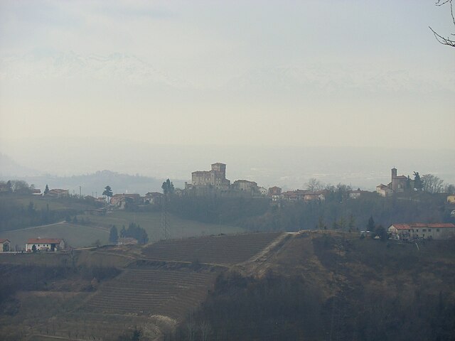
 Hiking in Niella Tanaro
Niella Tanaro is a charming village nestled in the Piedmont region of Italy, surrounded by the beautiful landscapes of the Alta Langa area. This region offers numerous opportunities for hiking enthusiasts, with trails that showcase the stunning natural scenery and rich biodiversity.
Hiking Highlights in Niella Tanaro:
-
Scenic Trails: The area is home to various marked trails that range in difficulty. These trails often lead through forests, vineyards, and charming rural landscapes, providing an excellent opportunity to immerse yourself in nature.
-
Historical Routes: Many hiking paths in the region connect to historical points of interest, such as ancient churches and traditional stone villages, allowing hikers to experience both natural beauty and cultural heritage.
-
Wildlife Spotting: The diverse ecosystems around Niella Tanaro are ideal for spotting various wildlife species. Keep an eye out for birds, deer, and other local fauna while you hike.
-
Food and Wine: After a day of hiking, you can enjoy local cuisine, particularly the renowned wines from the Langhe region. Many nearby towns offer cozy restaurants and wineries where you can taste local specialties.
-
Accessibility: Niella Tanaro can be accessed from various parts of Piedmont, making it a great base for hiking expeditions in the surrounding Alta Langa area.
Tips for Hiking in Niella Tanaro:
-
Trail Maps: Before heading out, make sure to obtain updated trail maps from local tourist information centers or hiking clubs to help you navigate the area.
-
Seasonal Considerations: The best times for hiking are during spring and fall when the weather is mild and the landscapes are particularly vibrant. Summer can be quite warm, while winter may present challenges due to snow.
-
Proper Gear: Always wear sturdy hiking boots and dress in layers to adapt to changing weather conditions. It’s also wise to carry a sufficient water supply and snacks.
-
Respect Nature: Follow Leave No Trace principles to preserve the environment. Stay on marked trails and dispose of waste properly.
Overall, hiking in Niella Tanaro promises a fantastic experience for outdoor enthusiasts looking to explore a less-traveled part of Italy while enjoying stunning landscapes and rich cultural experiences.
- Country:

- Postal Code: 12060
- Local Dialing Code: 0174
- Licence Plate Code: CN
- Coordinates: 44° 25' 0" N, 7° 55' 0" E


- GPS tracks (wikiloc): [Link]
- AboveSeaLevel: 371 м m
- Area: 15.71 sq km
- Population: 1041
- Web site: http://www.comune.niellatanaro.cn.it/
- Wikipedia en: wiki(en)
- Wikipedia: wiki(it)
- Wikidata storage: Wikidata: Q20261
- Freebase ID: [/m/0gbbz3]
- GeoNames ID: Alt: [6542434]
- VIAF ID: Alt: [238808566]
- OSM relation ID: [43124]
- UN/LOCODE: [ITZOV]
- ISTAT ID: 004151
- Italian cadastre code: F895
Shares border with regions:
Briaglia
- Italian comune
Hiking in Briaglia
Briaglia, a small town in the Piedmont region of Italy, offers a variety of hiking opportunities that cater to nature lovers and outdoor enthusiasts. Nestled in the hills of the Cuneo province, it presents a charming landscape characterized by rolling hills, lush forests, and panoramic views of the surrounding mountains....
- Country:
- Postal Code: 12080
- Local Dialing Code: 0174
- Licence Plate Code: CN
- Coordinates: 44° 24' 0" N, 7° 53' 0" E
- GPS tracks (wikiloc): [Link]
- AboveSeaLevel: 546 м m
- Area: 6.24 sq km
- Population: 309
- Web site: [Link]

Castellino Tanaro
- Italian comune
Hiking in Castellino Tanaro
Castellino Tanaro is a picturesque village in the Piedmont region of Italy, surrounded by beautiful landscapes that make it a great destination for hiking enthusiasts. Here are some key points to consider if you're planning to hike in and around Castellino Tanaro:...
- Country:
- Postal Code: 12060
- Local Dialing Code: 0174
- Licence Plate Code: CN
- Coordinates: 44° 26' 0" N, 7° 59' 0" E
- GPS tracks (wikiloc): [Link]
- AboveSeaLevel: 610 м m
- Area: 11.52 sq km
- Population: 293
- Web site: [Link]
Cigliè
- Italian comune
Hiking in Cigliè
Cigliè, a small town located in the Piedmont region of Italy, offers beautiful opportunities for hiking and outdoor activities. Nestled in the scenic landscape of the Langhe and Roero hills, the area is known for its picturesque views, vineyards, and rich history. Here are some highlights and tips for hiking in Cigliè:...
- Country:
- Postal Code: 12060
- Local Dialing Code: 0174
- Licence Plate Code: CN
- Coordinates: 44° 26' 0" N, 7° 56' 0" E
- GPS tracks (wikiloc): [Link]
- AboveSeaLevel: 549 м m
- Area: 6.12 sq km
- Population: 184
- Web site: [Link]

Lesegno
- Italian comune
Hiking in Lesegno
Lesegno is a charming village located in the Piedmont region of Italy, surrounded by the stunning landscapes of the Langhe and Monviso hills. Hiking in this area offers a unique combination of natural beauty, cultural heritage, and delicious local food and wine....
- Country:
- Postal Code: 12076
- Local Dialing Code: 0174
- Licence Plate Code: CN
- Coordinates: 44° 24' 11" N, 7° 58' 18" E
- GPS tracks (wikiloc): [Link]
- AboveSeaLevel: 422 м m
- Area: 14.24 sq km
- Population: 835
- Web site: [Link]

Mondovì
- Italian comune
Hiking in Mondovì
Mondovì, located in the Piedmont region of Italy, is an excellent destination for hiking enthusiasts due to its beautiful landscapes and varied terrain. Nestled in the foothills of the Alps, it offers a mix of rolling hills, scenic valleys, and striking panoramic views....
- Country:
- Postal Code: 12084
- Local Dialing Code: 0174
- Licence Plate Code: CN
- Coordinates: 44° 23' 0" N, 7° 49' 0" E
- GPS tracks (wikiloc): [Link]
- AboveSeaLevel: 395 м m
- Area: 87.05 sq km
- Population: 22444
- Web site: [Link]

Rocca Cigliè
- Italian comune
Hiking in Rocca Cigliè
Rocca Cigliè is a picturesque location in the Piedmont region of Italy, primarily known for its scenic beauty and historical significance. It is an excellent spot for hikers and nature enthusiasts, offering a variety of trails that highlight the area's stunning landscapes, diverse flora and fauna, and panoramic views....
- Country:
- Postal Code: 12060
- Local Dialing Code: 0174
- Licence Plate Code: CN
- Coordinates: 44° 27' 0" N, 7° 57' 0" E
- GPS tracks (wikiloc): [Link]
- AboveSeaLevel: 604 м m
- Area: 7.02 sq km
- Population: 134
- Web site: [Link]

San Michele Mondovì
- Italian comune
Hiking in San Michele Mondovì
San Michele Mondovì, located in the Piedmont region of Italy, offers a picturesque setting for hiking enthusiasts, with its beautiful landscapes, rich history, and diverse trails. The area is characterized by the Monregalese district, known for its rolling hills, panoramic views, and charming villages....
- Country:
- Postal Code: 12080
- Local Dialing Code: 0174
- Licence Plate Code: CN
- Coordinates: 44° 23' 0" N, 7° 54' 0" E
- GPS tracks (wikiloc): [Link]
- AboveSeaLevel: 444 м m
- Area: 18.11 sq km
- Population: 1956
- Web site: [Link]

Vicoforte
- Italian comune
Hiking in Vicoforte
Vicoforte is a charming village located in the Piedmont region of northern Italy, known for its stunning landscapes, rich history, and cultural heritage. The area is surrounded by the beautiful hills of the Langhe and Roero, making it an excellent destination for hiking enthusiasts....
- Country:
- Postal Code: 12080
- Local Dialing Code: 0174
- Licence Plate Code: CN
- Coordinates: 44° 22' 0" N, 7° 51' 0" E
- GPS tracks (wikiloc): [Link]
- AboveSeaLevel: 547 м m
- Area: 25.74 sq km
- Population: 3129
- Web site: [Link]