Nieul-le-Dolent (Nieul-le-Dolent)

- commune in Vendée, France
- Country:

- Postal Code: 85430
- Coordinates: 46° 34' 30" N, 1° 30' 32" E


- GPS tracks (wikiloc): [Link]
- Area: 27.5 sq km
- Population: 2457
- Web site: https://www.nieul-le-dolent.fr/
- Wikipedia en: wiki(en)
- Wikipedia: wiki(fr)
- Wikidata storage: Wikidata: Q1468502
- Wikipedia Commons Category: [Link]
- Freebase ID: [/m/03qhkcw]
- GeoNames ID: Alt: [2990382]
- SIREN number: [218501617]
- BnF ID: [152782871]
- Twitter username: Alt: [NieulLeDolent]
- INSEE municipality code: 85161
Shares border with regions:


La Boissière-des-Landes
- commune in Vendée, France
- Country:
- Postal Code: 85430
- Coordinates: 46° 33' 53" N, 1° 27' 44" E
- GPS tracks (wikiloc): [Link]
- Area: 23.74 sq km
- Population: 1369
- Web site: [Link]


Les Clouzeaux
- former commune in Vendée, France
- Country:
- Postal Code: 85430
- Coordinates: 46° 37' 48" N, 1° 30' 31" E
- GPS tracks (wikiloc): [Link]
- Area: 26.49 sq km
- Population: 2604
- Web site: [Link]
Le Girouard
- commune in Vendée, France
- Country:
- Postal Code: 85150
- Coordinates: 46° 34' 4" N, 1° 35' 58" E
- GPS tracks (wikiloc): [Link]
- Area: 25.1 sq km
- Population: 1009
- Web site: [Link]

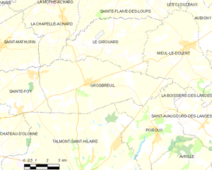
Grosbreuil
- commune in Vendée, France
- Country:
- Postal Code: 85440
- Coordinates: 46° 32' 22" N, 1° 37' 0" E
- GPS tracks (wikiloc): [Link]
- Area: 36.33 sq km
- Population: 2149
- Web site: [Link]

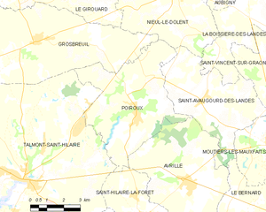
Poiroux
- commune in Vendée, France
- Country:
- Postal Code: 85440
- Coordinates: 46° 30' 17" N, 1° 32' 5" E
- GPS tracks (wikiloc): [Link]
- AboveSeaLevel: 46 м m
- Area: 25.38 sq km
- Population: 1069

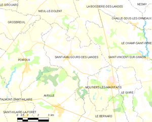
Saint-Avaugourd-des-Landes
- commune in Vendée, France
- Country:
- Postal Code: 85540
- Coordinates: 46° 30' 50" N, 1° 29' 4" E
- GPS tracks (wikiloc): [Link]
- Area: 20.85 sq km
- Population: 1042
- Web site: [Link]


Sainte-Flaive-des-Loups
- commune in Vendée, France
- Country:
- Postal Code: 85150
- Coordinates: 46° 36' 47" N, 1° 34' 51" E
- GPS tracks (wikiloc): [Link]
- Area: 36.11 sq km
- Population: 2362
- Web site: [Link]