Noceto (Noceto)
- Italian comune
Noceto is a charming town in the province of Parma, located in the Emilia-Romagna region of Italy. While it may not be as widely recognized as some other hiking destinations in Italy, it offers some lovely trails and regional parks nearby, ideal for those looking to explore nature.
Hiking in Noceto and Surroundings:
-
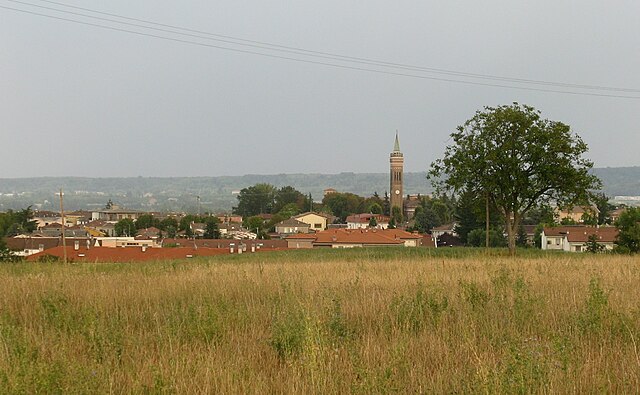
Natural Landscape: The area surrounding Noceto features rolling hills, vineyards, and picturesque countryside, making it suitable for both leisurely strolls and more challenging hikes.
-
Parco dei Boschi di Carrega: This nearby park is a great option for hikers. It is home to a variety of trails that meander through wooded areas and offer opportunities to observe local wildlife and enjoy the tranquility of nature.
-
Vineyard Trails: The region is known for its agriculture, particularly wine production. Many hikes can take you through vineyards, where you can not only enjoy the views but also stop at local wineries for tastings.
-
Guided Tours: If you prefer guided experiences, look for local organizations that offer hiking tours. These guides can provide insights into the local flora, fauna, and culture, enhancing your hiking experience.
-
Accessibility: Noceto's location makes it accessible from major cities such as Parma, making it a convenient option for a day hike or a weekend getaway.
Tips for Hiking in Noceto:
- Check the Weather: Italy can have variable weather, so it’s wise to check forecasts before heading out.
- Wear Appropriate Footwear: Ensure you have comfortable hiking boots or shoes suitable for various terrains.
- Stay Hydrated: Carry enough water, especially during warmer months.
- Local Maps: Consider obtaining local hiking maps, as they can provide essential information about trails and points of interest.
- Respect Nature: Follow Leave No Trace principles to preserve the natural beauty of the area.
Whether you’re a seasoned hiker or a casual walker, Noceto offers a lovely landscape for outdoor exploration while experiencing the charm of the Emilia-Romagna region.
- Country:

- Postal Code: 43015
- Local Dialing Code: 0521
- Licence Plate Code: PR
- Coordinates: 44° 49' 0" N, 10° 11' 0" E


- GPS tracks (wikiloc): [Link]
- AboveSeaLevel: 74 м m
- Area: 79.17 sq km
- Population: 12993
- Web site: http://www.comune.noceto.pr.it
- Wikipedia en: wiki(en)
- Wikipedia: wiki(it)
- Wikidata storage: Wikidata: Q100854
- Wikipedia Commons Category: [Link]
- Freebase ID: [/m/0gkdrj]
- GeoNames ID: Alt: [6541831]
- VIAF ID: Alt: [237038594]
- OSM relation ID: [43609]
- GND ID: Alt: [7555996-1]
- UN/LOCODE: [ITNCO]
- ISTAT ID: 034025
- Italian cadastre code: F914
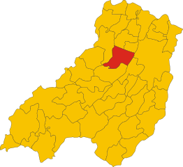
Shares border with regions:


Collecchio
- Italian comune
Collecchio, located in the Province of Parma in Emilia-Romagna, Italy, offers a variety of hiking opportunities that cater to different skill levels and preferences. The surrounding countryside features a mix of rolling hills, vineyards, and farmland, providing scenic trails and beautiful landscapes....
- Country:

- Postal Code: 43044
- Local Dialing Code: 0521
- Licence Plate Code: PR
- Coordinates: 44° 45' 10" N, 10° 12' 56" E


- GPS tracks (wikiloc): [Link]
- AboveSeaLevel: 112 м m
- Area: 58.83 sq km
- Population: 14634
- Web site: [Link]


Fidenza
- Italian comune
Fidenza, located in the Emilia-Romagna region of Italy, is known for its picturesque landscapes that combine rolling hills, lush countryside, and historical landmarks. While it may not be the most famous hiking destination, there are several trails around Fidenza that offer great opportunities for hiking enthusiasts....
- Country:

- Postal Code: 43036
- Local Dialing Code: 0524
- Licence Plate Code: PR
- Coordinates: 44° 52' 0" N, 10° 4' 0" E


- GPS tracks (wikiloc): [Link]
- AboveSeaLevel: 75 м m
- Area: 95.12 sq km
- Population: 26898
- Web site: [Link]


Fontanellato
- Italian comune
Fontanellato, located in the Emilia-Romagna region of Italy, is a charming town known for its historic landmarks, particularly the Rocca Sanvitale, a stunning fortress that adds to the scenic beauty of the area. While Fontanellato itself is not primarily known as a hiking destination, there are several outdoor activities and walking routes in the surrounding countryside that can be explored....
- Country:

- Postal Code: 43012
- Local Dialing Code: 0521
- Licence Plate Code: PR
- Coordinates: 44° 52' 57" N, 10° 9' 21" E


- GPS tracks (wikiloc): [Link]
- AboveSeaLevel: 45 м m
- Area: 53.98 sq km
- Population: 7034
- Web site: [Link]
Fontevivo
- Italian comune
Fontevivo is a charming location in Italy, nestled in the region of Emilia-Romagna, close to the city of Parma. While it's not as famous for hiking as some other regions in Italy (like the Dolomites or the Alps), it still offers some beautiful landscapes and trails for those looking to enjoy nature and the outdoors....
- Country:

- Postal Code: 43010
- Local Dialing Code: 0521
- Licence Plate Code: PR
- Coordinates: 44° 51' 0" N, 10° 10' 0" E


- GPS tracks (wikiloc): [Link]
- AboveSeaLevel: 53 м m
- Area: 26 sq km
- Population: 5615
- Web site: [Link]


Medesano
- Italian comune
Medesano is a charming town located in the province of Parma, in the Emilia-Romagna region of northern Italy. The surrounding area offers diverse hiking opportunities, from scenic trails through the countryside to more rugged paths in the nearby Apennine mountains. Here are some highlights for hiking in and around Medesano:...
- Country:

- Postal Code: 43014
- Local Dialing Code: 0525
- Licence Plate Code: PR
- Coordinates: 44° 45' 24" N, 10° 8' 25" E


- GPS tracks (wikiloc): [Link]
- AboveSeaLevel: 136 м m
- Area: 88.77 sq km
- Population: 10850
- Web site: [Link]


Parma
- city in the northern Italian region of Emilia-Romagna
Parma, located in northern Italy, is not just known for its rich culinary heritage, but it also offers beautiful hiking opportunities in its surroundings. The region is characterized by rolling hills, lush landscapes, and a variety of trails suitable for different levels of hikers....
- Country:

- Postal Code: 43121–43126
- Local Dialing Code: 0521
- Licence Plate Code: PR
- Coordinates: 44° 48' 5" N, 10° 19' 41" E


- GPS tracks (wikiloc): [Link]
- AboveSeaLevel: 55 м m
- Area: 260.6 sq km
- Population: 194417
- Web site: [Link]

