
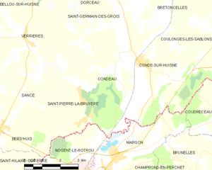
Nogent-le-Rotrou (Nogent-le-Rotrou)

- commune in Eure-et-Loir, France
- Country:

- Postal Code: 28400
- Coordinates: 48° 19' 18" N, 0° 49' 18" E


- GPS tracks (wikiloc): [Link]
- AboveSeaLevel: 108 м m
- Area: 23.49 sq km
- Population: 9956
- Web site: http://www.ville-nogent-le-rotrou.fr
- Wikipedia en: wiki(en)
- Wikipedia: wiki(fr)
- Wikidata storage: Wikidata: Q214432
- Wikipedia Commons Category: [Link]
- Freebase ID: [/m/08rgd9]
- SIREN number: [212802805]
- BnF ID: [152542102]
- VIAF ID: Alt: [154800425]
- GND ID: Alt: [4244664-8]
- Library of Congress authority ID: Alt: [n97099716]
- MusicBrainz area ID: [da9a593f-a2fa-4a76-ad09-8de8e3040868]
- WOEID: [614396]
- SUDOC authorities ID: [050171550]
- ISNI: Alt: [0000 0001 2298 5371]
- INSEE municipality code: 28280
Shares border with regions:


Berd'huis
- commune in Orne, France
- Country:
- Postal Code: 61340
- Coordinates: 48° 20' 43" N, 0° 44' 45" E
- GPS tracks (wikiloc): [Link]
- Area: 11.45 sq km
- Population: 1083
- Web site: [Link]


Dancé
- former commune in Orne, France
- Country:
- Postal Code: 61340
- Coordinates: 48° 21' 47" N, 0° 45' 30" E
- GPS tracks (wikiloc): [Link]
- Area: 14.61 sq km
- Population: 365


Mâle
- former commune in Orne, France
- Country:
- Postal Code: 61260
- Coordinates: 48° 16' 16" N, 0° 44' 20" E
- GPS tracks (wikiloc): [Link]
- Area: 21.9 sq km
- Population: 755
- Web site: [Link]

Condeau
- former commune in Orne, France
- Country:
- Postal Code: 61110
- Coordinates: 48° 23' 6" N, 0° 50' 1" E
- GPS tracks (wikiloc): [Link]
- Area: 15.28 sq km
- Population: 421


Saint-Hilaire-sur-Erre
- commune in Orne, France
- Country:
- Postal Code: 61340
- Coordinates: 48° 18' 45" N, 0° 44' 18" E
- GPS tracks (wikiloc): [Link]
- Area: 15.12 sq km
- Population: 533


Saint-Pierre-la-Bruyère
- commune in Orne, France
- Country:
- Postal Code: 61340
- Coordinates: 48° 21' 46" N, 0° 48' 18" E
- GPS tracks (wikiloc): [Link]
- Area: 6.33 sq km
- Population: 453


Trizay-Coutretot-Saint-Serge
- commune in Eure-et-Loir, France
- Country:
- Postal Code: 28400
- Coordinates: 48° 17' 34" N, 0° 52' 1" E
- GPS tracks (wikiloc): [Link]
- Area: 11.15 sq km
- Population: 453
- Web site: [Link]