Nordwestmecklenburg District (Landkreis Nordwestmecklenburg)

- district in Germany
 Hiking in Nordwestmecklenburg District
Nordwestmecklenburg, located in northern Germany, is a beautiful area characterized by its diverse landscapes, including forests, lakes, and access to the Baltic Sea. It's perfect for hiking enthusiasts looking for scenic routes and a peaceful environment. Here’s what you need to know about hiking in this region:
Trails and Natural Attractions
-
Wilderness Areas: The region features several nature reserves and parks, such as the Waldgebiet Kienhorst and parts of the Mecklenburg Lake District. These areas offer lush forests and a variety of wildlife.
-
Coastal Paths: The proximity to the Baltic Sea means there are opportunities for coastal hikes. You can explore the coastline, taking in views of sandy beaches and cliffs, particularly around towns like Wismar and Scharbeutz.
-
Lake Routes: Many lakes in the area, including Lake Schwerin, provide scenic hiking routes around their shores. These paths often allow for great birdwatching opportunities and are ideal for peaceful walks.
-
Historical Trails: The region has historical significance, with old castles, manors, and towns. Consider incorporating some of these historical sites into your hikes, like the castle in Schwerin.
Hiking Tips
-
Maps and Navigation: It's advisable to carry a detailed map of the area or use hiking apps to ensure you stay on course. Certain trails might not be well marked.
-
Weather Conditions: The weather can change quickly, especially near the coast. Be prepared for showers and have proper gear, including waterproof clothing and sturdy hiking boots.
-
Local Regulations: As with any natural area, be aware of any local regulations regarding trail use and wildlife protection. Stick to marked paths to preserve the landscape.
-
Duration and Difficulty: There are trails suitable for all levels, from short walks to more challenging hikes. Plan your route according to your experience level and the time you have available.
Local Amenities
-
Accommodations: There are various options for overnight stays, from hotels to campgrounds, which can cater to hikers looking to explore the region over a few days.
-
Food and Supplies: Many towns have cafes and restaurants where you can enjoy local cuisine. Make sure to stock up on water and snacks before heading out on a long hike.
Conclusion
Hiking in Nordwestmecklenburg offers a blend of natural beauty and cultural heritage, making it an enjoyable experience for any outdoor enthusiast. Whether you're a beginner or an experienced hiker, there are trails that cater to all levels, providing opportunities to connect with nature and explore the rich history of this scenic region. Enjoy your hike!
- Country:

- Capital: Wismar
- Licence Plate Code: (HWI); NWM; WIS; GVM; GDB
- Coordinates: 53° 49' 48" N, 11° 10' 12" E


- GPS tracks (wikiloc): [Link]
- AboveSeaLevel: 37 м m
- Area: 2117.00 sq km
- Population: 155424
- Web site: http://www.nordwestmecklenburg.de
- Wikipedia en: wiki(en)
- Wikipedia: wiki(de)
- Wikidata storage: Wikidata: Q2876
- Wikipedia Commons Category: [Link]
- Wikipedia Commons Maps Category: [Link]
- Freebase ID: [/m/0_0s1]
- GeoNames ID: Alt: [3302143]
- VIAF ID: Alt: [125624951]
- OSM relation ID: [1739380]
- GND ID: Alt: [4440561-3]
- archINFORM location ID: [3830]
- Library of Congress authority ID: Alt: [n91071090]
- WOEID: [12596988]
- TGN ID: [7076470]
- NUTS code: [DE80M]
- Instagram location ID: [154166877951484]
- German district key: 13074
Shares border with regions:


Schwerin
- capital city of Mecklenburg-Vorpommern, Germany
Hiking in Schwerin
Hiking in Schwerin, the capital of the state of Mecklenburg-Vorpommern in northern Germany, offers a delightful experience for nature enthusiasts and outdoor explorers. The region is known for its picturesque landscapes, lakes, and rich history. Here are some highlights and tips for hiking in and around Schwerin:...
- Country:
- Postal Code: 19063; 19061; 19059; 19057; 19055; 19053
- Local Dialing Code: 0385
- Licence Plate Code: SN
- Coordinates: 53° 38' 0" N, 11° 25' 0" E
- GPS tracks (wikiloc): [Link]
- AboveSeaLevel: 38 м m
- Area: 130.52 sq km
- Population: 95797
- Web site: [Link]
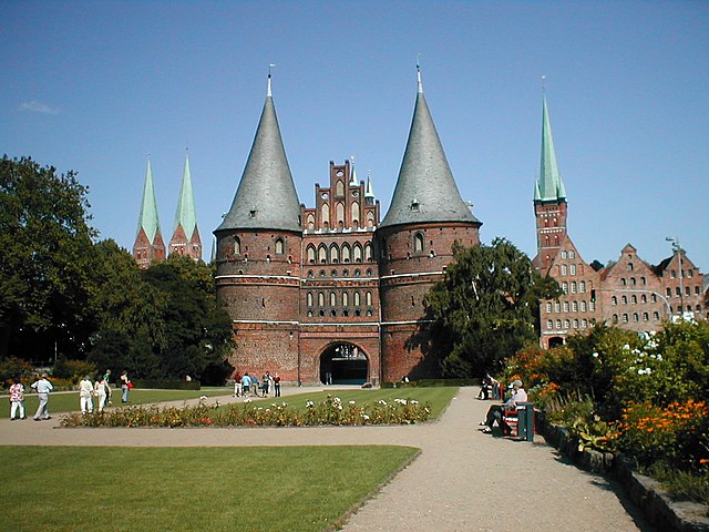

Lübeck
- city in Schleswig-Holstein, Germany
Hiking in Lübeck
Lübeck, located in northern Germany, is known for its rich medieval history, beautiful architecture, and proximity to the scenic Baltic Sea. While it may not be primarily recognized as a hiking destination, there are still several opportunities for outdoor enthusiasts to enjoy nature and explore the region through hiking....
- Country:
- Postal Code: 23552–23570
- Local Dialing Code: 451; 4508; 4502
- Licence Plate Code: HL
- Coordinates: 53° 52' 11" N, 10° 41' 11" E
- GPS tracks (wikiloc): [Link]
- AboveSeaLevel: 13 м m
- Area: 214.21 sq km
- Population: 216709
- Web site: [Link]


Rostock District
- district of Mecklenburg-Vorpommern, Germany
Hiking in Rostock District
Rostock, located in northern Germany along the Baltic Sea, is a beautiful region with a mix of coastal landscapes, forests, and charming countryside, making it a great destination for hiking enthusiasts. Here are some highlights for hiking in the Rostock district:...
- Country:
- Capital: Güstrow
- Licence Plate Code: TET; ROS; LRO; GÜ; DBR; BÜZ
- Coordinates: 53° 54' 0" N, 12° 15' 0" E
- GPS tracks (wikiloc): [Link]
- AboveSeaLevel: 39 м m
- Area: 3431 sq km
- Population: 211878
- Web site: [Link]


Ludwigslust-Parchim District
- German district
Hiking in Ludwigslust-Parchim District
Ludwigslust-Parchim is a district located in the state of Mecklenburg-Vorpommern in northern Germany. It's known for its diverse landscapes that include forests, lakes, and agricultural land, making it a great area for hiking enthusiasts. Here are some highlights and tips for hiking in the region:...
- Country:
- Licence Plate Code: STB; PCH; LWL; LUP; LBZ; HGN
- Coordinates: 53° 27' 0" N, 11° 33' 0" E
- GPS tracks (wikiloc): [Link]
- AboveSeaLevel: 41 м m
- Area: 4750.00 sq km
- Population: 212373
- Web site: [Link]
Herzogtum Lauenburg
- district of Germany
Hiking in Herzogtum Lauenburg
Herzogtum Lauenburg is a picturesque region in northern Germany, known for its scenic landscapes, rich history, and charming towns. If you're considering hiking in this area, you'll find a variety of trails and natural attractions that cater to different skill levels. Here are some highlights and tips for hiking in Herzogtum Lauenburg:...
- Country:
- Licence Plate Code: RZ
- Coordinates: 53° 35' 0" N, 10° 40' 0" E
- GPS tracks (wikiloc): [Link]
- AboveSeaLevel: 35 м m
- Area: 1262.97 sq km
- Population: 192999
- Web site: [Link]