Notre-Dame-de-l'Isle (Notre-Dame-de-l'Isle)

- commune in Eure, France
- Country:

- Postal Code: 27940
- Coordinates: 49° 8' 44" N, 1° 25' 54" E


- GPS tracks (wikiloc): [Link]
- Area: 11.81 sq km
- Population: 672
- Web site: http://notre-dame-de-lisle.fr
- Wikipedia en: wiki(en)
- Wikipedia: wiki(fr)
- Wikidata storage: Wikidata: Q1073051
- Wikipedia Commons Category: [Link]
- Freebase ID: [/m/03nqkp8]
- Freebase ID: [/m/03nqkp8]
- GeoNames ID: Alt: [6430512]
- GeoNames ID: Alt: [6430512]
- SIREN number: [212704407]
- SIREN number: [212704407]
- BnF ID: [15253675h]
- BnF ID: [15253675h]
- Library of Congress authority ID: Alt: [n2001031627]
- Library of Congress authority ID: Alt: [n2001031627]
- PACTOLS thesaurus ID: [pcrtAn7luxJRvD]
- PACTOLS thesaurus ID: [pcrtAn7luxJRvD]
- INSEE municipality code: 27440
- INSEE municipality code: 27440
Shares border with regions:
Hennezis
- commune in Eure, France
- Country:
- Postal Code: 27700
- Coordinates: 49° 11' 35" N, 1° 27' 53" E
- GPS tracks (wikiloc): [Link]
- Area: 15.63 sq km
- Population: 783
- Web site: [Link]
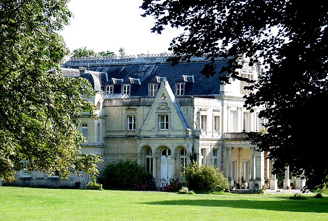
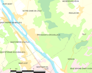
Pressagny-l'Orgueilleux
- commune in Eure, France
- Country:
- Postal Code: 27510
- Coordinates: 49° 7' 56" N, 1° 26' 45" E
- GPS tracks (wikiloc): [Link]
- AboveSeaLevel: 31 м m
- Area: 10.27 sq km
- Population: 706


Mézières-en-Vexin
- commune in Eure, France
- Country:
- Postal Code: 27510
- Coordinates: 49° 10' 21" N, 1° 30' 13" E
- GPS tracks (wikiloc): [Link]
- Area: 12.7 sq km
- Population: 627

Port-Mort
- commune in Eure, France
- Country:
- Postal Code: 27940
- Coordinates: 49° 10' 8" N, 1° 24' 24" E
- GPS tracks (wikiloc): [Link]
- Area: 12.17 sq km
- Population: 936
- Web site: [Link]


Panilleuse
- former commune in Eure, France
- Country:
- Postal Code: 27510
- Coordinates: 49° 9' 1" N, 1° 30' 8" E
- GPS tracks (wikiloc): [Link]
- Area: 8.87 sq km
- Population: 452
- Web site: [Link]