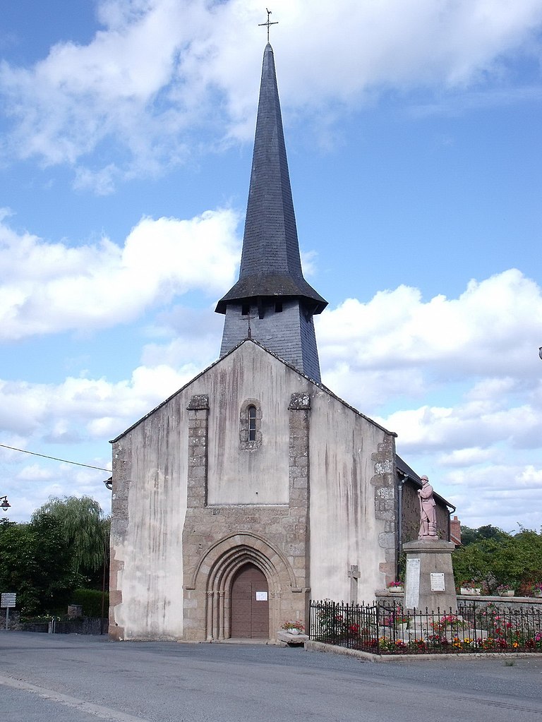
Nouziers (Nouziers)

- commune in Creuse, France
- Country:

- Postal Code: 23350
- Coordinates: 46° 25' 18" N, 1° 57' 28" E


- GPS tracks (wikiloc): [Link]
- Area: 14.33 sq km
- Population: 232
- Wikipedia en: wiki(en)
- Wikipedia: wiki(fr)
- Wikidata storage: Wikidata: Q472015
- Wikipedia Commons Category: [Link]
- Freebase ID: [/m/03mfk1d]
- Freebase ID: [/m/03mfk1d]
- GeoNames ID: Alt: [6612350]
- GeoNames ID: Alt: [6612350]
- SIREN number: [212314801]
- SIREN number: [212314801]
- BnF ID: [15251535h]
- BnF ID: [15251535h]
- INSEE municipality code: 23148
- INSEE municipality code: 23148
Shares border with regions:

La Cellette
- commune in Creuse, France
- Country:
- Postal Code: 23350
- Coordinates: 46° 24' 14" N, 2° 0' 51" E
- GPS tracks (wikiloc): [Link]
- Area: 21.48 sq km
- Population: 270


Sazeray
- commune in Indre, France
- Country:
- Postal Code: 36160
- Coordinates: 46° 25' 44" N, 2° 3' 15" E
- GPS tracks (wikiloc): [Link]
- Area: 22.69 sq km
- Population: 307


Pouligny-Notre-Dame
- commune in Indre, France
- Country:
- Postal Code: 36160
- Coordinates: 46° 28' 53" N, 2° 0' 12" E
- GPS tracks (wikiloc): [Link]
- Area: 33.75 sq km
- Population: 700

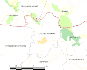
La Forêt-du-Temple
- commune in Creuse, France
- Country:
- Postal Code: 23360
- Coordinates: 46° 25' 15" N, 1° 54' 10" E
- GPS tracks (wikiloc): [Link]
- Area: 7.72 sq km
- Population: 141
Mortroux
- commune in Creuse, France
- Country:
- Postal Code: 23220
- Coordinates: 46° 23' 51" N, 1° 54' 55" E
- GPS tracks (wikiloc): [Link]
- Area: 13.28 sq km
- Population: 291


Crevant
- commune in Indre, France
- Country:
- Postal Code: 36140
- Coordinates: 46° 29' 11" N, 1° 56' 48" E
- GPS tracks (wikiloc): [Link]
- Area: 36.54 sq km
- Population: 722
- Web site: [Link]

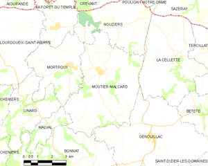
Moutier-Malcard
- commune in Creuse, France
- Country:
- Postal Code: 23220
- Coordinates: 46° 23' 37" N, 1° 56' 41" E
- GPS tracks (wikiloc): [Link]
- Area: 25.81 sq km
- Population: 519