Nozay (Nozay)

- commune in Aube, France
- Country:

- Postal Code: 10700
- Coordinates: 48° 30' 31" N, 4° 5' 44" E


- GPS tracks (wikiloc): [Link]
- Area: 15.75 sq km
- Population: 145
- Wikipedia en: wiki(en)
- Wikipedia: wiki(fr)
- Wikidata storage: Wikidata: Q1105470
- Wikipedia Commons Category: [Link]
- Freebase ID: [/m/03m8tqz]
- GeoNames ID: Alt: [6426496]
- SIREN number: [211002613]
- INSEE municipality code: 10269
Shares border with regions:

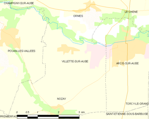
Villette-sur-Aube
- commune in Aube, France
- Country:
- Postal Code: 10700
- Coordinates: 48° 32' 6" N, 4° 6' 0" E
- GPS tracks (wikiloc): [Link]
- Area: 7.28 sq km
- Population: 263


Pouan-les-Vallées
- commune in Aube, France
- Country:
- Postal Code: 10700
- Coordinates: 48° 32' 29" N, 4° 3' 52" E
- GPS tracks (wikiloc): [Link]
- Area: 16.61 sq km
- Population: 560


Prémierfait
- commune in Aube, France
- Country:
- Postal Code: 10170
- Coordinates: 48° 30' 9" N, 4° 1' 39" E
- GPS tracks (wikiloc): [Link]
- Area: 14.79 sq km
- Population: 94

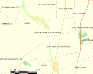
Saint-Étienne-sous-Barbuise
- commune in Aube, France
- Country:
- Postal Code: 10700
- Coordinates: 48° 30' 1" N, 4° 6' 33" E
- GPS tracks (wikiloc): [Link]
- Area: 10.84 sq km
- Population: 155


Arcis-sur-Aube
- commune in Aube, France
- Country:
- Postal Code: 10700
- Coordinates: 48° 32' 2" N, 4° 8' 20" E
- GPS tracks (wikiloc): [Link]
- Area: 9.49 sq km
- Population: 2822
- Web site: [Link]


Les Grandes-Chapelles
- commune in Aube, France
- Country:
- Postal Code: 10170
- Coordinates: 48° 28' 0" N, 4° 0' 58" E
- GPS tracks (wikiloc): [Link]
- Area: 22.1 sq km
- Population: 394