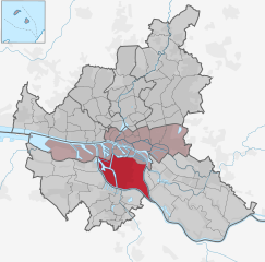
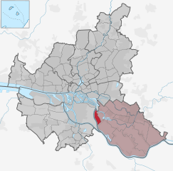
Hamburg-Ochsenwerder (Ochsenwerder)

- suburb in Bergedorf district, Germany
 Hiking in Hamburg-Ochsenwerder
Ochsenwerder is a charming area located in the Hamburg district of Germany, known for its beautiful natural landscapes, quiet surroundings, and opportunities for outdoor activities, including hiking. Here's what you can expect when hiking in Ochsenwerder:
Scenic Trails
- Nature Trails: The area features various trails that take you through lush greenery, meadows, and along the banks of the Elbe River. The views of the river and surrounding farmlands are picturesque, especially during sunrise or sunset.
- Wildlife Viewing: As you hike, you may encounter a variety of wildlife, making it a great spot for birdwatching and appreciating nature.
Difficulty Levels
- The hiking trails around Ochsenwerder vary in difficulty, making it suitable for both beginners and more experienced hikers. You can choose gentle paths for an easy stroll or more challenging routes if you seek a workout.
Local Attractions
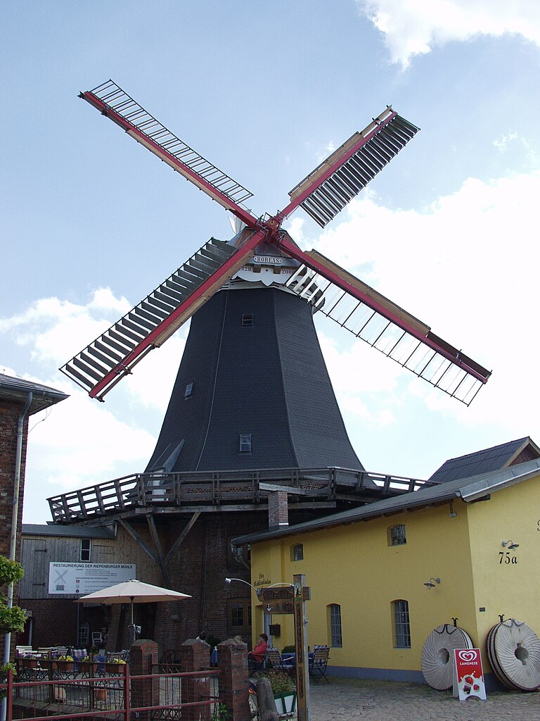
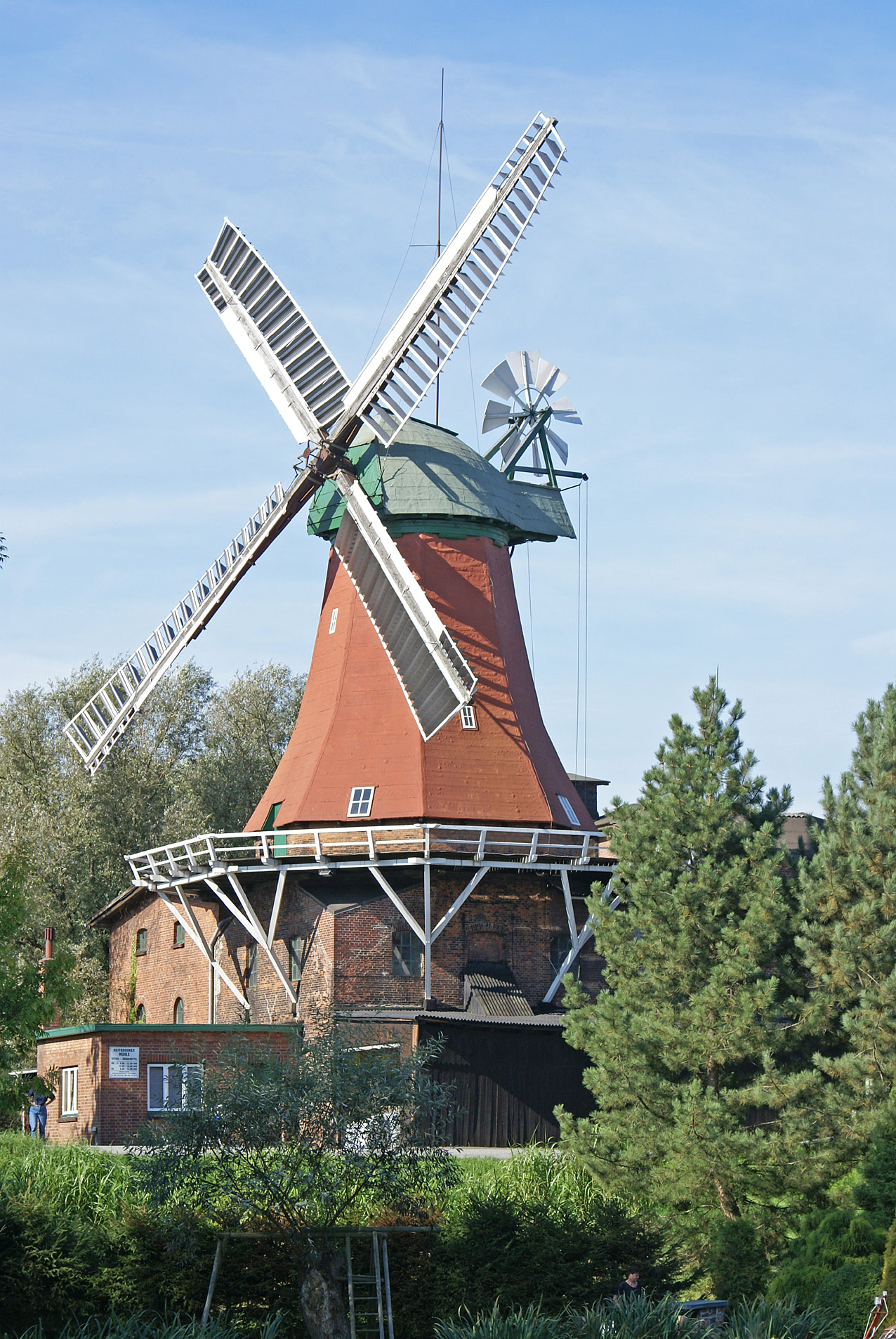
- Historical Sites: Along your hike, you might come across local historical sites or landmarks that reflect the region's heritage. These can add interest to your journey and provide opportunities for rest and exploration.
- Local Farms: The area is known for agriculture, and some trails may lead you past local farms, where you can enjoy fresh produce or local delicacies.
Family-Friendly Hikes
- The region offers family-friendly options, making it suitable for hikers of all ages. Many trails are flat and easily accessible, allowing younger hikers to join in the fun.
Tips for Hiking in Ochsenwerder
- Weather Preparedness: Check the weather before your hike and dress accordingly. Waterproof clothing and sturdy hiking shoes are advisable, especially if you plan to hike on less-developed paths.
- Stay Hydrated: Bring plenty of water and snacks to keep your energy up throughout the hike.
- Plan Ahead: Familiarize yourself with the trail maps and specifics about the area. It’s a good idea to let someone know your hiking plans for safety.
Conclusion
Hiking in Ochsenwerder offers a serene escape into nature and is a wonderful way to experience the beauty of the Hamburg region. Whether you're looking for a leisurely walk or a more vigorous hike, the area can accommodate your needs while providing a refreshing outdoor experience. Enjoy your hike!
- Country:

- Coordinates: 53° 27' 25" N, 10° 5' 33" E


- GPS tracks (wikiloc): [Link]
- Area: 14.1 sq km
- Wikipedia en: wiki(en)
- Wikipedia: wiki(de)
- Wikidata storage: Wikidata: Q2416
- Wikipedia Commons Category: [Link]
- Wikipedia Commons Maps Category: [Link]
- VIAF ID: Alt: [235233656]
- TGN ID: [1005255]
Shares border with regions:

Wilhelmsburg
- quarter of the German city of Hamburg
Hiking in Wilhelmsburg
Wilhelmsburg, a district in Hamburg, Germany, is known for its unique blend of nature and urban life. While it may not be a traditional hiking destination like the Alps or national parks, there are still several opportunities for outdoor adventures and exploring scenic routes....
- Country:
- Coordinates: 53° 29' 42" N, 10° 0' 40" E
- GPS tracks (wikiloc): [Link]
- AboveSeaLevel: -2 м m
- Area: 35.3 sq km


Allermöhe
- quarter in Hamburg, Germany
Hiking in Allermöhe
Allermöhe is a district located in Hamburg, Germany, known for its scenic landscapes and green spaces. While it may not be as well-known for hiking as some other areas in Germany, there are still enjoyable opportunities for walking and outdoor activities. Here are some aspects to consider when hiking or walking in Allermöhe:...
- Country:
- Coordinates: 53° 29' 0" N, 10° 9' 0" E
- GPS tracks (wikiloc): [Link]
- Area: 11.9 sq km
Hamburg-Kirchwerder
- quarter in the district Bergedorf, Germany
Hiking in Hamburg-Kirchwerder
Kirchwerder is a district located in the southeastern part of Hamburg, Germany, and while it is primarily known for its rural charm and waterways, there are some great opportunities for hiking and enjoying the natural surroundings....
- Country:
- Coordinates: 53° 25' 11" N, 10° 12' 6" E
- GPS tracks (wikiloc): [Link]
- Area: 32.4 sq km
- Population: 8669

Hamburg-Reitbrook
- suburb in the district Bergedorf, Germany
Hiking in Hamburg-Reitbrook
Reitbrook is a scenic area that offers a variety of hiking opportunities, though it might not be as widely known as some other hiking destinations. Here are some key points to consider if you're planning to hike in Reitbrook or similar regions:...
- Country:
- Coordinates: 53° 28' 0" N, 10° 9' 0" E
- GPS tracks (wikiloc): [Link]
- Area: 6.9 sq km

Spadenland
- suburb in the district Bergedorf, Germany
Hiking in Spadenland
Spadenland is not a widely recognized location in terms of popular hiking destinations. It may be a local or less-known area. If you meant a different place or a specific region within Spadenland, please provide more details so I can give you accurate information....
- Country:
- Coordinates: 53° 29' 16" N, 10° 3' 28" E
- GPS tracks (wikiloc): [Link]
- Area: 3.4 sq km


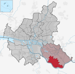
Tatenberg
- suburb in Bergedorf district, Germany
Hiking in Tatenberg
Tatenberg is a picturesque hiking destination, often sought after by outdoor enthusiasts due to its stunning landscapes and diverse trails. Although specific details can vary based on the exact region you're inquiring about, here are some general points of interest about hiking in areas typically associated with Tatenberg:...
- Country:
- Postal Code: 21037
- Local Dialing Code: 040
- Coordinates: 53° 29' 0" N, 10° 5' 0" E
- GPS tracks (wikiloc): [Link]
- Area: 3.1 sq km
- Population: 558