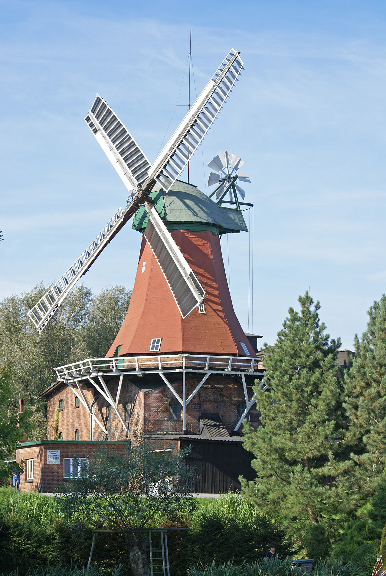
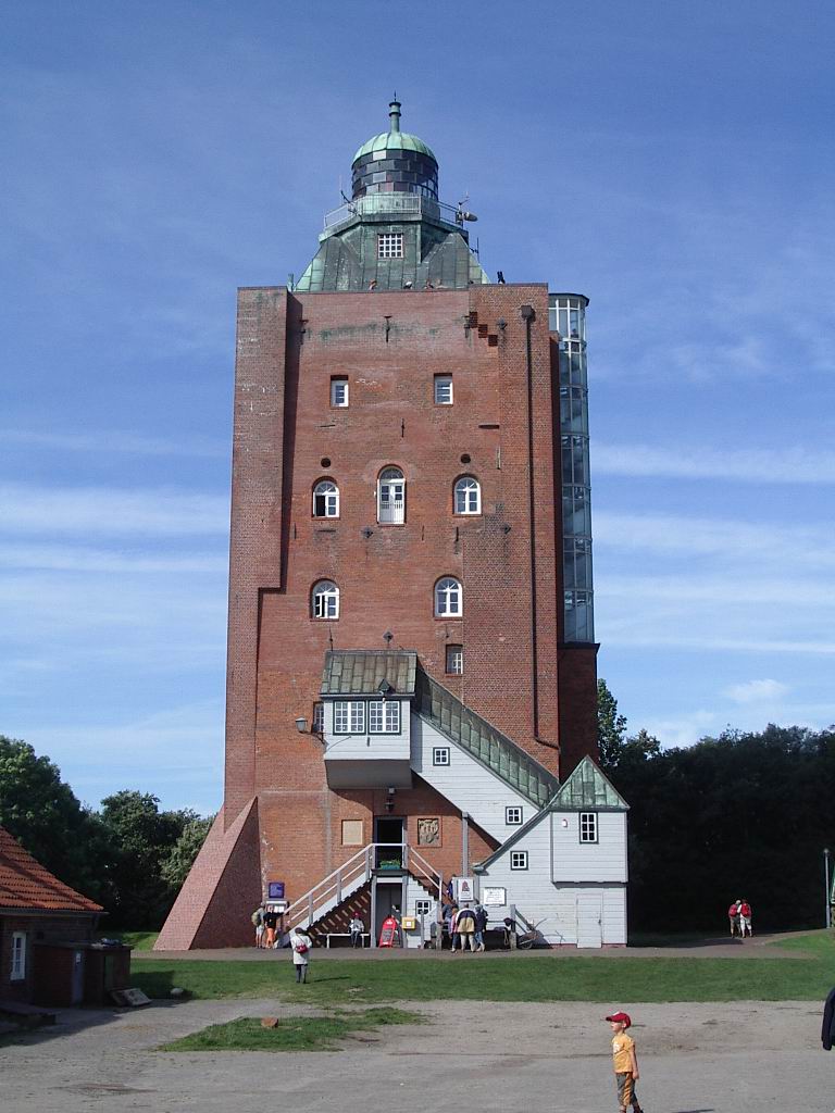
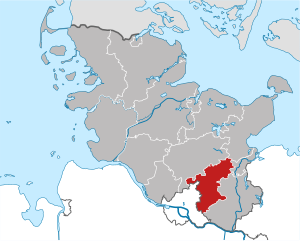
Bergedorf (Bezirk Bergedorf)

- borough of the city of Hamburg, Germany
 Hiking in Bergedorf
Bergedorf, a district in Hamburg, Germany, is known for its picturesque landscapes and outdoor opportunities. While it may not be a traditional hiking destination, there are several routes and natural parks in and around the area that provide great walking and hiking experiences. Here are some highlights:
1.
- Located to the east of Bergedorf, Boberger Duenen is a beautiful nature reserve featuring sandy hills, heath landscapes, and small lakes. There are marked trails that allow for leisurely hikes through diverse ecosystems. It's a popular spot for birdwatching as well.
2.
- A short distance from Bergedorf, the Sachsenwald landscape park offers extensive trails through forests and alongside rivers. The park is suitable for walkers looking to explore the serene nature of Northern Germany, with varying difficulties in trails.
3.
- The Elbe River offers beautiful walking paths that are ideal for both short strolls and longer hikes. The views of the waterway and surrounding areas are stunning, especially during sunset. Parts of the trail are also accessible for cyclists.
4.
- Within Hamburg itself, you can find numerous parks and green spaces connected by walking trails. Exploring these urban parks can provide a different kind of hiking experience with opportunities to enjoy art, gardens, and local flora and fauna.
5.
- Preparation: Ensure you have a good map or GPS for navigation, as trails can vary in marking.
- Weather: Check the local weather before heading out, as conditions can change rapidly.
- Footwear: Wear appropriate hiking shoes for comfort and support, especially if you're on forested or uneven terrain.
- Stay Hydrated: Bring water, especially if you're planning a longer hike.
6.
- Bergedorf is well-connected to Hamburg and other surrounding areas via public transport, making it easy to access hiking spots without needing a car.
Whether you're looking for an easy stroll or a more strenuous hike, Bergedorf and its surroundings offer a mix of nature and tranquility, perfect for outdoor enthusiasts.
- Country:

- Coordinates: 53° 29' 14" N, 10° 12' 37" E


- GPS tracks (wikiloc): [Link]
- AboveSeaLevel: 17 м m
- Area: 154.8 sq km
- Population: 129111
- Web site: https://www.bergedorf.de/willkommen.html
- Wikipedia en: wiki(en)
- Wikipedia: wiki(de)
- Wikidata storage: Wikidata: Q1637
- Wikipedia Commons Category: [Link]
- Freebase ID: [/m/01x64z]
- GeoNames ID: Alt: [7290243]
- VIAF ID: Alt: [158288325]
- OSM relation ID: [28936]
- GND ID: Alt: [4094608-3]
- archINFORM location ID: [44668]
- Library of Congress authority ID: Alt: [n81106807]
- NKCR AUT ID: [ge901588]
Includes regions:


Allermöhe
- quarter in Hamburg, Germany
Hiking in Allermöhe
Allermöhe is a district located in Hamburg, Germany, known for its scenic landscapes and green spaces. While it may not be as well-known for hiking as some other areas in Germany, there are still enjoyable opportunities for walking and outdoor activities. Here are some aspects to consider when hiking or walking in Allermöhe:...
- Country:
- Coordinates: 53° 29' 0" N, 10° 9' 0" E
- GPS tracks (wikiloc): [Link]
- Area: 11.9 sq km


Altengamme
- quarter in Hamburg, Germany
Hiking in Altengamme
Altengamme is a charming district located in the eastern part of Hamburg, Germany. Although not as widely known for hiking as some larger natural parks or mountainous regions, the area still offers opportunities for walks and light hiking, particularly along scenic routes and within green spaces....
- Country:
- Coordinates: 53° 25' 29" N, 10° 15' 45" E
- GPS tracks (wikiloc): [Link]
- AboveSeaLevel: 4 м m
- Area: 15.6 sq km
- Population: 2192
- Web site: [Link]
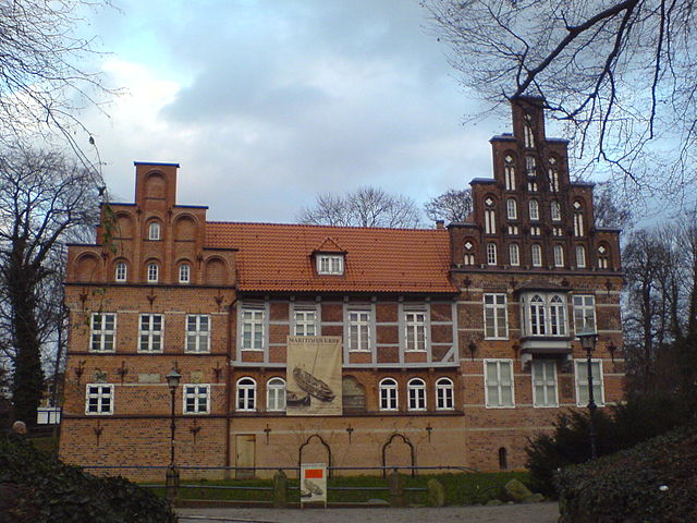

Bergedorf
- quarter of Hamburg, Germany
Hiking in Bergedorf
Bergedorf is a picturesque district in the east of Hamburg, Germany. While it may not be a traditional hiking haven, it offers beautiful walking paths, parks, and nearby nature reserves that are perfect for outdoor enthusiasts. Here are some highlights for hiking in and around Bergedorf:...
- Country:
- Coordinates: 53° 29' 0" N, 10° 13' 0" E
- GPS tracks (wikiloc): [Link]
- AboveSeaLevel: 9 м m
- Area: 11.3 sq km
- Population: 35105
- Web site: [Link]


Billwerder
- quarter of Hamburg, Germany
Hiking in Billwerder
Billwerder is a neighborhood located in Hamburg, Germany, and while it may not be renowned as a hiking destination, it can offer some opportunities for walking and exploring the natural surroundings. The region is primarily industrial and residential, but nearby areas along the Elbe River provide scenic routes for nature walks and leisurely strolls....
- Country:
- Coordinates: 53° 29' 57" N, 10° 8' 4" E
- GPS tracks (wikiloc): [Link]
- Area: 9.5 sq km


Curslack
- quarter in Hamburg, Germany
Hiking in Curslack
Curslack, located in the Hamburg district of Germany, offers a unique blend of nature and urban settings for hiking enthusiasts. Although it may not be as well-known as some larger hiking destinations, there are several opportunities for exploring the beautiful landscapes in and around this area....
- Country:
- Coordinates: 53° 27' 31" N, 10° 12' 57" E
- GPS tracks (wikiloc): [Link]
- Area: 10.6 sq km


Moorfleet
- suburb in the district Bergedorf, Germany
Hiking in Moorfleet
Moorfleet is a quaint area that might not be widely recognized as a hiking destination, but it can still offer some lovely terrain for outdoor enthusiasts if you’re looking for a peaceful experience....
- Country:
- Coordinates: 53° 30' 15" N, 10° 5' 7" E
- GPS tracks (wikiloc): [Link]
- Area: 4.3 sq km


Hamburg-Neuallermöhe
- suburb in Bergedorf district, Germany
Hiking in Hamburg-Neuallermöhe
Neuallermöhe is a suburb located in Hamburg, Germany, and while it may not be a well-known hiking destination, it can still offer opportunities for nature walks and urban exploration. Here are some insights into hiking and outdoor activities in and around Neuallermöhe:...
- Country:
- Coordinates: 53° 29' 0" N, 10° 10' 0" E
- GPS tracks (wikiloc): [Link]
- Area: 4.2 sq km


Neuengamme
- quarter of Hamburg, Germany
Hiking in Neuengamme
Neuengamme, located in the northern part of Germany near Hamburg, is a historically rich area primarily known for the Neuengamme concentration camp memorial. While it's not a traditional hiking destination, there are some outdoor opportunities nearby that you might enjoy if you're looking to combine historical and nature exploration....
- Country:
- Coordinates: 53° 25' 50" N, 10° 14' 1" E
- GPS tracks (wikiloc): [Link]
- AboveSeaLevel: 2 м m
- Area: 18.6 sq km
- Population: 3459


Hamburg-Ochsenwerder
- suburb in Bergedorf district, Germany
Hiking in Hamburg-Ochsenwerder
Ochsenwerder is a charming area located in the Hamburg district of Germany, known for its beautiful natural landscapes, quiet surroundings, and opportunities for outdoor activities, including hiking. Here's what you can expect when hiking in Ochsenwerder:...
- Country:
- Coordinates: 53° 27' 25" N, 10° 5' 33" E
- GPS tracks (wikiloc): [Link]
- Area: 14.1 sq km

Hamburg-Reitbrook
- suburb in the district Bergedorf, Germany
Hiking in Hamburg-Reitbrook
Reitbrook is a scenic area that offers a variety of hiking opportunities, though it might not be as widely known as some other hiking destinations. Here are some key points to consider if you're planning to hike in Reitbrook or similar regions:...
- Country:
- Coordinates: 53° 28' 0" N, 10° 9' 0" E
- GPS tracks (wikiloc): [Link]
- Area: 6.9 sq km

Spadenland
- suburb in the district Bergedorf, Germany
Hiking in Spadenland
Spadenland is not a widely recognized location in terms of popular hiking destinations. It may be a local or less-known area. If you meant a different place or a specific region within Spadenland, please provide more details so I can give you accurate information....
- Country:
- Coordinates: 53° 29' 16" N, 10° 3' 28" E
- GPS tracks (wikiloc): [Link]
- Area: 3.4 sq km


Tatenberg
- suburb in Bergedorf district, Germany
Hiking in Tatenberg
Tatenberg is a picturesque hiking destination, often sought after by outdoor enthusiasts due to its stunning landscapes and diverse trails. Although specific details can vary based on the exact region you're inquiring about, here are some general points of interest about hiking in areas typically associated with Tatenberg:...
- Country:
- Postal Code: 21037
- Local Dialing Code: 040
- Coordinates: 53° 29' 0" N, 10° 5' 0" E
- GPS tracks (wikiloc): [Link]
- Area: 3.1 sq km
- Population: 558
Shares border with regions:

Hamburg-Mitte
- district of Hamburg, Germany
Hiking in Hamburg-Mitte
Hiking in Hamburg-Mitte offers a unique blend of urban exploration, historical sites, and beautiful green spaces. While the area is predominantly urban, there are several parks and nature areas where you can enjoy some fresh air and scenic views. Here are a few highlights and suggestions for hiking and outdoor activities in Hamburg-Mitte:...
- Country:
- Coordinates: 53° 33' 1" N, 9° 59' 39" E
- GPS tracks (wikiloc): [Link]
- AboveSeaLevel: 11 м m
- Area: 142.2 sq km
- Population: 301550
Herzogtum Lauenburg
- district of Germany
Hiking in Herzogtum Lauenburg
Herzogtum Lauenburg is a picturesque region in northern Germany, known for its scenic landscapes, rich history, and charming towns. If you're considering hiking in this area, you'll find a variety of trails and natural attractions that cater to different skill levels. Here are some highlights and tips for hiking in Herzogtum Lauenburg:...
- Country:
- Licence Plate Code: RZ
- Coordinates: 53° 35' 0" N, 10° 40' 0" E
- GPS tracks (wikiloc): [Link]
- AboveSeaLevel: 35 м m
- Area: 1262.97 sq km
- Population: 192999
- Web site: [Link]

Stormarn
- German district
Hiking in Stormarn
Stormarn is a district in the federal state of Schleswig-Holstein, Germany, known for its beautiful landscapes, lush forests, and charming villages. Hiking in this area offers a variety of trails suitable for all levels of experience, catering to both casual walkers and avid trekkers. Here are some highlights and tips for hiking in Stormarn:...
- Country:
- Licence Plate Code: OD
- Coordinates: 53° 45' 0" N, 10° 19' 48" E
- GPS tracks (wikiloc): [Link]
- AboveSeaLevel: 34 м m
- Area: 766.33 sq km
- Population: 236705
- Web site: [Link]


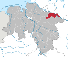
Harburg
- German district in Lower Saxony
Hiking in Harburg
Harburg, a district in the southern part of Hamburg, Germany, offers various hiking opportunities that allow you to explore the beautiful natural landscapes and scenic views of the region. Here are some key points about hiking in Harburg:...
- Country:
- Capital: Winsen
- Licence Plate Code: WL
- Coordinates: 53° 19' 43" N, 9° 58' 11" E
- GPS tracks (wikiloc): [Link]
- AboveSeaLevel: 49 м m
- Population: 250326
- Web site: [Link]

Lüneburg
- German district of Lower Saxony
Hiking in Lüneburg
Lüneburg district, located in Lower Saxony, Germany, is a wonderful area for hiking enthusiasts. The region is known for its scenic landscapes, featuring rolling hills, forests, rivers, and charming villages. Here are some highlights for hiking in Lüneburg:...
- Country:
- Capital: Lüneburg
- Licence Plate Code: LG
- Coordinates: 53° 15' 0" N, 10° 30' 0" E
- GPS tracks (wikiloc): [Link]
- AboveSeaLevel: 8 м m
- Area: 1323.10 sq km
- Population: 181605
- Web site: [Link]