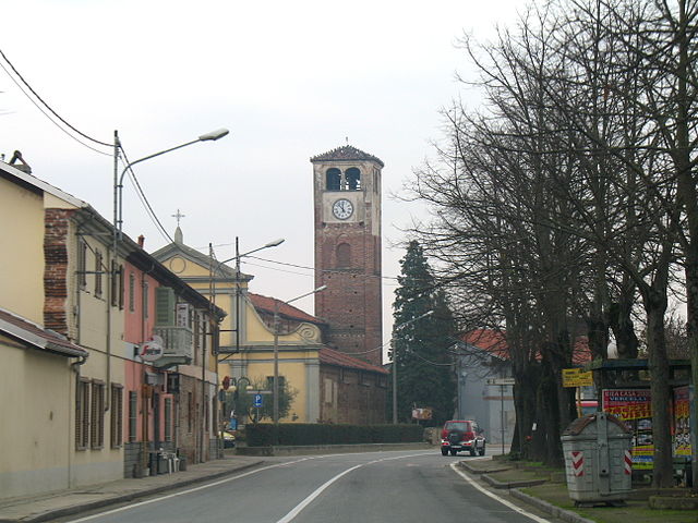
Oldenico (Oldenico)
- Italian comune
 Hiking in Oldenico
Oldenico is a charming area located in the Piedmont region of Italy, known for its natural beauty and outdoor activities. While it may not be as well-known as some of Italy's major hiking destinations, it offers some great opportunities for hiking enthusiasts.
Hiking Trails and Areas
-
Scenic Trails: The area around Oldenico features a range of trails that cater to different skill levels, from easy walks to more challenging hikes. The routes often include picturesque views of the surrounding countryside, including vineyards, rolling hills, and forests.
-
Nature Reserves: Exploring nearby Natural Reserves can provide a chance to hike through diverse ecosystems, where you can observe a variety of flora and fauna.
Recommendations:
-
Maps and Guides: It's advisable to obtain a local hiking map or guide to help navigate the trails. These can often be found at tourist information centers or local shops.
-
Best Time to Visit: The best seasons for hiking in Oldenico are typically spring and autumn, when the weather is mild and the landscapes are vibrant.
-
Safety: Always carry adequate water, snacks, and a first-aid kit. Inform someone of your plans before heading out, and be aware of the weather conditions.
Additional Activities
Besides hiking, Oldenico and its surroundings offer opportunities for cycling, bird watching, and enjoying local culture through food and wine tasting.
Whether you’re a seasoned hiker or looking for a leisurely nature walk, Oldenico has something to offer. Just ensure you’re well-prepared and informed about the local trails and regulations!
- Country:

- Postal Code: 13030
- Local Dialing Code: 0161
- Licence Plate Code: VC
- Coordinates: 45° 24' 0" N, 8° 23' 0" E


- GPS tracks (wikiloc): [Link]
- AboveSeaLevel: 143 м m
- Area: 6.53 sq km
- Population: 225
- Web site: http://www.comune.oldenico.vc.it
- Wikipedia en: wiki(en)
- Wikipedia: wiki(it)
- Wikidata storage: Wikidata: Q25165
- Freebase ID: [/m/0g8qnr]
- GeoNames ID: Alt: [6539545]
- OSM relation ID: [44858]
- ISTAT ID: 002089
- Italian cadastre code: G018
Shares border with regions:

San Nazzaro Sesia
- Italian comune
Hiking in San Nazzaro Sesia
San Nazzaro Sesia is a charming village located in the Piedmont region of Italy, set against the picturesque backdrop of the Sesia Valley. This area is known for its beautiful landscapes, rich history, and outdoor activities, making it an excellent destination for hiking enthusiasts....
- Country:
- Postal Code: 28060
- Local Dialing Code: 0321
- Licence Plate Code: NO
- Coordinates: 45° 26' 0" N, 8° 25' 0" E
- GPS tracks (wikiloc): [Link]
- AboveSeaLevel: 153 м m
- Area: 11.45 sq km
- Population: 728
- Web site: [Link]
Albano Vercellese
- Italian comune
Hiking in Albano Vercellese
Albano Vercellese is a small town located in the Piedmont region of northern Italy, surrounded by beautiful landscapes that offer various hiking opportunities. The area is characterized by its lush countryside, rice paddies, and proximity to the Sesia River, providing a unique blend of natural landscapes and serene environments....
- Country:
- Postal Code: 13030
- Local Dialing Code: 0161
- Licence Plate Code: VC
- Coordinates: 45° 26' 0" N, 8° 23' 0" E
- GPS tracks (wikiloc): [Link]
- AboveSeaLevel: 151 м m
- Area: 13.78 sq km
- Population: 335
- Web site: [Link]

Caresanablot
- Italian comune
Hiking in Caresanablot
Caresanablot, nestled in the beautiful region of Piedmont, Italy, offers a unique hiking experience characterized by its stunning natural landscapes, rich biodiversity, and cultural heritage. While it's not as widely known as some other hiking destinations, it provides a serene atmosphere ideal for outdoor enthusiasts....
- Country:
- Postal Code: 13030
- Local Dialing Code: 0161
- Licence Plate Code: VC
- Coordinates: 45° 21' 0" N, 8° 23' 0" E
- GPS tracks (wikiloc): [Link]
- AboveSeaLevel: 135 м m
- Area: 11.02 sq km
- Population: 1124
- Web site: [Link]
Collobiano
- Italian comune
Hiking in Collobiano
Collobiano, a small commune in the Piedmont region of Italy, is less widely known as a hiking destination compared to other areas in the Italian Alps, but it can offer beautiful views and some great hiking opportunities given its picturesque landscape....
- Country:
- Postal Code: 13030
- Local Dialing Code: 0161
- Licence Plate Code: VC
- Coordinates: 45° 24' 0" N, 8° 21' 0" E
- GPS tracks (wikiloc): [Link]
- AboveSeaLevel: 143 м m
- Area: 9.22 sq km
- Population: 92
- Web site: [Link]

Quinto Vercellese
- Italian comune
Hiking in Quinto Vercellese
Quinto Vercellese is a small municipality located in the Piedmont region of Italy, known for its beautiful landscapes, agricultural fields, and the natural charm characteristic of the region. While it's not a major hiking destination compared to some of Italy's more famous national parks and trails, it does offer some opportunities for outdoor enthusiasts who enjoy exploring rural and scenic areas....
- Country:
- Postal Code: 13030
- Local Dialing Code: 0161
- Licence Plate Code: VC
- Coordinates: 45° 23' 0" N, 8° 22' 0" E
- GPS tracks (wikiloc): [Link]
- AboveSeaLevel: 140 м m
- Area: 10.9 sq km
- Population: 390
- Web site: [Link]
Villata
- Italian comune
Hiking in Villata
As of my last update, there isn't a specific hiking destination known as "Villata" widely recognized in hiking communities. However, here are some steps you can take to gather more information about hiking in Villata:...
- Country:
- Postal Code: 13010
- Local Dialing Code: 0161
- Licence Plate Code: VC
- Coordinates: 45° 23' 11" N, 8° 25' 58" E
- GPS tracks (wikiloc): [Link]
- AboveSeaLevel: 136 м m
- Area: 14.58 sq km
- Population: 1563
- Web site: [Link]