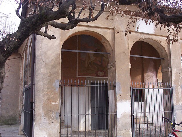
Orbassano (Orbassano)

- Italian comune
 Hiking in Orbassano
Orbassano, located near Turin in the Piedmont region of Italy, is primarily an urban area, but it offers access to several nearby trails and natural areas for hiking enthusiasts. Here are some aspects to consider when hiking around Orbassano:
Nearby Natural Areas
-
Parco della Rimembranza: This local park features walking trails and green spaces that are great for gentle hikes or leisurely walks. It’s perfect for families or those looking for a quick escape into nature.
-
Vigone and the surrounding countryside: Just a short drive from Orbassano, you can explore the rolling hills and rural landscapes, featuring more scenic trails that allow for longer hikes with beautiful views of the countryside.
-
Susa Valley: A bit farther out from Orbassano, the Susa Valley offers numerous hiking trails suited for various skill levels, leading to stunning mountain views, serene alpine lakes, and historical sites.
Hiking Tips
- Trail Difficulty: Most trails near Orbassano are relatively easy to moderate, making them accessible for beginners. Check local maps or hiking apps for detailed route information.
- Weather Conditions: Be mindful of the weather, particularly in the foothills and mountains, where conditions can change rapidly. Always check the forecast before heading out.
- Local Regulations: Respect nature and local guidelines, particularly in protected areas. Stay on marked paths to preserve wildlife and vegetation.
- Equipment: Wear sturdy hiking shoes and bring plenty of water, especially on warmer days. A hiking pole can also be handy on uneven terrain.
Additional Activities
- Historical Exploration: While hiking, you can also explore local history, including castles, small churches, and traditional villages that you may encounter along the way.
- Gastronomy: Take the opportunity to enjoy local cuisine after your hike. The Piedmont region is famous for its food and wine.
Getting There
Orbassano is easily accessible by public transport from Turin, making it a convenient base for exploring the surrounding areas. Make sure to plan your transportation ahead if you’re heading to more remote trailheads.
In summary, while Orbassano itself may not have extensive hiking options, its proximity to the natural beauty of the Piedmont region and nearby valleys provides plenty of opportunities for enjoyable hikes!
- Country:

- Postal Code: 10043
- Local Dialing Code: 011
- Licence Plate Code: TO
- Coordinates: 45° 0' 0" N, 7° 32' 0" E


- GPS tracks (wikiloc): [Link]
- AboveSeaLevel: 273 м m
- Area: 22.21 sq km
- Population: 23365
- Web site: http://www.comune.orbassano.to.it/
- Wikipedia en: wiki(en)
- Wikipedia: wiki(it)
- Wikidata storage: Wikidata: Q9519
- Wikipedia Commons Category: [Link]
- Freebase ID: [/m/039q7d]
- GeoNames ID: Alt: [6541995]
- VIAF ID: Alt: [153792635]
- OSM relation ID: [43944]
- archINFORM location ID: [1033]
- Quora topic ID: [Orbassano]
- TGN ID: [1045757]
- UN/LOCODE: [ITOBS]
- Gran Enciclopèdia Catalana ID: [0265395]
- ISTAT ID: 001171
- Italian cadastre code: G087
Shares border with regions:

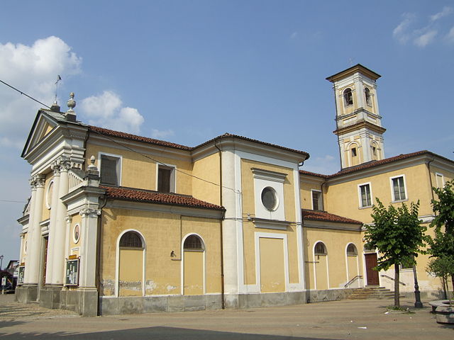
Rivalta di Torino
- Italian comune
Hiking in Rivalta di Torino
Rivalta di Torino, located in the Piedmont region of Italy, offers a variety of hiking opportunities that allow you to explore the natural beauty and landscapes of the area. While Rivalta itself is more of a suburban area, it is well-positioned near the scenic Susa Valley and the foothills of the Alps, providing access to several hiking trails....
- Country:
- Postal Code: 10040
- Local Dialing Code: 011
- Licence Plate Code: TO
- Coordinates: 45° 2' 0" N, 7° 32' 0" E
- GPS tracks (wikiloc): [Link]
- AboveSeaLevel: 295 м m
- Area: 25.11 sq km
- Population: 20185
- Web site: [Link]

Rivoli
- Italian comune
Hiking in Rivoli
Rivoli, located in the Piedmont region of Italy, offers a variety of hiking options that showcase its beautiful natural landscapes and rich historical context. Nestled near the Susa Valley and the foothills of the Italian Alps, Rivoli provides access to diverse trails that cater to different skill levels....
- Country:
- Postal Code: 10098
- Local Dialing Code: 011
- Licence Plate Code: TO
- Coordinates: 45° 4' 21" N, 7° 31' 38" E
- GPS tracks (wikiloc): [Link]
- AboveSeaLevel: 390 м m
- Area: 29.5 sq km
- Population: 48629
- Web site: [Link]


Volvera
- Italian comune
Hiking in Volvera
Volvera, located in the Piedmont region of Italy, is a charming area that offers a variety of hiking opportunities amid beautiful natural landscapes and historical sites. While it may not be as widely known for hiking as some larger parks or mountains, it still provides several enjoyable trails for outdoor enthusiasts....
- Country:
- Postal Code: 10040
- Local Dialing Code: 011
- Licence Plate Code: TO
- Coordinates: 44° 57' 0" N, 7° 30' 0" E
- GPS tracks (wikiloc): [Link]
- AboveSeaLevel: 251 м m
- Area: 20.98 sq km
- Population: 8675
- Web site: [Link]

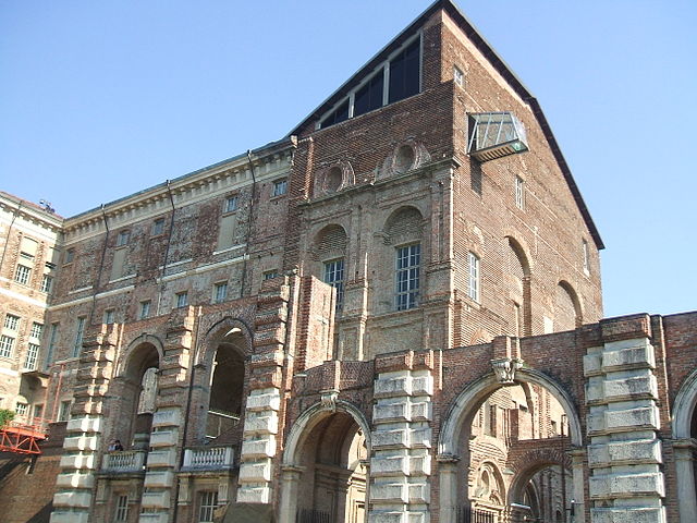
Turin
- city and commune in Italy
Hiking in Turin
Turin, located in the northwestern part of Italy, is surrounded by beautiful mountains and natural landscapes that offer fantastic hiking opportunities. Here are some highlights for hiking in and around Turin:...
- Country:
- Postal Code: 10121–10156
- Local Dialing Code: 011
- Licence Plate Code: TO
- Coordinates: 45° 4' 0" N, 7° 42' 0" E
- GPS tracks (wikiloc): [Link]
- AboveSeaLevel: 239 м m
- Area: 130.17 sq km
- Population: 889600
- Web site: [Link]


Beinasco
- Italian comune
Hiking in Beinasco
Beinasco is a town located in the Piedmont region of Italy, near Turin. While it may not be as widely known for hiking as some of the larger national parks or mountainous areas in Italy, there are still opportunities for outdoor activities and scenic walks in and around Beinasco. Here are some aspects to consider if you are interested in hiking in the area:...
- Country:
- Postal Code: 10092
- Local Dialing Code: 011
- Licence Plate Code: TO
- Coordinates: 45° 1' 22" N, 7° 35' 16" E
- GPS tracks (wikiloc): [Link]
- AboveSeaLevel: 260 м m
- Area: 6.73 sq km
- Population: 17981
- Web site: [Link]

Candiolo
- Italian comune
Hiking in Candiolo
Candiolo is a small town located in the Piedmont region of Italy, near Turin. While it is not a major hiking destination in the way that larger national parks or mountainous areas are, it does offer some opportunities for outdoor activities and exploration....
- Country:
- Postal Code: 10060
- Local Dialing Code: 011
- Licence Plate Code: TO
- Coordinates: 44° 58' 0" N, 7° 36' 0" E
- GPS tracks (wikiloc): [Link]
- AboveSeaLevel: 237 м m
- Area: 11.85 sq km
- Population: 5612
- Web site: [Link]


Nichelino
- Italian comune
Hiking in Nichelino
Nichelino is a town located in the Piedmont region of Italy, close to Turin. While it is primarily an urban area, there are nearby natural spaces and parks that can be great for hiking enthusiasts. Here are some options for hiking near Nichelino:...
- Country:
- Postal Code: 10042
- Local Dialing Code: 011
- Licence Plate Code: TO
- Coordinates: 45° 0' 0" N, 7° 39' 0" E
- GPS tracks (wikiloc): [Link]
- AboveSeaLevel: 229 м m
- Area: 20.56 sq km
- Population: 47721
- Web site: [Link]


None
- Italian comune
Hiking in None
None, a small town in the Piedmont region of Italy, offers a charming backdrop for hiking enthusiasts. While it may not be as well-known as larger destinations, its proximity to the stunning landscapes of the surrounding areas makes it a worthwhile spot for hiking....
- Country:
- Postal Code: 10060
- Local Dialing Code: 011
- Licence Plate Code: TO
- Coordinates: 44° 56' 0" N, 7° 32' 0" E
- GPS tracks (wikiloc): [Link]
- AboveSeaLevel: 245 м m
- Area: 24.64 sq km
- Population: 8015
- Web site: [Link]