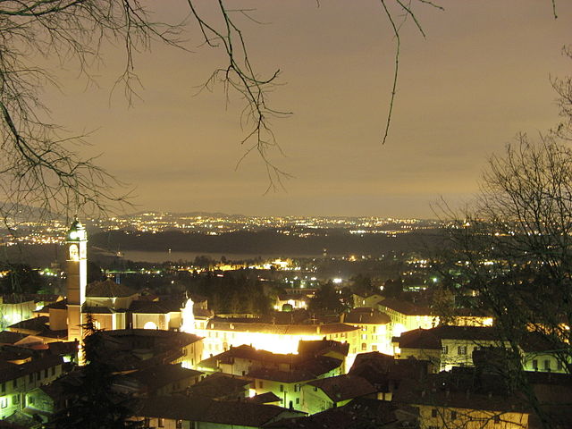
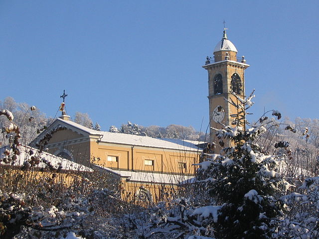
Orsenigo (Orsenigo)
.svg)
- Italian comune
 Hiking in Orsenigo
Orsenigo is a charming municipality located in the province of Como, in the Lombardy region of northern Italy. It is nestled in an area renowned for its natural beauty and offers a variety of outdoor activities, including hiking.
Hiking Opportunities in Orsenigo
-
Nature Trails: The surrounding areas feature several nature trails that vary in difficulty, catering to both novice and experienced hikers. These trails often wind through picturesque landscapes, including forests, hills, and small streams.
-
Scenic Views: As you hike in and around Orsenigo, you'll have opportunities to capture stunning views of the surrounding hills and the famous Lake Como region, which is not far away. The area is known for its lush greenery and charming rural landscapes.
-
Historical Sites: Some trails may lead to historical or cultural points of interest, such as ancient churches or village centers, which can enrich your hiking experience.
-
Nearby Hiking Areas: If you're willing to venture a bit further, the nearby regions, like the Barni and Triangolo Lariano area, provide more extensive hiking trails and are popular among mountain enthusiasts. These include paths leading to higher altitudes with breathtaking panoramic views.
Tips for Hiking in Orsenigo
- Weather: Check the weather forecast before heading out, as conditions can change quickly, especially in the mountains.
- Gear: Wear appropriate hiking gear, including sturdy footwear, and consider carrying trekking poles for added stability.
- Water and Snacks: Bring plenty of water and snacks, especially if you plan to hike longer trails.
- Local Maps and Guides: It may be helpful to obtain local maps or consult with local hiking organizations for trail recommendations and safety tips.
- Respect Nature: Follow Leave No Trace principles to preserve the natural environment for future hikers.
Conclusion
Hiking in Orsenigo, Lombardy, offers a delightful blend of nature, tranquility, and cultural exploration. Whether you're in search of a leisurely stroll or a more challenging trek, you'll find plenty of opportunities in this beautiful part of Italy. Make sure to enjoy the stunning landscapes and embrace the serene ambiance that the region has to offer!
- Country:

- Postal Code: 22030
- Local Dialing Code: 031
- Licence Plate Code: CO
- Coordinates: 45° 47' 0" N, 9° 11' 0" E


- GPS tracks (wikiloc): [Link]
- AboveSeaLevel: 390 м m
- Area: 4.46 sq km
- Population: 2769
- Web site: http://www.comune.orsenigo.co.it/
- Wikipedia en: wiki(en)
- Wikipedia: wiki(it)
- Wikidata storage: Wikidata: Q47410
- Wikipedia Commons Category: [Link]
- Freebase ID: [/m/0gj12y]
- GeoNames ID: Alt: [6541491]
- VIAF ID: Alt: [125507751]
- OSM relation ID: [46060]
- UN/LOCODE: [ITORS]
- ISTAT ID: 013170
- Italian cadastre code: G126
Shares border with regions:

Albavilla
- Italian comune
Hiking in Albavilla
Albabilla, located in the region of Lombardy in Italy, is a charming area near the foothills of the Alps. It offers various opportunities for hiking enthusiasts, featuring scenic trails that navigate through beautiful landscapes....
- Country:
- Postal Code: 22031
- Local Dialing Code: 031
- Licence Plate Code: CO
- Coordinates: 45° 48' 0" N, 9° 11' 0" E
- GPS tracks (wikiloc): [Link]
- AboveSeaLevel: 427 м m
- Area: 10.38 sq km
- Population: 6361
- Web site: [Link]
Albese con Cassano
- Italian comune
Hiking in Albese con Cassano
Albese con Cassano, located in the Lombardy region of Italy, is surrounded by beautiful landscapes that include hills, forests, and scenic views of the nearby mountains. While it may not be as famous for hiking as some other areas of Italy, there are still opportunities for outdoor enthusiasts to explore the local environment....
- Country:
- Postal Code: 22032
- Local Dialing Code: 031
- Licence Plate Code: CO
- Coordinates: 45° 48' 0" N, 9° 10' 0" E
- GPS tracks (wikiloc): [Link]
- AboveSeaLevel: 402 м m
- Area: 7.95 sq km
- Population: 4251
- Web site: [Link]


Alserio
- Italian comune
Hiking in Alserio
Alserio is a charming village located in the Como Province of northern Italy. It is nestled at the foot of the scenic hills surrounding Lake Como. While Alserio itself may not be widely known as a hiking destination, its proximity to the beautiful natural landscapes of the Lake Como area offers plenty of opportunities for outdoor enthusiasts....
- Country:
- Postal Code: 22040
- Local Dialing Code: 031
- Licence Plate Code: CO
- Coordinates: 45° 47' 0" N, 9° 12' 0" E
- GPS tracks (wikiloc): [Link]
- AboveSeaLevel: 265 м m
- Area: 1.99 sq km
- Population: 1257
- Web site: [Link]
Alzate Brianza
- Italian comune
Hiking in Alzate Brianza
Alzate Brianza is a charming municipality located in the Lombardy region of Italy, nestled between the scenic hills and beautiful landscapes that characterize the area. The region offers a variety of outdoor activities, including hiking, making it a great destination for outdoor enthusiasts....
- Country:
- Postal Code: 22040
- Local Dialing Code: 031
- Licence Plate Code: CO
- Coordinates: 45° 46' 0" N, 9° 11' 0" E
- GPS tracks (wikiloc): [Link]
- AboveSeaLevel: 341 м m
- Area: 7.58 sq km
- Population: 5019
- Web site: [Link]
Anzano del Parco
- Italian comune
Hiking in Anzano del Parco
Anzano del Parco, located in the province of Como in Italy, offers a delightful escape for hiking enthusiasts. This small village is situated in a picturesque landscape characterized by rolling hills, lush forests, and stunning views of the surrounding area, including Lake Como....
- Country:
- Postal Code: 22040
- Local Dialing Code: 031
- Licence Plate Code: CO
- Coordinates: 45° 46' 0" N, 9° 12' 0" E
- GPS tracks (wikiloc): [Link]
- AboveSeaLevel: 329 м m
- Area: 3.25 sq km
- Population: 1805
- Web site: [Link]

Capiago Intimiano
- Italian comune
Hiking in Capiago Intimiano
Capiago Intimiano is a charming municipality located in the province of Como, in the Lombardy region of Italy. While it may not be widely known as a major hiking destination compared to parts of the nearby Italian Alps or the lakes, it does offer some lovely walking and hiking opportunities, particularly for those who appreciate a mix of nature and quaint Italian towns....
- Country:
- Postal Code: 22070
- Local Dialing Code: 031
- Licence Plate Code: CO
- Coordinates: 45° 46' 0" N, 9° 7' 0" E
- GPS tracks (wikiloc): [Link]
- AboveSeaLevel: 410 м m
- Area: 8.72 sq km
- Population: 5516
- Web site: [Link]


Cantù
- Italian comune
Hiking in Cantù
Cantù, located in the Lombardy region of Italy, is surrounded by beautiful landscapes and offers various hiking opportunities. While it may be best known for its rich history and local craftsmanship, particularly in furniture making, the area also serves as a great starting point for exploring nearby natural attractions....
- Country:
- Postal Code: 22063
- Local Dialing Code: 031
- Licence Plate Code: CO
- Coordinates: 45° 44' 0" N, 9° 8' 0" E
- GPS tracks (wikiloc): [Link]
- AboveSeaLevel: 370 м m
- Area: 23.25 sq km
- Population: 39932
- Web site: [Link]


Montorfano
- Italian comune
Hiking in Montorfano
Montorfano, located in the Lombardy region of Italy, is a small but beautiful area known for its natural scenery and outdoor activities, including hiking. Here’s what you need to know:...
- Country:
- Postal Code: 22030
- Local Dialing Code: 031
- Licence Plate Code: CO
- Coordinates: 45° 47' 11" N, 9° 8' 37" E
- GPS tracks (wikiloc): [Link]
- AboveSeaLevel: 414 м m
- Area: 3.52 sq km
- Population: 2567
- Web site: [Link]