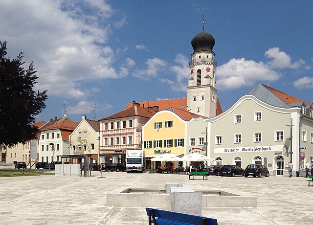
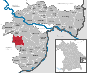
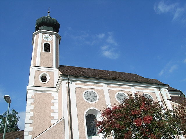
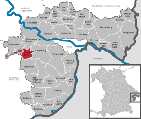
Ortenburg (Ortenburg)
- municipality of Germany
Ortenburg, located in Bavaria, Germany, offers some beautiful hiking opportunities in a picturesque setting. Situated near the border with Austria, this area is characterized by rolling hills, lush forests, and stunning landscapes that are appealing for both casual walkers and more experienced hikers.
Hiking Trails
- Local Trails: There are various marked trails around Ortenburg that cater to different skill levels. These trails often lead through dense forests, scenic fields, and offer views of the surrounding countryside.
- Bavarian Forest National Park: Although not directly in Ortenburg, the Bavarian Forest is a short drive away and offers extensive trails through one of Germany's largest protected areas, known for its biodiversity and natural beauty.
Key Features
- Scenic Views: Hikers can enjoy views of the surrounding hills and valleys, particularly from higher elevations in the area.
- Flora and Fauna: The region is home to a variety of wildlife and plant species, making it a rewarding experience for nature enthusiasts.
- Cultural Attractions: Along the hiking trails, you may come across historical sites, charming villages, and local farms.
Best Time to Hike
- Spring and Autumn: These seasons offer mild temperatures and beautiful scenery with blooming flowers in spring and colorful foliage in autumn, making them ideal for hiking.
- Summer: While summer can be warm, early mornings and late afternoons are typically pleasant for hiking.
Tips for Hiking in Ortenburg
- Gear Up: Wear sturdy hiking boots and bring a backpack with water, snacks, and a first-aid kit.
- Trail Maps: Consider obtaining local trail maps or using a hiking app to navigate effectively.
- Weather Check: Before heading out, check the weather forecast to dress appropriately and ensure safety during your hike.
- Respect Nature: Stay on marked trails and follow local guidelines to protect the natural environment.
Overall, hiking in Ortenburg can be a delightful experience for nature lovers and adventure seekers alike, with a mix of tranquility and stunning Bavarian scenery.
- Country:

- Postal Code: 94496
- Local Dialing Code: 08542
- Licence Plate Code: PA
- Coordinates: 48° 32' 0" N, 13° 13' 0" E


- GPS tracks (wikiloc): [Link]
- AboveSeaLevel: 358 м m
- Area: 60.75 sq km
- Population: 6546
- Web site: http://www.ortenburg.de
- Wikipedia en: wiki(en)
- Wikipedia: wiki(de)
- Wikidata storage: Wikidata: Q264999
- Wikipedia Commons Category: [Link]
- Freebase ID: [/m/02rfqpt]
- GeoNames ID: Alt: [2857011]
- BnF ID: [120639048]
- OSM relation ID: [958094]
- GND ID: Alt: [4116793-4]
- archINFORM location ID: [14011]
- Historical Gazetteer (GOV) ID: [ORTURGJN68ON]
- Bavarikon ID: [ODB_A00009143]
- German municipality key: 09275138
Shares border with regions:


Bad Griesbach im Rottal
- municipality of Germany
 Hiking in Bad Griesbach im Rottal
Bad Griesbach, located in the Rottal area of Bavaria, Germany, is renowned for its beautiful landscapes, spa facilities, and a variety of hiking opportunities. Here’s what you can expect when hiking in this picturesque area:...
- Country:

- Postal Code: 94086
- Local Dialing Code: 08542; 08532
- Coordinates: 48° 27' 0" N, 13° 12' 0" E


- GPS tracks (wikiloc): [Link]
- AboveSeaLevel: 453 м m
- Area: 70.13 sq km
- Population: 8859
- Web site: [Link]


Fürstenzell
- municipality of Germany
Fürstenzell is a charming municipality located in Bavaria, Germany, known for its picturesque landscapes and outdoor activities, including hiking. The area is characterized by rolling hills, wooded areas, and beautiful countryside, making it an ideal destination for nature enthusiasts and hikers....
- Country:

- Postal Code: 94081
- Local Dialing Code: 08502
- Licence Plate Code: PA
- Coordinates: 48° 31' 21" N, 13° 19' 4" E


- GPS tracks (wikiloc): [Link]
- AboveSeaLevel: 358 м m
- Area: 79.36 sq km
- Population: 6794
- Web site: [Link]

Haarbach
- municipality of Germany
Haarbach, located in Bavaria, Germany, is a lesser-known gem for those interested in hiking and nature exploration. While many people gravitate towards the popular hiking regions in the Alps or along more famous trails, Haarbach offers its own unique experiences. Here are a few highlights for hiking in and around Haarbach:...
- Country:

- Postal Code: 94542
- Local Dialing Code: 08535
- Licence Plate Code: PA
- Coordinates: 48° 30' 0" N, 13° 9' 0" E


- GPS tracks (wikiloc): [Link]
- AboveSeaLevel: 380 м m
- Area: 47.71 sq km
- Population: 2374
- Web site: [Link]


Vilshofen an der Donau
- municipality of Germany
 Hiking in Vilshofen an der Donau
Vilshofen an der Donau is a picturesque town located in Bavaria, Germany, along the banks of the Danube River. This area offers a variety of hiking opportunities suitable for different skill levels, enhanced by its stunning landscapes, lush forests, and charming riverside views....
- Country:

- Postal Code: 94474
- Local Dialing Code: 08549; 08548; 08541
- Licence Plate Code: PA
- Coordinates: 48° 37' 59" N, 13° 11' 18" E


- GPS tracks (wikiloc): [Link]
- AboveSeaLevel: 308 м m
- Area: 86.29 sq km
- Population: 15142
- Web site: [Link]


Ruhstorf an der Rott
- municipality in the district of Passau in Bavaria
 Hiking in Ruhstorf an der Rott
Ruhstorf an der Rott is a picturesque village located in Bavaria, Germany, and offers a charming environment for hiking enthusiasts. The surrounding region is characterized by rolling hills, lush meadows, and scenic woodlands, making it an excellent destination for various outdoor activities. Here are some highlights and tips for hiking in and around Ruhstorf an der Rott:...
- Country:

- Postal Code: 94099
- Local Dialing Code: 08531
- Licence Plate Code: PA
- Coordinates: 48° 26' 0" N, 13° 20' 0" E


- GPS tracks (wikiloc): [Link]
- AboveSeaLevel: 317 м m
- Area: 51.46 sq km
- Population: 5844
- Web site: [Link]

Beutelsbach
- municipality of Germany
Beutelsbach, located in the picturesque region of Baden-Württemberg, Germany, offers a variety of hiking opportunities that cater to different skill levels. The area is characterized by its rolling hills, vineyards, and scenic landscapes, making it a delightful destination for outdoor enthusiasts....
- Country:

- Postal Code: 94501
- Local Dialing Code: 08543
- Licence Plate Code: PA
- Coordinates: 48° 33' 0" N, 13° 7' 0" E


- GPS tracks (wikiloc): [Link]
- AboveSeaLevel: 357 м m
- Area: 20.39 sq km
- Population: 1082
- Web site: [Link]
