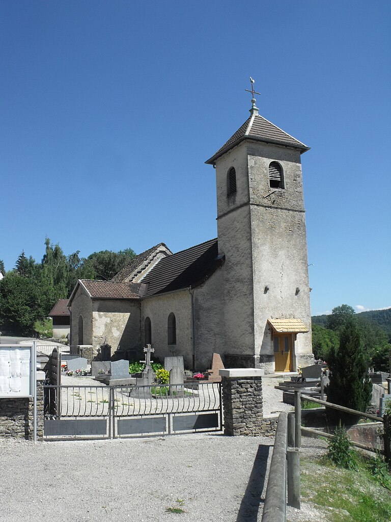
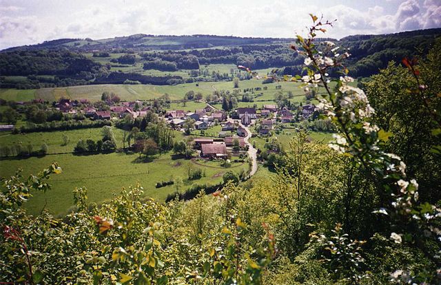
Péseux (Péseux)

- commune in Doubs, France
 Hiking in Péseux
Péseux is a charming area located in Switzerland, known for its picturesque landscapes and outdoor activities, including hiking. While specific trails and conditions may change over time, I can offer some general information on hiking in the region.
Hiking Trails:
-
Scenic Views: The region often features trails that provide stunning views of the surrounding mountains, valleys, and lakes. Look for paths that lead to viewpoints or summits to experience the beauty of the Swiss landscape.
-
Diverse Terrain: Expect a mix of easy to moderate trails suitable for families, as well as more challenging routes for experienced hikers. The terrain can vary from forest paths to alpine meadows.
-
Marked Trails: Many hiking routes in Switzerland are well-marked with signage indicating the difficulty level and estimated walking time. Always pay attention to these signs and carry a map or use a hiking app for navigation.
Preparation:
- Weather: Check the weather forecast before you go. The weather in the mountains can change rapidly, so be prepared for various conditions.
- Gear: Wear sturdy hiking shoes, dress in layers, and carry a backpack with essentials such as water, snacks, a first-aid kit, and a rain jacket.
- Permits: Typically, there are no special permits required for hiking in public areas, but always check local regulations or park rules.
Local Culture:
Since Péseux is located in Switzerland, you may also have the opportunity to experience local culture, cuisine, and hospitality. Consider trying regional dishes after your hike at nearby restaurants or cafes.
Safety Tips:
- Always let someone know your hiking plans.
- Stay on marked trails to protect the environment and for your safety.
- Bring a fully charged mobile phone for emergencies.
If you choose to hike in Péseux, enjoy the serene beauty of nature and the fresh mountain air, but always prioritize safety and environmental respect!
- Country:

- Postal Code: 25190
- Coordinates: 47° 18' 59" N, 6° 40' 47" E


- GPS tracks (wikiloc): [Link]
- AboveSeaLevel: 600 м m
- Area: 6.63 sq km
- Population: 113
- Wikipedia en: wiki(en)
- Wikipedia: wiki(fr)
- Wikidata storage: Wikidata: Q906625
- Wikipedia Commons Category: [Link]
- Freebase ID: [/m/02r3dy1]
- Freebase ID: [/m/02r3dy1]
- GeoNames ID: Alt: [6453861]
- GeoNames ID: Alt: [6453861]
- SIREN number: [212504492]
- SIREN number: [212504492]
- INSEE municipality code: 25449
- INSEE municipality code: 25449
Shares border with regions:


Froidevaux
- commune in Doubs, France
Hiking in Froidevaux
Froidevaux is a picturesque area in the Swiss Alps, known for its stunning landscapes and hiking opportunities. Whether you’re an experienced hiker or just starting out, Froidevaux offers a variety of trails suitable for all levels. Here are some highlights for hiking in the area:...
- Country:
- Postal Code: 25190
- Coordinates: 47° 18' 2" N, 6° 41' 30" E
- GPS tracks (wikiloc): [Link]
- Area: 3.98 sq km
- Population: 70


Valonne
- commune in Doubs, France
Hiking in Valonne
Valonne is not widely recognized as a specific hiking destination, but if you meant the Valles de Valonne in France, or perhaps a similar area, there are certainly some beautiful hiking opportunities in the surrounding regions. Here are some general points to consider while hiking in scenic areas like Valonne or any mountainous area:...
- Country:
- Postal Code: 25190
- Coordinates: 47° 20' 36" N, 6° 39' 31" E
- GPS tracks (wikiloc): [Link]
- Area: 8.33 sq km
- Population: 248

Solemont
- commune in Doubs, France
Hiking in Solemont
Solemont is a picturesque area located in the Jura Mountains of France, known for its stunning natural beauty, diverse landscapes, and tranquil atmosphere. As a hiking destination, Solemont offers various trails that cater to different skill levels, from leisurely walks to challenging hikes....
- Country:
- Postal Code: 25190
- Coordinates: 47° 20' 38" N, 6° 42' 15" E
- GPS tracks (wikiloc): [Link]
- Area: 8.09 sq km
- Population: 165


Les Terres-de-Chaux
- commune in Doubs, France
Hiking in Les Terres-de-Chaux
Les Terres-de-Chaux is an appealing destination for hiking enthusiasts, located in the Jura region of France. This area is characterized by its stunning natural landscapes, rolling hills, lush forests, and unique geological features. Here are some aspects to consider when hiking in Les Terres-de-Chaux:...
- Country:
- Postal Code: 25190
- Coordinates: 47° 19' 7" N, 6° 44' 16" E
- GPS tracks (wikiloc): [Link]
- AboveSeaLevel: 700 м m
- Area: 14.49 sq km
- Population: 150
- Web site: [Link]

Rosières-sur-Barbèche
- commune in Doubs, France
Hiking in Rosières-sur-Barbèche
Rosières-sur-Barbèche is a picturesque village located in the Auvergne-Rhône-Alpes region of France. Hiking in this area offers a blend of beautiful landscapes, diverse wildlife, and a variety of trails suitable for different skill levels. Here are some highlights and tips for hiking in Rosières-sur-Barbèche:...
- Country:
- Postal Code: 25190
- Coordinates: 47° 18' 56" N, 6° 39' 33" E
- GPS tracks (wikiloc): [Link]
- Area: 5.31 sq km
- Population: 121