Paizay-Naudouin-Embourie (Paizay-Naudouin-Embourie)

- commune in Charente, France
- Country:

- Postal Code: 16240
- Coordinates: 46° 1' 49" N, 0° 0' 12" E


- GPS tracks (wikiloc): [Link]
- AboveSeaLevel: 83 м m
- Area: 25.42 sq km
- Population: 381
- Web site: http://www.pne16.fr/
- Wikipedia en: wiki(en)
- Wikipedia: wiki(fr)
- Wikidata storage: Wikidata: Q1623790
- Wikipedia Commons Category: [Link]
- Freebase ID: [/m/03mcckv]
- GeoNames ID: Alt: [2988778]
- SIREN number: [211602537]
- BnF ID: [152486923]
- PACTOLS thesaurus ID: [pcrtvmdurdO37A]
- INSEE municipality code: 16253
Shares border with regions:
Couture-d'Argenson
- commune in Deux-Sèvres, France
- Country:
- Postal Code: 79110
- Coordinates: 45° 59' 34" N, 0° 5' 3" E
- GPS tracks (wikiloc): [Link]
- Area: 24.16 sq km
- Population: 372
Hanc
- commune in Deux-Sèvres, France
- Country:
- Postal Code: 79110
- Coordinates: 46° 4' 31" N, 0° 0' 55" E
- GPS tracks (wikiloc): [Link]
- Area: 18.12 sq km
- Population: 257

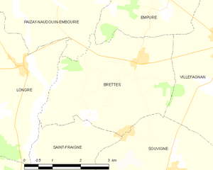
Brettes
- commune in Charente, France
- Country:
- Postal Code: 16240
- Coordinates: 46° 0' 19" N, 0° 2' 28" E
- GPS tracks (wikiloc): [Link]
- Area: 12.21 sq km
- Population: 183
Loubillé
- commune in Deux-Sèvres, France
- Country:
- Postal Code: 79110
- Coordinates: 46° 2' 59" N, 0° 3' 50" E
- GPS tracks (wikiloc): [Link]
- Area: 21.21 sq km
- Population: 386
- Web site: [Link]

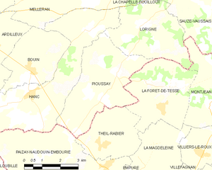
Pioussay
- commune in Deux-Sèvres, France
- Country:
- Postal Code: 79110
- Coordinates: 46° 4' 28" N, 0° 1' 30" E
- GPS tracks (wikiloc): [Link]
- Area: 13.77 sq km
- Population: 301
- Web site: [Link]


Empuré
- commune in Charente, France
- Country:
- Postal Code: 16240
- Coordinates: 46° 1' 21" N, 0° 3' 6" E
- GPS tracks (wikiloc): [Link]
- Area: 8.37 sq km
- Population: 102


La Magdeleine
- commune in Charente, France
- Country:
- Postal Code: 16240
- Coordinates: 46° 3' 3" N, 0° 4' 24" E
- GPS tracks (wikiloc): [Link]
- Area: 6.68 sq km
- Population: 129


Theil-Rabier
- commune in Charente, France
- Country:
- Postal Code: 16240
- Coordinates: 46° 2' 59" N, 0° 2' 14" E
- GPS tracks (wikiloc): [Link]
- Area: 7.43 sq km
- Population: 175


Longré
- commune in Charente, France
- Country:
- Postal Code: 16240
- Coordinates: 46° 0' 6" N, 0° 0' 46" E
- GPS tracks (wikiloc): [Link]
- Area: 14.73 sq km
- Population: 201