Pauligne (Pauligne)

- commune in Aude, France
- Country:

- Postal Code: 11300
- Coordinates: 43° 4' 24" N, 2° 9' 40" E


- GPS tracks (wikiloc): [Link]
- Area: 6.06 sq km
- Population: 345
- Wikipedia en: wiki(en)
- Wikipedia: wiki(fr)
- Wikidata storage: Wikidata: Q1082102
- Wikipedia Commons Category: [Link]
- Freebase ID: [/m/03m8_8k]
- GeoNames ID: Alt: [6426784]
- SIREN number: [211102744]
- BnF ID: [152468100]
- INSEE municipality code: 11274
Shares border with regions:

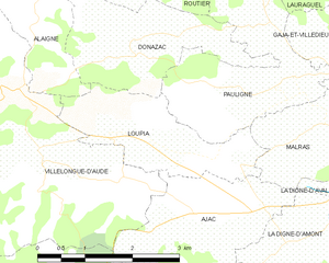
Loupia
- commune in Aude, France
- Country:
- Postal Code: 11300
- Coordinates: 43° 3' 43" N, 2° 6' 43" E
- GPS tracks (wikiloc): [Link]
- Area: 4.46 sq km
- Population: 242
Gaja-et-Villedieu
- commune in Aude, France
- Country:
- Postal Code: 11300
- Coordinates: 43° 4' 52" N, 2° 11' 14" E
- GPS tracks (wikiloc): [Link]
- Area: 7.75 sq km
- Population: 291
Donazac
- commune in Aude, France
- Country:
- Postal Code: 11240
- Coordinates: 43° 4' 39" N, 2° 7' 9" E
- GPS tracks (wikiloc): [Link]
- Area: 5.06 sq km
- Population: 106
- Web site: [Link]
Routier
- commune in Aude, France
- Country:
- Postal Code: 11240
- Coordinates: 43° 6' 28" N, 2° 7' 36" E
- GPS tracks (wikiloc): [Link]
- AboveSeaLevel: 195 м m
- Area: 11.27 sq km
- Population: 250
Lauraguel
- commune in Aude, France
- Country:
- Postal Code: 11300
- Coordinates: 43° 5' 55" N, 2° 10' 29" E
- GPS tracks (wikiloc): [Link]
- Area: 7.01 sq km
- Population: 625
Malras
- commune in Aude, France
- Country:
- Postal Code: 11300
- Coordinates: 43° 3' 48" N, 2° 10' 20" E
- GPS tracks (wikiloc): [Link]
- Area: 4.22 sq km
- Population: 373