Pavezin (Pavezin)

- commune in Loire, France
- Country:

- Postal Code: 42410
- Coordinates: 45° 27' 56" N, 4° 40' 15" E


- GPS tracks (wikiloc): [Link]
- Area: 8.87 sq km
- Population: 355
- Wikipedia en: wiki(en)
- Wikipedia: wiki(fr)
- Wikidata storage: Wikidata: Q430379
- Wikipedia Commons Category: [Link]
- Freebase ID: [/m/03nwb9_]
- Freebase ID: [/m/03nwb9_]
- GeoNames ID: Alt: [6434220]
- GeoNames ID: Alt: [6434220]
- SIREN number: [214201675]
- SIREN number: [214201675]
- BnF ID: [152597350]
- BnF ID: [152597350]
- INSEE municipality code: 42167
- INSEE municipality code: 42167
Shares border with regions:

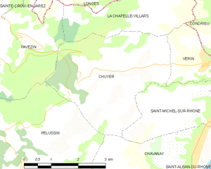
Chuyer
- commune in Loire, France
- Country:
- Postal Code: 42410
- Coordinates: 45° 27' 26" N, 4° 41' 37" E
- GPS tracks (wikiloc): [Link]
- Area: 12.06 sq km
- Population: 779


Longes
- commune in Rhône, France
- Country:
- Postal Code: 69420
- Coordinates: 45° 30' 17" N, 4° 41' 19" E
- GPS tracks (wikiloc): [Link]
- Area: 24.06 sq km
- Population: 944

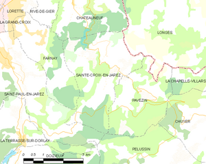
Sainte-Croix-en-Jarez
- commune in Loire, France
- Country:
- Postal Code: 42800
- Coordinates: 45° 28' 46" N, 4° 38' 50" E
- GPS tracks (wikiloc): [Link]
- Area: 12.05 sq km
- Population: 461
- Web site: [Link]
La Chapelle-Villars
- commune in Loire, France
- Country:
- Postal Code: 42410
- Coordinates: 45° 28' 21" N, 4° 42' 59" E
- GPS tracks (wikiloc): [Link]
- Area: 8.25 sq km
- Population: 529


Pélussin
- commune in Loire, France
- Country:
- Postal Code: 42410
- Coordinates: 45° 25' 6" N, 4° 40' 51" E
- GPS tracks (wikiloc): [Link]
- Area: 32.16 sq km
- Population: 3757
- Web site: [Link]