Payra-sur-l'Hers (Payra-sur-l'Hers)

- commune in Aude, France
- Country:

- Postal Code: 11410
- Coordinates: 43° 15' 58" N, 1° 51' 18" E


- GPS tracks (wikiloc): [Link]
- Area: 24.52 sq km
- Population: 194
- Wikipedia en: wiki(en)
- Wikipedia: wiki(fr)
- Wikidata storage: Wikidata: Q192458
- Wikipedia Commons Category: [Link]
- Freebase ID: [/m/03m8_8x]
- GeoNames ID: Alt: [6426785]
- SIREN number: [211102751]
- BnF ID: [15246811b]
- INSEE municipality code: 11275
Shares border with regions:

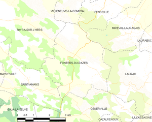
Fonters-du-Razès
- commune in Aude, France
- Country:
- Postal Code: 11400
- Coordinates: 43° 13' 43" N, 1° 56' 5" E
- GPS tracks (wikiloc): [Link]
- Area: 12.15 sq km
- Population: 75
Saint-Amans
- commune in Aude, France
- Country:
- Postal Code: 11270
- Coordinates: 43° 13' 38" N, 1° 53' 11" E
- GPS tracks (wikiloc): [Link]
- AboveSeaLevel: 285 м m
- Area: 8.16 sq km
- Population: 64


Villeneuve-la-Comptal
- commune in Aude, France
- Country:
- Postal Code: 11400
- Coordinates: 43° 17' 13" N, 1° 55' 17" E
- GPS tracks (wikiloc): [Link]
- Area: 15.1 sq km
- Population: 1243


Peyrefitte-sur-l'Hers
- commune in Aude, France
- Country:
- Postal Code: 11410
- Coordinates: 43° 14' 53" N, 1° 49' 44" E
- GPS tracks (wikiloc): [Link]
- Area: 6.47 sq km
- Population: 75


Montauriol
- commune in Aude, France
- Country:
- Postal Code: 11410
- Coordinates: 43° 16' 40" N, 1° 50' 8" E
- GPS tracks (wikiloc): [Link]
- AboveSeaLevel: 252 м m
- Area: 8.47 sq km
- Population: 86


Mayreville
- commune in Aude, France
- Country:
- Postal Code: 11420
- Coordinates: 43° 14' 22" N, 1° 50' 23" E
- GPS tracks (wikiloc): [Link]
- Area: 8.17 sq km
- Population: 75


Mas-Saintes-Puelles
- commune in Aude, France
- Country:
- Postal Code: 11400
- Coordinates: 43° 18' 47" N, 1° 52' 36" E
- GPS tracks (wikiloc): [Link]
- Area: 27.63 sq km
- Population: 911
- Web site: [Link]