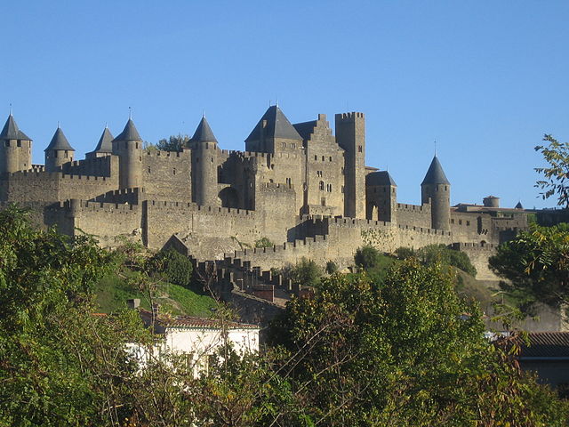
arrondissement of Carcassonne (arrondissement de Carcassonne)
- arrondissement of France
- Country:

- Capital: Carcassonne
- Coordinates: 43° 15' 0" N, 2° 10' 0" E


- GPS tracks (wikiloc): [Link]
- Population: 158949
- Wikipedia en: wiki(en)
- Wikipedia: wiki(fr)
- Wikidata storage: Wikidata: Q700826
- Freebase ID: [/m/095k17]
- GeoNames ID: Alt: [3028640]
- Library of Congress authority ID: Alt: [n91044882]
- INSEE arrondissement code: [111]
- GNS Unique Feature ID: -1416702
Includes regions:

canton of Castelnaudary-Sud
- canton of France (until March 2015)
- Country:

- Capital: Castelnaudary
- Coordinates: 43° 19' 9" N, 1° 57' 16" E


- GPS tracks (wikiloc): [Link]

canton of Salles-sur-l'Hers
- canton of France (until March 2015)
- Country:

- Capital: Salles-sur-l'Hers
- Coordinates: 43° 17' 42" N, 1° 47' 10" E


- GPS tracks (wikiloc): [Link]
canton of Alzonne
- canton of France
- Country:

- Capital: Alzonne
- Coordinates: 43° 15' 18" N, 2° 10' 39" E


- GPS tracks (wikiloc): [Link]
- Population: 8725

canton of Carcassonne-Est
- canton of France
- Country:

- Capital: Carcassonne
- Coordinates: 43° 12' 47" N, 2° 21' 7" E


- GPS tracks (wikiloc): [Link]

canton of Carcassonne-Nord
- canton of France
- Country:

- Capital: Carcassonne
- Coordinates: 43° 12' 47" N, 2° 21' 7" E


- GPS tracks (wikiloc): [Link]

canton of Carcassonne-Sud
- canton of France
- Country:

- Capital: Carcassonne
- Coordinates: 43° 12' 47" N, 2° 21' 7" E


- GPS tracks (wikiloc): [Link]

canton of Carcassonne-Centre
- canton of France
- Country:

- Capital: Carcassonne
- Coordinates: 43° 12' 47" N, 2° 21' 7" E


- GPS tracks (wikiloc): [Link]

canton of Castelnaudary-Nord
- canton of France
- Country:

- Capital: Castelnaudary
- Coordinates: 43° 19' 9" N, 1° 57' 16" E


- GPS tracks (wikiloc): [Link]

canton of Mas-Cabardès
- canton of France
- Country:

- Capital: Mas-Cabardès
- Coordinates: 43° 22' 18" N, 2° 21' 47" E


- GPS tracks (wikiloc): [Link]

canton of Peyriac-Minervois
- canton of France
- Country:

- Capital: Peyriac-Minervois
- Coordinates: 43° 17' 32" N, 2° 34' 5" E


- GPS tracks (wikiloc): [Link]

canton of Conques-sur-Orbiel
- canton of France (until March 2015)
- Country:

- Capital: Conques-sur-Orbiel
- Coordinates: 43° 16' 14" N, 2° 24' 9" E


- GPS tracks (wikiloc): [Link]

canton of Mouthoumet
- canton of France (until March 2015)
- Country:

- Capital: Mouthoumet
- Coordinates: 42° 57' 39" N, 2° 31' 39" E


- GPS tracks (wikiloc): [Link]


