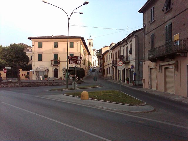
Peccioli (Peccioli)
.svg)
- Italian comune
 Hiking in Peccioli
Peccioli is a charming town located in the Tuscany region of Italy, known for its scenic landscapes and rich history. While it may not be as famous as some of its Tuscan neighbors, Peccioli offers beautiful hiking opportunities that showcase the natural beauty of the region.
Hiking Trails in Peccioli
-
Countryside Trails: The rolling hills surrounding Peccioli are crisscrossed with various hiking trails that offer stunning views of vineyards, olive groves, and quaint villages. These trails are often well-marked and can range from easy walks to more challenging hikes.
-
Monti Pisani and Casciana Terme: Just a short distance from Peccioli, the Monti Pisani offers a network of hiking trails that take you through lush forests and provide panoramic views of the surrounding countryside.
-
Via Francigena: Portions of the famous pilgrimage route, Via Francigena, pass near Peccioli. This historical trail runs from Canterbury, England, to Rome, and sections can be explored for both cultural and scenic experiences.
-
Natural Reserves: The area is home to natural parks and reserves, such as the Parco Regionale di Montalbano, which includes various trails suitable for hiking and nature walks.
Tips for Hiking in Peccioli
- Season: Spring and autumn are ideal times for hiking in Tuscany due to mild weather. Summer can be hot, so plan hikes for early morning or late afternoon.
- Footwear: Wear sturdy hiking shoes with good grip, as some trails can be rocky or uneven.
- Water and Snacks: Bring plenty of water and snacks to stay hydrated and energized during your hikes.
- Maps and Guides: Consider getting a local hiking map or joining a guided tour to ensure you stay on the right track and learn about the area's history and wildlife.
- Respect Nature: Follow Leave No Trace principles by staying on marked trails, taking your trash with you, and respecting wildlife.
Local Attractions
After your hike, Peccioli offers a variety of attractions, including historical sites, local wineries, and delicious Tuscan cuisine. Don't hesitate to explore the town and enjoy its picturesque streets and warm hospitality.
Whether you're an experienced hiker or a casual walker, Peccioli provides an excellent backdrop for experiencing the natural beauty of Tuscany.
- Country:

- Postal Code: 56037
- Local Dialing Code: 0587
- Licence Plate Code: PI
- Coordinates: 43° 33' 0" N, 10° 43' 0" E


- GPS tracks (wikiloc): [Link]
- AboveSeaLevel: 144 м m
- Area: 92.52 sq km
- Population: 4724
- Web site: http://www.comune.peccioli.pisa.it/
- Wikipedia en: wiki(en)
- Wikipedia: wiki(it)
- Wikidata storage: Wikidata: Q103186
- Wikipedia Commons Category: [Link]
- Freebase ID: [/m/0glfy4]
- GeoNames ID: Alt: [6536838]
- VIAF ID: Alt: [159276913]
- OSM relation ID: [42475]
- WOEID: [720071]
- UN/LOCODE: [ITPCC]
- ISTAT ID: 050025
- Italian cadastre code: G395
Shares border with regions:
Capannoli
- Italian comune
Hiking in Capannoli
Capannoli is a charming municipality located in the Tuscany region of Italy, surrounded by beautiful landscapes that make it a fantastic destination for hiking enthusiasts. The area typically features rolling hills, vineyards, olive groves, and picturesque villages, providing a diverse range of trails for different skill levels. Here are some aspects to consider if you're planning to hike in and around Capannoli:...
- Country:
- Postal Code: 56033
- Local Dialing Code: 0587
- Licence Plate Code: PI
- Coordinates: 43° 35' 24" N, 10° 40' 11" E
- GPS tracks (wikiloc): [Link]
- AboveSeaLevel: 51 м m
- Area: 22.69 sq km
- Population: 6359
- Web site: [Link]

Lajatico
- Italian comune
Hiking in Lajatico
Lajatico is a picturesque village located in the Tuscany region of Italy, known for its stunning landscapes, rolling hills, and rich cultural heritage. Hiking in and around Lajatico offers a wonderful opportunity to experience the natural beauty of the Tuscan countryside along with its historical sites....
- Country:
- Postal Code: 56030
- Local Dialing Code: 0587
- Licence Plate Code: PI
- Coordinates: 43° 28' 20" N, 10° 43' 46" E
- GPS tracks (wikiloc): [Link]
- AboveSeaLevel: 205 м m
- Area: 72.66 sq km
- Population: 1301
- Web site: [Link]

Palaia
- Italian comune
Hiking in Palaia
Palaia, located in the Pisa Province of Tuscany, Italy, offers beautiful hiking opportunities set against a backdrop of rolling hills, vineyards, and charming medieval villages. Here are some key points to consider for hiking in the area:...
- Country:
- Postal Code: 56036
- Local Dialing Code: 0587
- Licence Plate Code: PI
- Coordinates: 43° 36' 21" N, 10° 46' 22" E
- GPS tracks (wikiloc): [Link]
- AboveSeaLevel: 240 м m
- Area: 73.71 sq km
- Population: 4542
- Web site: [Link]

Terricciola
- Italian comune
Hiking in Terricciola
Terricciola is a picturesque village located in the Tuscany region of Italy, nestled between the rolling hills and vineyards that characterize this beautiful part of the world. Hiking in and around Terricciola offers a blend of scenic views, cultural experiences, and opportunities to explore the rich natural environment....
- Country:
- Postal Code: 56030
- Local Dialing Code: 0587
- Licence Plate Code: PI
- Coordinates: 43° 31' 32" N, 10° 40' 51" E
- GPS tracks (wikiloc): [Link]
- AboveSeaLevel: 180 м m
- Area: 43.28 sq km
- Population: 4520
- Web site: [Link]

Volterra
- Italian comune
Hiking in Volterra
Volterra, located in the heart of Tuscany, Italy, is not only known for its rich history and medieval architecture but also offers some stunning hiking opportunities. Here are some highlights for hiking in and around Volterra:...
- Country:
- Postal Code: 56048
- Local Dialing Code: 0588
- Licence Plate Code: PI
- Coordinates: 43° 24' 0" N, 10° 52' 0" E
- GPS tracks (wikiloc): [Link]
- AboveSeaLevel: 531 м m
- Area: 252.85 sq km
- Population: 10290
- Web site: [Link]

Montaione
- Italian comune
Hiking in Montaione
Montaione, located in the Tuscany region of Italy, is a hidden gem for hikers looking to explore the beautiful Italian countryside. It's surrounded by rolling hills, vineyards, olive groves, and picturesque medieval towns, providing a variety of trails suitable for different skill levels....
- Country:
- Postal Code: 50050
- Local Dialing Code: 0571
- Licence Plate Code: FI
- Coordinates: 43° 33' 12" N, 10° 54' 42" E
- GPS tracks (wikiloc): [Link]
- AboveSeaLevel: 342 м m
- Area: 104.76 sq km
- Population: 3638
- Web site: [Link]