Penna San Giovanni (Penna San Giovanni)
.svg)
- Italian comune
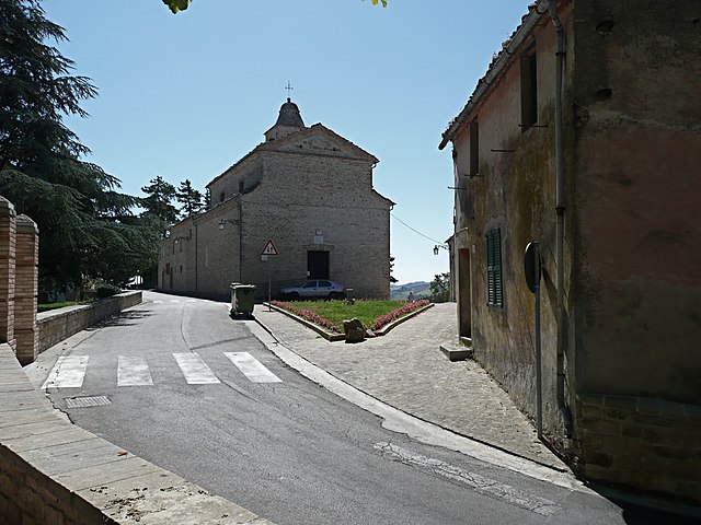
 Hiking in Penna San Giovanni
Penna San Giovanni, located in the Marche region of Italy, offers a charming experience for hikers and nature enthusiasts. This area is characterized by rolling hills, picturesque landscapes, and a rich cultural heritage. Here are some key points about hiking in Penna San Giovanni:
Scenic Trails
-
Variety of Trails: The region has a mix of trails that cater to different skill levels, from easy walks to more challenging hikes. You can choose routes that offer stunning views of the surrounding countryside and the Sibillini Mountains.
-
Natural Beauty: As you hike, you'll encounter lush forests, olive groves, and vineyards, making it a visually rewarding experience. The changing seasons also offer unique scenery, particularly in spring and autumn.
Cultural Insights
-
Historical Sites: While hiking, you may come across medieval ruins, charming villages, and historical landmarks that reflect the rich cultural background of the area. Penna San Giovanni itself has beautiful architecture and places of interest.
-
Local Wildlife: The area around Penna San Giovanni is home to diverse flora and fauna. Keep an eye out for various bird species and other wildlife as you trek through the natural environment.
Hiking Tips
-
Local Maps: It's advisable to obtain local hiking maps for the best experience. These can often be found at visitor centers or local tourist offices.
-
Weather Considerations: Be sure to check the weather before heading out, as conditions can change rapidly in this region. Dress in layers and come prepared for various weather scenarios.
-
Safety First: Ensure you have enough water, snacks, and a first-aid kit. It's also wise to inform someone about your hiking plans, especially if you're going solo.
-
Guided Tours: If you're unfamiliar with the area, consider joining a guided hike. Local guides can provide insights into the landscape and history while ensuring you navigate safely.
Conclusion
Hiking in Penna San Giovanni provides a wonderful blend of natural beauty and cultural exploration. Whether you're looking for a leisurely stroll through the countryside or a more strenuous mountain trek, the area offers a unique and memorable experience for all hiking enthusiasts. Enjoy your adventure!
- Country:

- Postal Code: 62020
- Local Dialing Code: 0733
- Licence Plate Code: MC
- Coordinates: 43° 3' 21" N, 13° 25' 24" E


- GPS tracks (wikiloc): [Link]
- AboveSeaLevel: 630 м m
- Area: 28.08 sq km
- Population: 1065
- Web site: http://www.pennasangiovanni.sinp.net
- Wikipedia en: wiki(en)
- Wikipedia: wiki(it)
- Wikidata storage: Wikidata: Q83226
- Wikipedia Commons Gallery: [Link]
- Wikipedia Commons Category: [Link]
- Freebase ID: [/m/0gl6zd]
- GeoNames ID: Alt: [6540454]
- VIAF ID: Alt: [239191950]
- OSM relation ID: [42294]
- ISTAT ID: 043035
- Italian cadastre code: G436
Shares border with regions:


Amandola
- Italian comune
Hiking in Amandola
Amandola is a charming town located in the Marche region of Italy, nestled within the Sibillini Mountains National Park. This area is a fantastic destination for hiking enthusiasts, offering a variety of trails that cater to different skill levels. Here are some key points about hiking in Amandola:...
- Country:
- Postal Code: 63857
- Local Dialing Code: 0736
- Licence Plate Code: FM
- Coordinates: 42° 58' 48" N, 13° 21' 27" E
- GPS tracks (wikiloc): [Link]
- AboveSeaLevel: 550 м m
- Area: 69.5 sq km
- Population: 3569
- Web site: [Link]


Falerone
- Italian comune
Hiking in Falerone
Falerone, located in the Le Marche region of Italy, is a picturesque town that offers a range of hiking opportunities, particularly suited for those who appreciate a mix of natural beauty, history, and culture. The surrounding countryside is characterized by rolling hills, vineyards, and olive groves, making it a wonderful destination for outdoor enthusiasts....
- Country:
- Postal Code: 63837
- Local Dialing Code: 0734
- Licence Plate Code: FM
- Coordinates: 43° 6' 28" N, 13° 28' 24" E
- GPS tracks (wikiloc): [Link]
- AboveSeaLevel: 432 м m
- Area: 24.61 sq km
- Population: 3330
- Web site: [Link]


Servigliano
- Italian comune
Hiking in Servigliano
Servigliano is a charming town located in the Marche region of Italy, surrounded by picturesque landscapes that make it an excellent destination for hiking enthusiasts. Here are some aspects to consider if you're thinking about hiking in and around Servigliano:...
- Country:
- Postal Code: 63839
- Local Dialing Code: 0734
- Licence Plate Code: FM
- Coordinates: 43° 4' 51" N, 13° 29' 31" E
- GPS tracks (wikiloc): [Link]
- AboveSeaLevel: 216 м m
- Area: 18.49 sq km
- Population: 2267
- Web site: [Link]
Gualdo, Marche
- Italian comune
Hiking in Gualdo, Marche
Gualdo is a picturesque village located in the Marche region of Italy, surrounded by beautiful landscapes that are ideal for hiking enthusiasts. The area combines rich natural beauty with cultural heritage, making it a great destination for outdoor activities. Here are some highlights to consider when hiking in and around Gualdo:...
- Country:
- Postal Code: 62020
- Local Dialing Code: 0733
- Licence Plate Code: MC
- Coordinates: 43° 4' 1" N, 13° 20' 17" E
- GPS tracks (wikiloc): [Link]
- AboveSeaLevel: 650 м m
- Area: 22.22 sq km
- Population: 786
- Web site: [Link]

Monte San Martino
- Italian comune
Hiking in Monte San Martino
Monte San Martino, located in the Marche region of Italy, is a fantastic destination for hiking enthusiasts. The area is known for its picturesque landscapes, rolling hills, and rich biodiversity, offering a range of trails suitable for various skill levels....
- Country:
- Postal Code: 62020
- Local Dialing Code: 0733
- Licence Plate Code: MC
- Coordinates: 43° 1' 58" N, 13° 26' 23" E
- GPS tracks (wikiloc): [Link]
- AboveSeaLevel: 603 м m
- Area: 18.47 sq km
- Population: 745
- Web site: [Link]
Sant'Angelo in Pontano
- Italian comune
Hiking in Sant'Angelo in Pontano
Sant'Angelo in Pontano is a beautiful village located in the Marche region of Italy, known for its stunning landscapes, rich history, and excellent hiking opportunities. The surrounding area offers a variety of trails that cater to different skill levels, making it a suitable destination for both novice and experienced hikers....
- Country:
- Postal Code: 62020
- Local Dialing Code: 0733
- Licence Plate Code: MC
- Coordinates: 43° 5' 57" N, 13° 23' 43" E
- GPS tracks (wikiloc): [Link]
- AboveSeaLevel: 473 м m
- Area: 27.38 sq km
- Population: 1377
- Web site: [Link]