Perarolo di Cadore (Perarolo di Cadore)
.svg)
- Italian comune
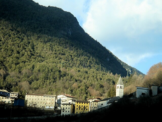
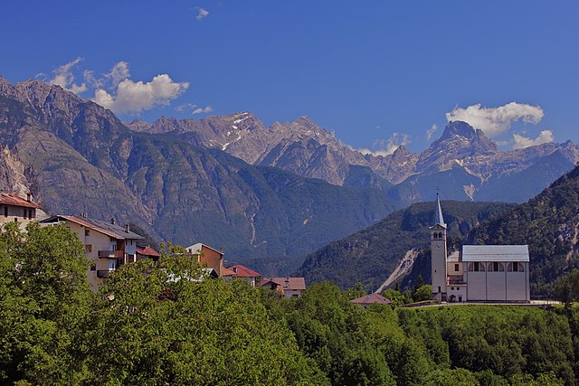
 Hiking in Perarolo di Cadore
Perarolo di Cadore is a charming village located in the Belluno province of the Veneto region in Italy, surrounded by the stunning Dolomite mountains. This area is known for its breathtaking scenery, rich natural heritage, and a variety of hiking trails that cater to different skill levels. Here’s what you should know if you're considering hiking in Perarolo di Cadore:
Scenic Trails
-
Sentiero della Pace (Peace Trail): This trail runs along the Cadore Valley, showcasing the historical significance of the area, particularly related to World War I. It's a great choice for those interested in both history and nature.
-
Valle del Boite: This area offers a range of trails that provide stunning views of the surrounding mountains and valleys. It's perfect for hikers looking to experience the natural beauty of the Dolomites.
-
Monte Sorapiss: An ambitious trail leads to this mountain, known for its turquoise lakes and dramatic landscapes. It’s a more challenging hike, recommended for seasoned hikers.
Difficulty Levels
-
Easy Trails: There are gentle paths suitable for families and beginners, often with stunning views or leading to small panoramic spots.
-
Moderate to Difficult Trails: Many trails vary in difficulty, and those looking for more strenuous hikes will find challenging elevations and rugged terrain.
Preparation and Tips
-
Gear: Wear appropriate hiking boots and bring water, snacks, and a map or GPS device.
-
Weather Conditions: Check the weather forecast before heading out, as conditions can change quickly in the mountains.
-
Local Regulations: Be aware of local rules regarding trail usage and wildlife protection.
-
Guided Tours: If you're unfamiliar with the area or hiking in general, consider joining a guided tour for a safer and more informative experience.
Best Time to Visit
The best time for hiking in Perarolo di Cadore is typically from late spring to early autumn (May to October), when the trails are clear of snow and the weather is favorable.
Cultural Sights
Alongside the hiking opportunities, you can also explore the village itself, which has historical sites, local cuisine, and friendly inhabitants. It’s an excellent place to experience the local culture after a day on the trails.
Overall, whether you're an experienced hiker or just looking for a pleasant walk in nature, Perarolo di Cadore offers a wonderful setting for outdoor enthusiasts.
- Country:

- Postal Code: 32010
- Local Dialing Code: 0435
- Licence Plate Code: BL
- Coordinates: 46° 23' 44" N, 12° 21' 23" E


- GPS tracks (wikiloc): [Link]
- AboveSeaLevel: 532 м m
- Area: 43.94 sq km
- Population: 372
- Web site: http://www.comune.perarolodicadore.bl.it
- Wikipedia en: wiki(en)
- Wikipedia: wiki(it)
- Wikidata storage: Wikidata: Q39516
- Wikipedia Commons Category: [Link]
- Freebase ID: [/m/0gk1_x]
- GeoNames ID: Alt: [6536275]
- VIAF ID: Alt: [243906005]
- OSM relation ID: [47127]
- WOEID: [720142]
- UN/LOCODE: [ITPCJ]
- ISTAT ID: 025037
- Italian cadastre code: G442
Shares border with regions:

Ospitale di Cadore
- Italian comune
Hiking in Ospitale di Cadore
Ospitale di Cadore is a picturesque village located in the Dolomite region of northern Italy. Renowned for its stunning natural landscapes, Ospitale di Cadore serves as an excellent base for hiking enthusiasts looking to explore the Dolomites' breathtaking scenery....
- Country:
- Postal Code: 32010
- Local Dialing Code: 0437
- Licence Plate Code: BL
- Coordinates: 46° 19' 45" N, 12° 19' 27" E
- GPS tracks (wikiloc): [Link]
- AboveSeaLevel: 490 м m
- Area: 39.78 sq km
- Population: 281
- Web site: [Link]

Valle di Cadore
- Italian comune
Hiking in Valle di Cadore
Valle di Cadore, located in the Dolomite region of northern Italy, is a stunning destination for hiking enthusiasts. This picturesque valley offers breathtaking landscapes, charming villages, and a variety of trails suitable for different skill levels....
- Country:
- Postal Code: 32040
- Local Dialing Code: 0435
- Licence Plate Code: BL
- Coordinates: 46° 25' 0" N, 12° 20' 0" E
- GPS tracks (wikiloc): [Link]
- AboveSeaLevel: 851 м m
- Area: 40.64 sq km
- Population: 1885
- Web site: [Link]


Pieve di Cadore
- Italian comune
Hiking in Pieve di Cadore
Pieve di Cadore, located in the Dolomite Mountain range in northern Italy, offers stunning hiking opportunities for both novice and experienced hikers. This scenic town is not just known for its natural beauty but also for its cultural significance, being the birthplace of the famous painter Tiziano Vecellio (Titian)....
- Country:
- Postal Code: 32044
- Local Dialing Code: 0435
- Licence Plate Code: BL
- Coordinates: 46° 26' 0" N, 12° 22' 0" E
- GPS tracks (wikiloc): [Link]
- AboveSeaLevel: 878 м m
- Area: 67.17 sq km
- Population: 3788
- Web site: [Link]


Cimolais
- Italian comune
Hiking in Cimolais
Cimolais, located in the beautiful Friuli Venezia Giulia region of Italy, is a stunning destination for hikers. Nestled in the Dolomites, it offers breathtaking landscapes, diverse trails, and a rich natural environment. Here are some highlights about hiking in and around Cimolais:...
- Country:
- Postal Code: 33080
- Local Dialing Code: 0427
- Licence Plate Code: PN
- Coordinates: 46° 17' 0" N, 12° 26' 0" E
- GPS tracks (wikiloc): [Link]
- AboveSeaLevel: 652 м m
- Area: 100.86 sq km
- Population: 363
- Web site: [Link]


Erto e Casso
- Italian comune
Hiking in Erto e Casso
Erto e Casso is a picturesque municipality in the Friuli Venezia Giulia region of Italy, known for its stunning landscapes, rich history, and outdoor activities. It is situated near the Dolomites and the Friulian Alps, making it a great destination for hiking enthusiasts....
- Country:
- Postal Code: 33080
- Local Dialing Code: 0427
- Licence Plate Code: PN
- Coordinates: 46° 16' 35" N, 12° 22' 17" E
- GPS tracks (wikiloc): [Link]
- AboveSeaLevel: 775 м m
- Area: 52.43 sq km
- Population: 371
- Web site: [Link]