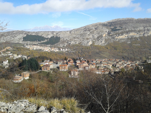
Pereto (Pereto)
.svg)
- Italian comune
 Hiking in Pereto
Pereto is a small town located in the Abruzzo region of Italy, surrounded by stunning natural landscapes and mountain ranges, making it an attractive destination for hiking enthusiasts. The area is characterized by its beautiful scenery, diverse flora and fauna, and various trails suitable for different skill levels.
Hiking Trails in and around Pereto:
-
Monte Soratte:
- Difficulty: Moderate
- This trail offers beautiful views of the surrounding valleys. The ascent can be challenging, but the panoramic views from the summit are rewarding.
-
Parco Regionale dei Simbruini:
- Difficulty: Various (easy to difficult)
- Located not far from Pereto, this regional park offers numerous trails through dense forests, along rivers, and up to mountain peaks. The trails vary, allowing hikers of all levels to find suitable hikes.
-
Lago del Salto:
- Distance: Approximately 10 km loop
- An ideal path for those looking for a scenic hike around a beautiful lake. The area provides spots for picnicking and enjoying the natural beauty.
-
Historical Hikes:
- Consider hiking routes that pass through historical sites or ancient villages. The area around Pereto has rich cultural heritage, and some trails may lead you to ancient ruins and picturesque settlements.
Best Hiking Practices:
-
Preparation: Always check the weather forecast and trail conditions before heading out. Make sure to wear suitable footwear, use sunscreen, and carry enough water and snacks.
-
Leave No Trace: Follow the principles of responsible hiking. Carry out any trash, respect wildlife, and stay on marked paths to protect the natural environment.
-
Safety: Inform someone about your hiking plans and expected return time, especially if you’re venturing into less frequented trails.
Local Attractions:
After a day of hiking, enjoy local cuisine at nearby restaurants. The Abruzzo region is known for its hearty dishes, wine, and hospitality.
Conclusion:
Hiking in and around Pereto offers a blend of natural beauty, adventure, and cultural experiences. Whether you're looking for hearty mountain hikes or leisurely walks in nature, this area provides something for every hiking enthusiast. Make sure to plan your trip according to your fitness level and interests for the best experience. Happy hiking!
- Country:

- Postal Code: 67064
- Local Dialing Code: 0863
- Licence Plate Code: AQ
- Coordinates: 42° 3' 38" N, 13° 5' 51" E


- GPS tracks (wikiloc): [Link]
- AboveSeaLevel: 800 м m
- Area: 41.16 sq km
- Population: 669
- Web site: http://www.comune.pereto.aq.it/
- Wikipedia en: wiki(en)
- Wikipedia: wiki(it)
- Wikidata storage: Wikidata: Q50120
- Wikipedia Commons Category: [Link]
- Freebase ID: [/m/0fg4z8]
- GeoNames ID: Alt: [6541695]
- VIAF ID: Alt: [247422119]
- OSM relation ID: [41731]
- Google Maps Customer ID: [9742965558740107555]
- ISTAT ID: 066067
- Italian cadastre code: G449
Shares border with regions:

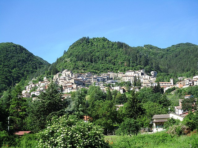
Cappadocia, Abruzzo
- Italian comune
Hiking in Cappadocia, Abruzzo
Cappadocia in Turkey and Abruzzo in Italy are two fantastic hiking destinations, each with its own unique landscapes and cultural experiences. However, since you mentioned "Cappadocia, Abruzzo," I'm assuming you might be looking for information on hiking in both regions separately....
- Country:
- Postal Code: 67060
- Local Dialing Code: 0863
- Licence Plate Code: AQ
- Coordinates: 42° 0' 27" N, 13° 16' 51" E
- GPS tracks (wikiloc): [Link]
- AboveSeaLevel: 1108 м m
- Area: 68.58 sq km
- Population: 546
- Web site: [Link]


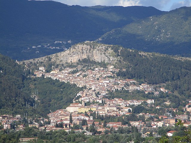
Carsoli
- Italian comune
Hiking in Carsoli
Carsoli, located in the Abruzzo region of Italy, offers some beautiful hiking opportunities amidst its picturesque landscapes, rich history, and diverse flora and fauna. Here are some highlights and tips for hiking in and around Carsoli:...
- Country:
- Postal Code: 67061
- Local Dialing Code: 0863
- Licence Plate Code: AQ
- Coordinates: 42° 5' 56" N, 13° 5' 19" E
- GPS tracks (wikiloc): [Link]
- AboveSeaLevel: 616 м m
- Area: 95.8 sq km
- Population: 5314
- Web site: [Link]


Oricola
- Italian comune
Hiking in Oricola
Oricola is a charming town located in the province of L'Aquila, in the Abruzzo region of Italy. It is known for its stunning natural landscapes, making it an excellent destination for hiking enthusiasts. Here are some key points to consider when hiking in Oricola:...
- Country:
- Postal Code: 67063
- Local Dialing Code: 0863
- Licence Plate Code: AQ
- Coordinates: 42° 3' 1" N, 13° 2' 22" E
- GPS tracks (wikiloc): [Link]
- AboveSeaLevel: 810 м m
- Area: 18.36 sq km
- Population: 1251
- Web site: [Link]

Rocca di Botte
- Italian comune
Hiking in Rocca di Botte
Rocca di Botte is a charming mountain village located in the Abruzzo region of Italy, nestled in the scenic Apennine Mountains. The area is known for its stunning natural landscapes, rich biodiversity, and opportunities for outdoor activities, particularly hiking....
- Country:
- Postal Code: 67066
- Local Dialing Code: 0863
- Licence Plate Code: AQ
- Coordinates: 42° 1' 38" N, 13° 4' 7" E
- GPS tracks (wikiloc): [Link]
- AboveSeaLevel: 750 м m
- Area: 31.1 sq km
- Population: 842
- Web site: [Link]

Tagliacozzo
- Italian comune
Hiking in Tagliacozzo
Tagliacozzo, located in the Abruzzo region of Italy, is a beautiful destination for hiking enthusiasts. Nestled in the heart of the Apennine mountain range, it offers a mix of stunning landscapes, historical sites, and a variety of trails suitable for different skill levels. Here are some key points about hiking in Tagliacozzo:...
- Country:
- Postal Code: 67069
- Local Dialing Code: 0863
- Licence Plate Code: AQ
- Coordinates: 42° 4' 10" N, 13° 15' 17" E
- GPS tracks (wikiloc): [Link]
- AboveSeaLevel: 740 м m
- Area: 87.4 sq km
- Population: 6755
- Web site: [Link]