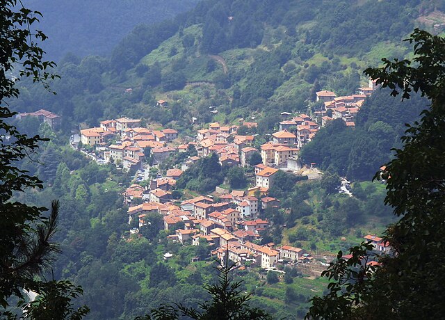
Pescaglia (Pescaglia)
.svg)
- Italian comune
 Hiking in Pescaglia
Pescaglia is a picturesque town located in the Tuscan region of Italy, offering beautiful hiking opportunities amidst its stunning natural landscapes. Nestled in the Apuan Alps, Pescaglia provides hikers with a variety of trails that range in difficulty, making it suitable for both beginners and experienced trekkers.
Key Hiking Trails:
-
Monte Procinto: This is a popular hike leading to one of the prominent peaks in the area. The trail offers breathtaking views of the surrounding mountains and valleys. The ascent can be challenging, so it's best suited for those with a moderate to high fitness level.
-
Sentiero della Libertà: This historic trail is not only a hike but also a journey through history, following the route that local partisans took during WWII. It passes through beautiful forests and offers insights into the region's past.
-
Trail to Sant’Anna di Stazzema: A more leisurely hike that allows you to explore lush woods and charming rural landscapes. This trail leads to the small village of Sant’Anna, known for its historical significance.
-
The Vasca dei Santi Trail: This is a scenic route that includes views of ancient water tanks and offers a glimpse of the traditional rural architecture. It's a relatively easy hike suitable for families.
Tips for Hiking in Pescaglia:
- Preparation: Make sure to wear sturdy hiking boots and pack enough water and snacks. The weather can change quickly, so dress in layers.
- Maps and Guides: While many trails are well-marked, consider bringing a local hiking map or book to help navigate the area and learn more about the local flora and fauna.
- Respect Nature: Stay on marked trails to minimize your impact on the environment, and carry out all trash.
- Local Regulations: Be aware of any local regulations regarding wildlife and protected areas.
Overall, hiking in Pescaglia offers a blend of natural beauty, historical significance, and the opportunity to immerse yourself in the tranquil Tuscan countryside. Whether you're looking for a rigorous trek or a gentle stroll, you'll find a trail that suits your preference in this charming region.
- Country:

- Postal Code: 55064
- Local Dialing Code: 0583
- Licence Plate Code: LU
- Coordinates: 43° 58' 0" N, 10° 25' 0" E


- GPS tracks (wikiloc): [Link]
- AboveSeaLevel: 504 м m
- Area: 70.55 sq km
- Population: 3456
- Web site: http://www.comune.pescaglia.lu.it/
- Wikipedia en: wiki(en)
- Wikipedia: wiki(it)
- Wikidata storage: Wikidata: Q217661
- Wikipedia Commons Category: [Link]
- Freebase ID: [/m/0glb8d]
- GeoNames ID: Alt: [6536815]
- VIAF ID: Alt: [150427966]
- OSM relation ID: [42748]
- GND ID: Alt: [4210654-0]
- UN/LOCODE: [ITZPW]
- ISTAT ID: 046022
- Italian cadastre code: G480
Shares border with regions:


Lucca
- city and comune in Tuscany, Central Italy
Hiking in Lucca
Hiking in and around Lucca, a beautiful city in Tuscany, Italy, offers a delightful combination of stunning landscapes, historical sites, and charming countryside. Here are some key points to consider for an enjoyable hiking experience in the area:...
- Country:
- Postal Code: 55100
- Local Dialing Code: 0583
- Coordinates: 43° 51' 0" N, 10° 31' 0" E
- GPS tracks (wikiloc): [Link]
- AboveSeaLevel: 19 м m
- Area: 185.79 sq km
- Population: 88397
- Web site: [Link]


Borgo a Mozzano
- Italian comune
Hiking in Borgo a Mozzano
Borgo a Mozzano, located in the province of Lucca in Tuscany, Italy, is a charming town that serves as an excellent base for hiking enthusiasts. Surrounded by stunning landscapes, including the Apuan Alps and the Serchio River valley, it offers a variety of trails that cater to different skill levels....
- Country:
- Postal Code: 55023
- Local Dialing Code: 0583
- Licence Plate Code: LU
- Coordinates: 43° 58' 47" N, 10° 32' 48" E
- GPS tracks (wikiloc): [Link]
- AboveSeaLevel: 97 м m
- Area: 72.2 sq km
- Population: 6994
- Web site: [Link]


Camaiore
- City and comune within the province of Lucca, Tuscany, central-western Italy. It stretches from the Apuan Alps to the east, to the plains and the coast of Versilia to the west.
Hiking in Camaiore
Camaiore, located in the Tuscany region of Italy, offers a variety of hiking opportunities that are appealing to both novice and experienced hikers. The area is characterized by beautiful landscapes, charming villages, and a rich tapestry of flora and fauna....
- Country:
- Postal Code: 55041
- Local Dialing Code: 0584
- Licence Plate Code: LU
- Coordinates: 43° 56' 0" N, 10° 18' 0" E
- GPS tracks (wikiloc): [Link]
- AboveSeaLevel: 34 м m
- Area: 85.43 sq km
- Population: 32328
- Web site: [Link]

Stazzema
- Italian comune
Hiking in Stazzema
Stazzema, located in the Apuan Alps of Tuscany, Italy, is a wonderful destination for hiking enthusiasts. This area is known for its stunning landscapes, rich history, and diverse wildlife. Here are some key points to consider when hiking in and around Stazzema:...
- Country:
- Postal Code: 55040; 55060
- Local Dialing Code: 0584
- Licence Plate Code: LU
- Coordinates: 43° 59' 35" N, 10° 18' 38" E
- GPS tracks (wikiloc): [Link]
- AboveSeaLevel: 453 м m
- Area: 82.08 sq km
- Population: 3083
- Web site: [Link]