Peyrabout (Peyrabout)

- commune in Creuse, France
- Country:

- Postal Code: 23000
- Coordinates: 46° 6' 26" N, 1° 54' 43" E


- GPS tracks (wikiloc): [Link]
- Area: 8.91 sq km
- Population: 147
- Wikipedia en: wiki(en)
- Wikipedia: wiki(fr)
- Wikidata storage: Wikidata: Q199501
- Wikipedia Commons Category: [Link]
- Freebase ID: [/m/03mfk22]
- Freebase ID: [/m/03mfk22]
- GeoNames ID: Alt: [6429241]
- GeoNames ID: Alt: [6429241]
- SIREN number: [212315006]
- SIREN number: [212315006]
- BnF ID: [152515376]
- BnF ID: [152515376]
- INSEE municipality code: 23150
- INSEE municipality code: 23150
Shares border with regions:

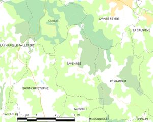
Savennes
- commune in Creuse, France
- Country:
- Postal Code: 23000
- Coordinates: 46° 6' 21" N, 1° 53' 17" E
- GPS tracks (wikiloc): [Link]
- Area: 6.93 sq km
- Population: 216


Saint-Yrieix-les-Bois
- commune in Creuse, France
- Country:
- Postal Code: 23150
- Coordinates: 46° 5' 59" N, 1° 56' 18" E
- GPS tracks (wikiloc): [Link]
- Area: 15.7 sq km
- Population: 288


Sainte-Feyre
- commune in Creuse, France
- Country:
- Postal Code: 23000
- Coordinates: 46° 8' 18" N, 1° 54' 54" E
- GPS tracks (wikiloc): [Link]
- Area: 29.99 sq km
- Population: 2488
- Web site: [Link]
Lépinas
- commune in Creuse, France
- Country:
- Postal Code: 23150
- Coordinates: 46° 4' 35" N, 1° 55' 42" E
- GPS tracks (wikiloc): [Link]
- Area: 14.8 sq km
- Population: 154


La Saunière
- commune in Creuse, France
- Country:
- Postal Code: 23000
- Coordinates: 46° 7' 49" N, 1° 56' 13" E
- GPS tracks (wikiloc): [Link]
- Area: 7.5 sq km
- Population: 616


Maisonnisses
- commune in Creuse, France
- Country:
- Postal Code: 23150
- Coordinates: 46° 3' 47" N, 1° 53' 56" E
- GPS tracks (wikiloc): [Link]
- Area: 11.12 sq km
- Population: 204


Sardent
- commune in Creuse, France
- Country:
- Postal Code: 23250
- Coordinates: 46° 3' 2" N, 1° 51' 20" E
- GPS tracks (wikiloc): [Link]
- Area: 41.11 sq km
- Population: 783
- Web site: [Link]