Peyret-Saint-André (Peyret-Saint-André)

- commune in Hautes-Pyrénées, France
- Country:

- Postal Code: 65230
- Coordinates: 43° 19' 10" N, 0° 30' 29" E


- GPS tracks (wikiloc): [Link]
- Area: 6.25 sq km
- Population: 56
- Wikipedia en: wiki(en)
- Wikipedia: wiki(fr)
- Wikidata storage: Wikidata: Q1326947
- Wikipedia Commons Category: [Link]
- Freebase ID: [/m/03nv2q6]
- Freebase ID: [/m/03nv2q6]
- GeoNames ID: Alt: [6440869]
- GeoNames ID: Alt: [6440869]
- SIREN number: [216503581]
- SIREN number: [216503581]
- BnF ID: [152707895]
- BnF ID: [152707895]
- INSEE municipality code: 65358
- INSEE municipality code: 65358
Shares border with regions:

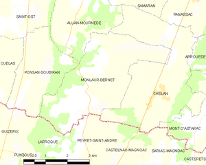
Monlaur-Bernet
- commune in Gers, France
- Country:
- Postal Code: 32140
- Coordinates: 43° 21' 6" N, 0° 30' 42" E
- GPS tracks (wikiloc): [Link]
- Area: 12.21 sq km
- Population: 160


Chélan
- commune in Gers, France
- Country:
- Postal Code: 32140
- Coordinates: 43° 20' 43" N, 0° 32' 54" E
- GPS tracks (wikiloc): [Link]
- Area: 13.49 sq km
- Population: 180


Larroque
- commune in Hautes-Pyrénées, France
- Country:
- Postal Code: 65230
- Coordinates: 43° 18' 39" N, 0° 29' 27" E
- GPS tracks (wikiloc): [Link]
- AboveSeaLevel: 354 м m
- Area: 6.89 sq km
- Population: 106


Castelnau-Magnoac
- commune in Hautes-Pyrénées, France
- Country:
- Postal Code: 65230
- Coordinates: 43° 17' 41" N, 0° 30' 27" E
- GPS tracks (wikiloc): [Link]
- Area: 12.56 sq km
- Population: 781
- Web site: [Link]