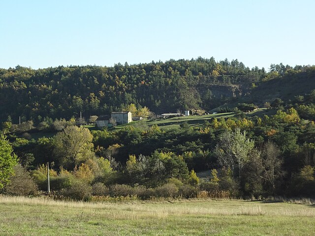
Peyruis (Peyruis)
- commune in Alpes-de-Haute-Provence, France
Peyruis, located in the Alpes-de-Haute-Provence region of France, offers some charming hiking opportunities that attract nature enthusiasts. The area is characterized by its picturesque landscapes, rolling hills, and scenic views of the surrounding alpine environment. Here are some key points to consider when hiking in and around Peyruis:
Scenic Trails
-
Local Trails: There are several well-marked trails in and around Peyruis that cater to various skill levels. Some trails can take you through forests, fields of wildflowers, and offer panoramic views of the Durance Valley.
-
Nearby Nature Parks: The proximity to natural parks such as the Verdon Regional Natural Park provides even more options for hiking, where you can explore stunning gorges, canyons, and diverse wildlife.
Key Attractions
-
Natural Scenery: The area boasts a range of habitats, so hikers may encounter lavender fields, vineyards, and views of the mountains, especially the Luberon and the Alps.
-
Cultural Sites: Along some hiking routes, you may find historical landmarks, small villages, and local markets that reflect the region's culture and history.
Practical Tips
-
Season Considerations: Spring and fall are ideal times for hiking in the Peyruis area due to mild temperatures and blooming flora. Summer can be hot, while winter may require snow gear if you venture into elevated regions.
-
Preparation and Gear: Always wear appropriate hiking boots and carry water, snacks, a map, and a first aid kit. It's also wise to inform someone of your route and expected return time.
-
Local Regulations: Follow local guidelines and trail markers, and be respectful of the environment to preserve its natural beauty.
Conclusion
Hiking in Peyruis can be a rewarding experience, whether you're looking for a leisurely stroll or a more challenging trek. Take the time to enjoy the beautiful landscapes and immerse yourself in the tranquil natural environment. Remember to check local resources for updated trail information and maps before your hike.
- Country:

- Postal Code: 04310
- Coordinates: 44° 1' 44" N, 5° 56' 25" E


- GPS tracks (wikiloc): [Link]
- Area: 23.23 sq km
- Population: 2849
- Wikipedia en: wiki(en)
- Wikipedia: wiki(fr)
- Wikidata storage: Wikidata: Q374183
- Wikipedia Commons Category: [Link]
- Freebase ID: [/m/02rl9m_]
- Freebase ID: [/m/02rl9m_]
- GeoNames ID: Alt: [2987459]
- GeoNames ID: Alt: [2987459]
- SIREN number: [210401493]
- SIREN number: [210401493]
- INSEE municipality code: 04149
- INSEE municipality code: 04149
Shares border with regions:

Mallefougasse-Augès
- commune in Alpes-de-Haute-Provence, France
Mallefougasse-Augès is a charming village located in the Provence-Alpes-Côte d'Azur region of southeastern France. It's situated near the Luberon Regional Natural Park, which offers excellent opportunities for hiking, thanks to its diverse landscapes, picturesque villages, and rich flora and fauna....
- Country:

- Postal Code: 04230
- Coordinates: 44° 3' 58" N, 5° 53' 52" E


- GPS tracks (wikiloc): [Link]
- AboveSeaLevel: 700 м m
- Area: 19.71 sq km
- Population: 326

Ganagobie
- commune in Alpes-de-Haute-Provence, France
Ganagobie is a beautiful region located in the Alpes-de-Haute-Provence department of southeastern France. It is known for its stunning landscapes, rich biodiversity, and the historic Saint-Marie de Ganagobie Monastery, which sits on a hill overlooking the countryside. Here are some highlights about hiking in Ganagobie:...
- Country:

- Postal Code: 04310
- Coordinates: 44° 0' 32" N, 5° 54' 59" E


- GPS tracks (wikiloc): [Link]
- Area: 10.5 sq km
- Population: 85

Sigonce
- commune in Alpes-de-Haute-Provence, France
Sigonce, a picturesque village located in the Provence-Alpes-Côte d'Azur region of France, is a hidden gem for outdoor enthusiasts. The surrounding landscape features rolling hills, dense forests, and stunning views that make it an ideal destination for hiking. Here are some highlights and tips for hiking in Sigonce:...
- Country:

- Postal Code: 04300
- Coordinates: 43° 59' 49" N, 5° 50' 25" E


- GPS tracks (wikiloc): [Link]
- Area: 19.97 sq km
- Population: 429

Montlaux
- commune in Alpes-de-Haute-Provence, France
Montlaux is a charming destination for hiking enthusiasts, located in the Provence-Alpes-Côte d'Azur region of France. Nestled in the picturesque Verdon region, it offers a variety of trails that cater to different levels of hikers, from beginners to experienced trekkers....
- Country:

- Postal Code: 04230
- Coordinates: 44° 2' 49" N, 5° 50' 40" E


- GPS tracks (wikiloc): [Link]
- AboveSeaLevel: 550 м m
- Area: 19.75 sq km
- Population: 143

Les Mées
- commune in Alpes-de-Haute-Provence, France
Les Mées, located in the Alpes-de-Haute-Provence region of France, is known for its stunning landscapes, diverse trails, and the unique geological formations that characterize the area. Here’s what you can expect when hiking in Les Mées:...
- Country:

- Postal Code: 04190
- Coordinates: 44° 1' 46" N, 5° 58' 35" E


- GPS tracks (wikiloc): [Link]
- Area: 65.4 sq km
- Population: 3664
- Web site: [Link]

Montfort
- commune in Alpes-de-Haute-Provence, France
Montfort is a charming village in the Alpes-de-Haute-Provence region of France, surrounded by stunning natural landscapes that are perfect for hiking enthusiasts. The area is characterized by its picturesque scenery, including rolling hills, lush forests, and the nearby Verdon River, which offers a variety of hiking trails suitable for different skill levels....
- Country:

- Postal Code: 04600
- Coordinates: 44° 3' 49" N, 5° 58' 22" E


- GPS tracks (wikiloc): [Link]
- Area: 12.08 sq km
- Population: 346
- Web site: [Link]
