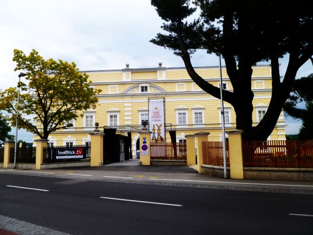
Pfaffstätt (Pfaffstätt)
- municipality in Austria
 Hiking in Pfaffstätt
Pfaffstätt, located in Austria, is a charming area that offers various hiking opportunities with picturesque landscapes and natural beauty. While the specifics of trails can vary, here are some general tips and highlights for hiking in the Pfaffstätt region.
Hiking Trails
-
Local Trails: The area typically features a network of well-marked hiking trails suitable for all levels, from easy walks to more challenging hikes. Make sure to check local maps for specific routes.
-
Scenic Views: Many trails offer stunning views of the surrounding countryside, including rolling hills, forests, and possibly local wildlife, making them ideal for photography and nature observation.
-
Nature Reserves: Some trails might lead you through natural reserves where you can enjoy diverse flora and fauna. Respecting these areas is vital for their preservation.
Preparation
- Footwear: Wear sturdy hiking boots with good traction, as the terrain can vary from smooth paths to rugged trails.
- Weather: Always check the local weather before you head out. Conditions can change rapidly in mountainous areas.
- Water and Snacks: Bring plenty of water and energy snacks to keep your energy up while hiking.
- Navigation Tools: Have a map or a hiking app downloaded to help with navigation, especially if you're exploring less familiar trails.
Safety
- Local Wildlife: Be attentive to local wildlife; keep a safe distance and don’t feed animals.
- Trail Etiquette: When hiking, be considerate to others on the trail. Yield the path to those going uphill and maintain a quiet environment to enjoy nature.
Nearby Attractions
- After a day of hiking, you might want to explore local cultural sites or enjoy a meal at a nearby restaurant to experience regional cuisine.
Before heading out, it’s always best to consult local tourism websites or visitor centers for updated trail information and any specific tips for hiking in the Pfaffstätt area. Enjoy your hiking adventure!
- Country:

- Postal Code: 5223
- Local Dialing Code: 07742
- Licence Plate Code: BR
- Coordinates: 48° 4' 30" N, 13° 8' 40" E


- GPS tracks (wikiloc): [Link]
- AboveSeaLevel: 471 м m
- Area: 9.2 sq km
- Population: 1101
- Web site: http://www.pfaffstaett.ooe.gv.at/
- Wikipedia en: wiki(en)
- Wikipedia: wiki(de)
- Wikidata storage: Wikidata: Q669169
- Wikipedia Commons Category: [Link]
- Freebase ID: [/m/03gv2k8]
- GeoNames ID: Alt: [7873105]
- VIAF ID: Alt: [245818535]
- Austrian municipality key: [40431]
Shares border with regions:
Auerbach, Upper Austria
- municipality in Austria
Hiking in Auerbach, Upper Austria
Auerbach is a picturesque area in Upper Austria, nestled amidst stunning natural landscapes that provide an excellent backdrop for hiking enthusiasts. The region features a variety of trails suitable for different skill levels, offering both tranquil walks and challenging hikes. Here are some highlights of hiking in Auerbach and its surrounding areas:...
- Country:
- Postal Code: 5224
- Local Dialing Code: 07747
- Licence Plate Code: BR
- Coordinates: 48° 3' 54" N, 13° 6' 33" E
- GPS tracks (wikiloc): [Link]
- AboveSeaLevel: 488 м m
- Area: 10.8 sq km
- Population: 583
- Web site: [Link]

Jeging
- municipality in Austria
Hiking in Jeging
It seems like there might be a typo in your inquiry—did you mean hiking in Jeju Island, South Korea, or are you referring to a specific area that might be less well-known?...
- Country:
- Postal Code: 5225
- Local Dialing Code: 07744
- Licence Plate Code: BR
- Coordinates: 48° 3' 0" N, 13° 9' 0" E
- GPS tracks (wikiloc): [Link]
- AboveSeaLevel: 486 м m
- Area: 6.58 sq km
- Population: 691
- Web site: [Link]
Mattighofen
- municipality in Austria
Hiking in Mattighofen
Mattighofen, located in the Austrian state of Salzburg, is an attractive area for hiking enthusiasts due to its stunning natural landscapes and variety of trails. Nestled near the foothills of the Alps, the region offers a mix of rural charm and scenic beauty, making it suitable for both novice and experienced hikers....
- Country:
- Postal Code: 5230
- Local Dialing Code: 07742
- Licence Plate Code: BR
- Coordinates: 48° 6' 24" N, 13° 8' 58" E
- GPS tracks (wikiloc): [Link]
- AboveSeaLevel: 454 м m
- Area: 5.16 sq km
- Population: 6524
- Web site: [Link]
Pischelsdorf am Engelbach
- municipality in Austria
Hiking in Pischelsdorf am Engelbach
Pischelsdorf am Engelbach is a charming village located in Austria, surrounded by beautiful landscapes that offer various hiking opportunities. The area is characterized by its lush countryside, rolling hills, and picturesque views, making it an ideal location for both novice and experienced hikers....
- Country:
- Postal Code: 5233
- Local Dialing Code: 07742
- Licence Plate Code: BR
- Coordinates: 48° 7' 50" N, 13° 5' 0" E
- GPS tracks (wikiloc): [Link]
- AboveSeaLevel: 433 м m
- Area: 32.82 sq km
- Population: 1662
- Web site: [Link]
Kirchberg bei Mattighofen
- municipality in Austria
Hiking in Kirchberg bei Mattighofen
Kirchberg bei Mattighofen is a charming village located in the Austrian state of Upper Austria, surrounded by beautiful landscapes that are ideal for hiking enthusiasts. The region offers a variety of trails, catering to different skill levels and allowing hikers to explore the picturesque countryside, forests, and hills. Here are some highlights to consider for your hiking experience in this area:...
- Country:
- Postal Code: 5232
- Local Dialing Code: 07747
- Licence Plate Code: BR
- Coordinates: 48° 2' 22" N, 13° 6' 2" E
- GPS tracks (wikiloc): [Link]
- AboveSeaLevel: 560 м m
- Area: 15.74 sq km
- Population: 1175
- Web site: [Link]

Munderfing
- municipality in Austria
Hiking in Munderfing
Munderfing, a picturesque village in Austria, is surrounded by beautiful landscapes that offer a variety of hiking opportunities for nature enthusiasts. Here's an overview of what you can expect when hiking in this region:...
- Country:
- Postal Code: 5222
- Local Dialing Code: 07744
- Licence Plate Code: BR
- Coordinates: 48° 4' 0" N, 13° 11' 0" E
- GPS tracks (wikiloc): [Link]
- AboveSeaLevel: 468 м m
- Area: 31.09 sq km
- Population: 2963
- Web site: [Link]