Braunau am Inn District (Bezirk Braunau am Inn)

- district of Austria
 Hiking in Braunau am Inn District
Braunau am Inn District, located in Austria near the border with Germany, offers a variety of hiking opportunities that cater to different skill levels and preferences. The landscape is characterized by rolling hills, lush greenery, and scenic views, making it an attractive destination for nature lovers and outdoor enthusiasts.
Hiking Areas and Trails:
-
Inn River Valley: The area around the Inn River features flat trails that are perfect for leisurely walks or biking alongside the river. These paths provide stunning views of the water and surrounding countryside.
-
Mühlviertel Region: Just a short distance from Braunau, this region offers more challenging hikes through forested areas and higher elevations. Various trails lead you through serene woods and past small streams.
-
Kobernausser Wald: This forested area offers a range of hiking trails. You can explore serene trails that vary in length and difficulty, providing options for both day hikers and those looking for longer excursions.
-
Hiking to Local Peaks: For those seeking more challenging hikes, there are several local hills and mountains such as the Kuhberg (at approximately 600 meters), which provide rewarding views at the summit.
-
Cultural Trails: Some trails combine hiking with cultural experiences, leading you through villages where you can explore local history and cuisine.
Recommendations:
- Preparation: Always check the weather forecast before heading out, as conditions can change rapidly in mountainous areas. Dress in layers and wear comfortable, sturdy footwear.
- Maps and Guides: Utilize local hiking maps or apps to ensure you stay on designated trails and understand your route.
- Water and Snacks: Carry enough water and snacks, especially for longer hikes, to keep your energy levels up.
- Respect Nature: Stick to marked trails to preserve nature and wildlife. Always pack out what you pack in.
Seasonal Considerations:
- Spring and summer are ideal for hiking in this region due to the mild weather, but be careful of potential rain.
- Autumn offers beautiful foliage and pleasant temperatures, making it another great time for hiking.
- Winter hiking is possible but requires additional gear like snowshoes or crampons.
Whether you're looking for a peaceful nature walk or a more challenging hike, Braunau am Inn District has something to offer every hiking enthusiast. Make sure to take the time to appreciate the stunning natural beauty and cultural landmarks along your journey!
- Country:

- Capital: Braunau am Inn
- Licence Plate Code: BR
- Coordinates: 48° 7' 52" N, 13° 6' 32" E


- GPS tracks (wikiloc): [Link]
- AboveSeaLevel: 451 м m
- Area: 1040.38 sq km
- Web site: http://www.bh-braunau.gv.at/
- Wikipedia en: wiki(en)
- Wikipedia: wiki(de)
- Wikidata storage: Wikidata: Q255626
- Wikipedia Commons Category: [Link]
- Wikipedia Commons Maps Category: [Link]
- Freebase ID: [/m/0dmcjz]
- GeoNames ID: Alt: [2781519]
- VIAF ID: Alt: [125522893]
- GND ID: Alt: [4089985-8]
- archINFORM location ID: [14667]
- Library of Congress authority ID: Alt: [n83023247]
Includes regions:
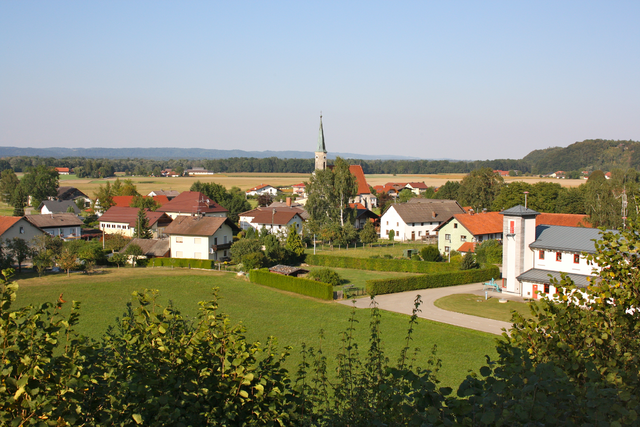
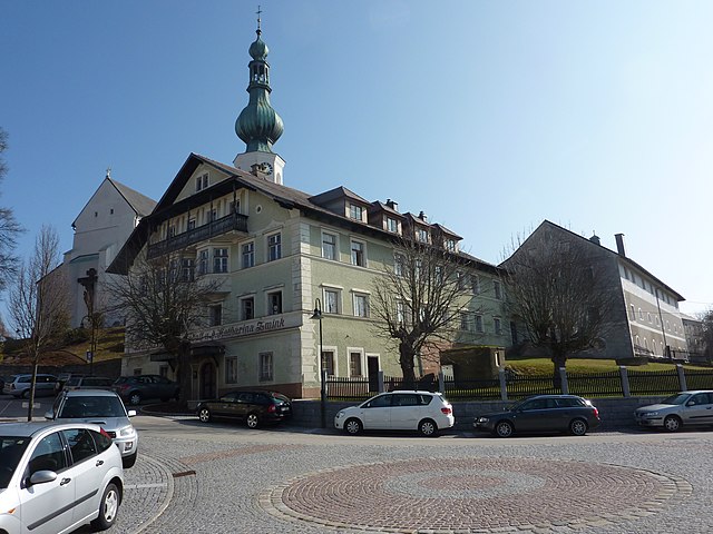
Sankt Georgen am Fillmannsbach
- municipality in Austria
Hiking in Sankt Georgen am Fillmannsbach
Sankt Georgen am Fillmannsbach is a charming village located in Austria's Salzburg region, known for its picturesque landscapes and hiking opportunities. The area offers a mix of forest trails, meadows, and scenic views of the surrounding hills and mountains, making it suitable for hikers of various skill levels....
- Country:
- Postal Code: 5144
- Local Dialing Code: 07748
- Licence Plate Code: BR
- Coordinates: 48° 7' 30" N, 13° 1' 10" E
- GPS tracks (wikiloc): [Link]
- AboveSeaLevel: 488 м m
- Area: 7.21 sq km
- Population: 404
- Web site: [Link]
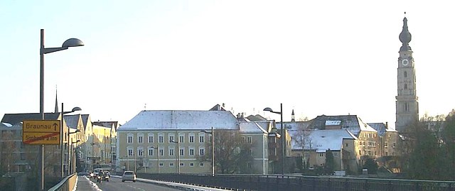

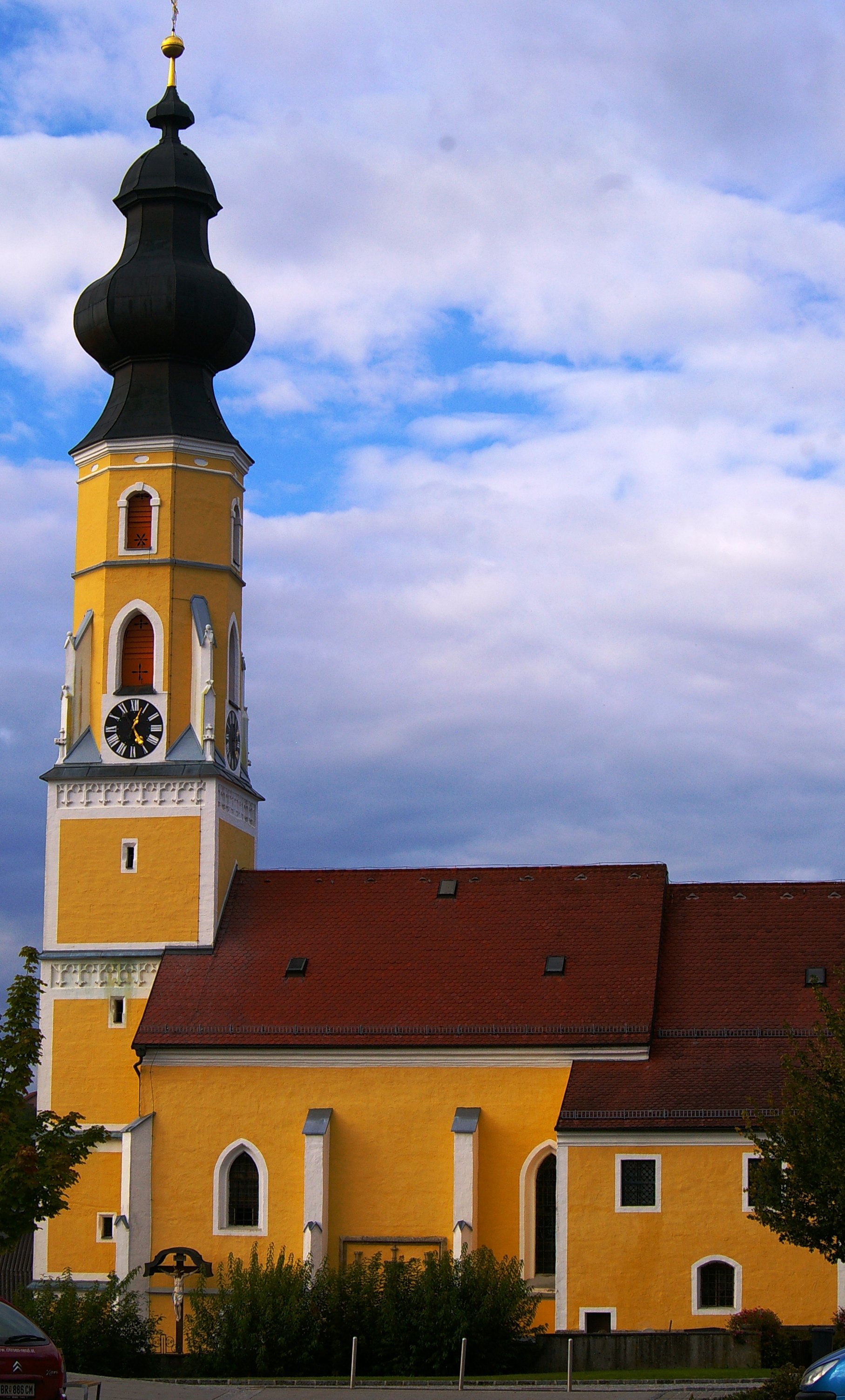
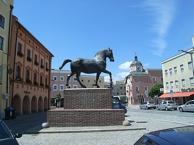
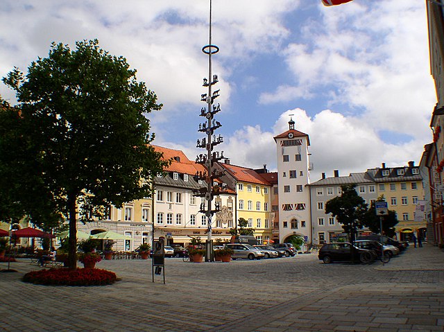
Braunau am Inn
- municipality in Austria
Hiking in Braunau am Inn
Braunau am Inn, located in Austria near the border with Germany, is surrounded by beautiful landscapes that offer various hiking opportunities. The region features gentle hills, lush forests, and picturesque views of the Inn River and the surrounding countryside....
- Country:
- Postal Code: 5289; 5283; 5280
- Local Dialing Code: 07722
- Licence Plate Code: BR
- Coordinates: 48° 15' 30" N, 13° 2' 0" E
- GPS tracks (wikiloc): [Link]
- AboveSeaLevel: 352 м m
- Area: 24.84 sq km
- Population: 17095
- Web site: [Link]

Geretsberg
- municipality in Austria
Hiking in Geretsberg
Geretsberg, located in Austria, offers beautiful hiking opportunities amidst stunning natural landscapes. The region is characterized by rolling hills, lush forests, and picturesque views, making it a delightful destination for outdoor enthusiasts....
- Country:
- Local Dialing Code: 07748
- Licence Plate Code: BR
- Coordinates: 48° 5' 20" N, 12° 56' 5" E
- GPS tracks (wikiloc): [Link]
- AboveSeaLevel: 491 м m
- Area: 37.54 sq km
- Population: 1187
- Web site: [Link]

St. Pantaleon
- municipality in Austria
Hiking in St. Pantaleon
Sankt Pantaleon is a picturesque village situated in the Austrian region of Salzburg. It is a great destination for hiking enthusiasts, offering stunning natural landscapes and various trails suitable for different skill levels. Here are some highlights and tips for hiking in the area:...
- Country:
- Postal Code: 5120
- Local Dialing Code: 06277
- Licence Plate Code: BR
- Coordinates: 48° 0' 26" N, 12° 53' 44" E
- GPS tracks (wikiloc): [Link]
- AboveSeaLevel: 436 м m
- Area: 18.32 sq km
- Population: 3085
- Web site: [Link]
Treubach
- municipality in Austria
Hiking in Treubach
Treubach is likely a lesser-known location for hiking, as there isn't a widely recognized hiking destination by that name in popular hiking literature or resources. However, if you are referring to a specific region or a local area with that name, the details could vary significantly based on the local geography, trails, and natural features....
- Country:
- Local Dialing Code: 07724
- Licence Plate Code: BR
- Coordinates: 48° 11' 42" N, 13° 12' 47" E
- GPS tracks (wikiloc): [Link]
- AboveSeaLevel: 417 м m
- Area: 13.04 sq km
- Population: 725
- Web site: [Link]
Überackern
- municipality in Austria
Hiking in Überackern
Überackern is a beautiful location for hiking, nestled in Austria. While the specifics can vary based on the specific trails and areas you choose, here are some general aspects to consider when hiking in and around Überackern:...
- Country:
- Postal Code: 5122
- Local Dialing Code: 07727
- Licence Plate Code: BR
- Coordinates: 48° 11' 35" N, 12° 52' 36" E
- GPS tracks (wikiloc): [Link]
- AboveSeaLevel: 356 м m
- Area: 27.1 sq km
- Population: 685
- Web site: [Link]

Altheim
- municipality in Austria
Hiking in Altheim
Altheim, Austria, is a small but charming town located in the upper part of the country, nestled amidst beautiful landscapes that provide opportunities for various outdoor activities, including hiking. While Altheim itself might not be a major hiking destination, its surrounding areas offer numerous trails and routes suitable for hikers of all skill levels....
- Country:
- Postal Code: 4950
- Local Dialing Code: 07723
- Licence Plate Code: BR
- Coordinates: 48° 15' 0" N, 13° 14' 0" E
- GPS tracks (wikiloc): [Link]
- AboveSeaLevel: 363 м m
- Area: 22.63 sq km
- Population: 4839
- Web site: [Link]
Gilgenberg am Weilhart
- municipality in Austria
Hiking in Gilgenberg am Weilhart
Gilgenberg am Weilhart is a picturesque village in Austria, located in the state of Upper Austria. While it might not be as well-known as some of the larger hiking destinations, it offers a number of scenic trails and beautiful countryside, making it a great spot for hiking enthusiasts....
- Country:
- Postal Code: 5133
- Local Dialing Code: 07728
- Licence Plate Code: BR
- Coordinates: 48° 7' 54" N, 12° 56' 21" E
- GPS tracks (wikiloc): [Link]
- AboveSeaLevel: 466 м m
- Area: 26.58 sq km
- Population: 1327
- Web site: [Link]

Perwang am Grabensee
- municipality in Austria
Hiking in Perwang am Grabensee
Perwang am Grabensee is a picturesque village in Austria, located near the shores of Lake Grabensee, which offers a serene environment perfect for hiking enthusiasts. The area boasts stunning natural landscapes, making it a great destination for hikers of all levels....
- Country:
- Postal Code: 5166
- Local Dialing Code: 06217
- Licence Plate Code: BR
- Coordinates: 48° 0' 20" N, 13° 5' 0" E
- GPS tracks (wikiloc): [Link]
- AboveSeaLevel: 531 м m
- Area: 6.83 sq km
- Population: 997
- Web site: [Link]

Burgkirchen
- municipality in Austria
Hiking in Burgkirchen
Burgkirchen, located in Austria’s picturesque Upper Austria region, offers a variety of hiking opportunities that cater to different skill levels. The area is characterized by beautiful landscapes, including rolling hills, forests, and rivers, making it perfect for both casual walkers and more experienced hikers....
- Country:
- Local Dialing Code: 07724
- Licence Plate Code: BR
- Coordinates: 48° 12' 16" N, 13° 6' 5" E
- GPS tracks (wikiloc): [Link]
- AboveSeaLevel: 393 м m
- Area: 45.91 sq km
- Population: 2661
- Web site: [Link]
Auerbach, Upper Austria
- municipality in Austria
Hiking in Auerbach, Upper Austria
Auerbach is a picturesque area in Upper Austria, nestled amidst stunning natural landscapes that provide an excellent backdrop for hiking enthusiasts. The region features a variety of trails suitable for different skill levels, offering both tranquil walks and challenging hikes. Here are some highlights of hiking in Auerbach and its surrounding areas:...
- Country:
- Postal Code: 5224
- Local Dialing Code: 07747
- Licence Plate Code: BR
- Coordinates: 48° 3' 54" N, 13° 6' 33" E
- GPS tracks (wikiloc): [Link]
- AboveSeaLevel: 488 м m
- Area: 10.8 sq km
- Population: 583
- Web site: [Link]

Jeging
- municipality in Austria
Hiking in Jeging
It seems like there might be a typo in your inquiry—did you mean hiking in Jeju Island, South Korea, or are you referring to a specific area that might be less well-known?...
- Country:
- Postal Code: 5225
- Local Dialing Code: 07744
- Licence Plate Code: BR
- Coordinates: 48° 3' 0" N, 13° 9' 0" E
- GPS tracks (wikiloc): [Link]
- AboveSeaLevel: 486 м m
- Area: 6.58 sq km
- Population: 691
- Web site: [Link]
Mattighofen
- municipality in Austria
Hiking in Mattighofen
Mattighofen, located in the Austrian state of Salzburg, is an attractive area for hiking enthusiasts due to its stunning natural landscapes and variety of trails. Nestled near the foothills of the Alps, the region offers a mix of rural charm and scenic beauty, making it suitable for both novice and experienced hikers....
- Country:
- Postal Code: 5230
- Local Dialing Code: 07742
- Licence Plate Code: BR
- Coordinates: 48° 6' 24" N, 13° 8' 58" E
- GPS tracks (wikiloc): [Link]
- AboveSeaLevel: 454 м m
- Area: 5.16 sq km
- Population: 6524
- Web site: [Link]

Handenberg
- municipality in Austria
Hiking in Handenberg
Handenberg, situated in Austria, offers beautiful landscapes and a variety of hiking trails suited for different skill levels. The region is known for its stunning natural scenery, including lush forests, rolling hills, and panoramic views of the surrounding areas. Here are some key highlights and tips for hiking in Handenberg:...
- Country:
- Postal Code: 5144
- Local Dialing Code: 07748
- Licence Plate Code: BR
- Coordinates: 48° 8' 0" N, 13° 0' 30" E
- GPS tracks (wikiloc): [Link]
- AboveSeaLevel: 497 м m
- Area: 27.64 sq km
- Population: 1290
- Web site: [Link]

Sankt Veit im Innkreis
- municipality in Austria
Hiking in Sankt Veit im Innkreis
Sankt Veit im Innkreis, located in the Austrian state of Upper Austria, offers a charming setting for hiking enthusiasts. The region is characterized by picturesque landscapes featuring rolling hills, lush forests, and stunning views of the surrounding countryside....
- Country:
- Postal Code: 5273
- Local Dialing Code: 07723
- Licence Plate Code: BR
- Coordinates: 48° 12' 33" N, 13° 16' 32" E
- GPS tracks (wikiloc): [Link]
- AboveSeaLevel: 411 м m
- Area: 5.39 sq km
- Population: 408
- Web site: [Link]
Pischelsdorf am Engelbach
- municipality in Austria
Hiking in Pischelsdorf am Engelbach
Pischelsdorf am Engelbach is a charming village located in Austria, surrounded by beautiful landscapes that offer various hiking opportunities. The area is characterized by its lush countryside, rolling hills, and picturesque views, making it an ideal location for both novice and experienced hikers....
- Country:
- Postal Code: 5233
- Local Dialing Code: 07742
- Licence Plate Code: BR
- Coordinates: 48° 7' 50" N, 13° 5' 0" E
- GPS tracks (wikiloc): [Link]
- AboveSeaLevel: 433 м m
- Area: 32.82 sq km
- Population: 1662
- Web site: [Link]

Schalchen
- municipality in Austria
Hiking in Schalchen
Schalchen, located in Austria, offers beautiful landscapes for hiking enthusiasts. Nestled in the picturesque region of Upper Austria, this area provides a mix of scenic trails that cater to various skill levels....
- Country:
- Postal Code: 5231
- Local Dialing Code: 07742
- Licence Plate Code: BR
- Coordinates: 48° 7' 8" N, 13° 9' 25" E
- GPS tracks (wikiloc): [Link]
- AboveSeaLevel: 438 м m
- Area: 41.13 sq km
- Population: 3877
- Web site: [Link]
Kirchberg bei Mattighofen
- municipality in Austria
Hiking in Kirchberg bei Mattighofen
Kirchberg bei Mattighofen is a charming village located in the Austrian state of Upper Austria, surrounded by beautiful landscapes that are ideal for hiking enthusiasts. The region offers a variety of trails, catering to different skill levels and allowing hikers to explore the picturesque countryside, forests, and hills. Here are some highlights to consider for your hiking experience in this area:...
- Country:
- Postal Code: 5232
- Local Dialing Code: 07747
- Licence Plate Code: BR
- Coordinates: 48° 2' 22" N, 13° 6' 2" E
- GPS tracks (wikiloc): [Link]
- AboveSeaLevel: 560 м m
- Area: 15.74 sq km
- Population: 1175
- Web site: [Link]

Palting
- municipality in Austria
Hiking in Palting
It seems there may be a misunderstanding, as "Palting" is not a widely recognized hiking destination. However, if you meant a specific region, trail, or country with a similar name, please clarify, or if you're looking for general hiking information, I’d be happy to help!...
- Country:
- Postal Code: 5163
- Local Dialing Code: 06217
- Licence Plate Code: BR
- Coordinates: 48° 1' 0" N, 13° 7' 40" E
- GPS tracks (wikiloc): [Link]
- AboveSeaLevel: 514 м m
- Area: 11.51 sq km
- Population: 938
- Web site: [Link]


Sankt Peter am Hart
- town in Austria
Hiking in Sankt Peter am Hart
Sankt Peter am Hart, located in the Austrian state of Upper Austria, is a charming village that offers various outdoor activities, including hiking. The region is known for its picturesque landscapes, featuring rolling hills, lush forests, and scenic views, making it a great destination for nature lovers and hikers....
- Country:
- Postal Code: 4963
- Local Dialing Code: 07722
- Licence Plate Code: BR
- Coordinates: 48° 15' 15" N, 13° 5' 40" E
- GPS tracks (wikiloc): [Link]
- AboveSeaLevel: 372 м m
- Area: 2285 sq km
- Population: 2447
- Web site: [Link]

Pfaffstätt
- municipality in Austria
Hiking in Pfaffstätt
Pfaffstätt, located in Austria, is a charming area that offers various hiking opportunities with picturesque landscapes and natural beauty. While the specifics of trails can vary, here are some general tips and highlights for hiking in the Pfaffstätt region....
- Country:
- Postal Code: 5223
- Local Dialing Code: 07742
- Licence Plate Code: BR
- Coordinates: 48° 4' 30" N, 13° 8' 40" E
- GPS tracks (wikiloc): [Link]
- AboveSeaLevel: 471 м m
- Area: 9.2 sq km
- Population: 1101
- Web site: [Link]

Sankt Radegund
- municipality in Austria
Hiking in Sankt Radegund
Sankt Radegund, located in Austria near Graz, is a beautiful destination for hikers, offering a range of trails that showcase the stunning landscapes of the Styrian region. Here are some key points about hiking in Sankt Radegund:...
- Country:
- Postal Code: 5121
- Local Dialing Code: 06278
- Licence Plate Code: BR
- Coordinates: 48° 5' 48" N, 12° 45' 43" E
- GPS tracks (wikiloc): [Link]
- AboveSeaLevel: 480 м m
- Area: 17.97 sq km
- Population: 589
- Web site: [Link]

Lengau
- municipality in Austria
Hiking in Lengau
Lengau is a picturesque area located in Austria, often known for its beautiful landscapes and nature trails that appeal to hikers of all skill levels. While specific trails and conditions can change, here are some key points to consider when hiking in Lengau:...
- Country:
- Postal Code: 5211
- Local Dialing Code: 07746
- Licence Plate Code: BR
- Coordinates: 48° 0' 18" N, 13° 13' 4" E
- GPS tracks (wikiloc): [Link]
- AboveSeaLevel: 532 м m
- Area: 58.09 sq km
- Population: 4738
- Web site: [Link]
Moosbach
- municipality in Austria
Hiking in Moosbach
Moosbach, a picturesque area in Austria, is surrounded by beautiful natural landscapes, making it an excellent destination for hiking enthusiasts. Nestled in the Upper Austria region, near the border with Bavaria, Moosbach offers a variety of trails catering to different skill levels, from easy walks to challenging hikes....
- Country:
- Local Dialing Code: 07724
- Licence Plate Code: BR
- Coordinates: 48° 12' 20" N, 13° 9' 50" E
- GPS tracks (wikiloc): [Link]
- AboveSeaLevel: 403 м m
- Area: 19.1 sq km
- Population: 1042
- Web site: [Link]


Neukirchen an der Enknach
- municipality in Austria
Hiking in Neukirchen an der Enknach
Neukirchen an der Enknach is a picturesque village located in Bavaria, Germany, known for its beautiful natural landscapes and outdoor recreational activities, including hiking. The region is characterized by rolling hills, lush forests, and scenic fields, making it an ideal destination for both casual walkers and avid hikers....
- Country:
- Postal Code: 5145
- Local Dialing Code: 07729
- Licence Plate Code: BR
- Coordinates: 48° 10' 40" N, 13° 2' 50" E
- GPS tracks (wikiloc): [Link]
- AboveSeaLevel: 411 м m
- Area: 33.26 sq km
- Population: 2212
- Web site: [Link]
Schwand im Innkreis
- municipality in Austria
Hiking in Schwand im Innkreis
Schwand im Innkreis, located in Austria, offers a picturesque backdrop for hiking enthusiasts. This region is part of Upper Austria and is characterized by its beautiful landscapes, rolling hills, and lush greenery, making it an ideal spot for outdoor activities....
- Country:
- Postal Code: 5134
- Local Dialing Code: 07728
- Licence Plate Code: BR
- Coordinates: 48° 10' 42" N, 12° 58' 5" E
- GPS tracks (wikiloc): [Link]
- AboveSeaLevel: 423 м m
- Area: 17.13 sq km
- Population: 972
- Web site: [Link]

Munderfing
- municipality in Austria
Hiking in Munderfing
Munderfing, a picturesque village in Austria, is surrounded by beautiful landscapes that offer a variety of hiking opportunities for nature enthusiasts. Here's an overview of what you can expect when hiking in this region:...
- Country:
- Postal Code: 5222
- Local Dialing Code: 07744
- Licence Plate Code: BR
- Coordinates: 48° 4' 0" N, 13° 11' 0" E
- GPS tracks (wikiloc): [Link]
- AboveSeaLevel: 468 м m
- Area: 31.09 sq km
- Population: 2963
- Web site: [Link]

Feldkirchen bei Mattighofen
- municipality in Austria
Hiking in Feldkirchen bei Mattighofen
Feldkirchen bei Mattighofen, located in the Austrian state of Upper Austria, is surrounded by a beautiful landscape ideal for hiking enthusiasts. The region offers a mix of scenic trails that cater to different skill levels, from easy walks to more challenging routes for experienced hikers....
- Country:
- Local Dialing Code: 07748
- Licence Plate Code: BR
- Coordinates: 48° 4' 10" N, 13° 2' 44" E
- GPS tracks (wikiloc): [Link]
- AboveSeaLevel: 509 м m
- Area: 34.64 sq km
- Population: 1978
- Web site: [Link]

Franking
- municipality in Austria
Hiking in Franking
Franking, a small town located in Upper Austria, is nestled near the borders of Bavaria, Germany. It offers a picturesque setting for hiking enthusiasts looking for stunning landscapes, tranquil nature, and a touch of local culture....
- Country:
- Postal Code: 5131
- Local Dialing Code: 06277
- Licence Plate Code: BR
- Coordinates: 48° 3' 3" N, 12° 54' 50" E
- GPS tracks (wikiloc): [Link]
- AboveSeaLevel: 457 м m
- Area: 10.46 sq km
- Population: 953
- Web site: [Link]

Haigermoos
- municipality in Austria
Hiking in Haigermoos
Haigermoos is a lesser-known hiking destination, often sought out for its scenic landscapes and tranquil setting. While it may not be as famous as other locations, it offers a unique experience for hikers who are looking for peace away from the crowds....
- Country:
- Postal Code: 5120
- Local Dialing Code: 06277
- Licence Plate Code: BR
- Coordinates: 48° 2' 41" N, 12° 52' 58" E
- GPS tracks (wikiloc): [Link]
- AboveSeaLevel: 470 м m
- Area: 7.45 sq km
- Population: 610
- Web site: [Link]

Polling im Innkreis
- municipality in Austria
Hiking in Polling im Innkreis
Polling im Innkreis, a charming municipality in Austria, offers a variety of hiking opportunities surrounded by picturesque landscapes. The region features rolling hills, meadows, and forests that provide a serene setting for outdoor enthusiasts....
- Country:
- Postal Code: 4951
- Local Dialing Code: 07723
- Licence Plate Code: BR
- Coordinates: 48° 13' 50" N, 13° 16' 50" E
- GPS tracks (wikiloc): [Link]
- AboveSeaLevel: 385 м m
- Area: 15.11 sq km
- Population: 997
- Web site: [Link]

Moosdorf
- municipality in Austria
Hiking in Moosdorf
Moosdorf is a small village located in the scenic region of Austria, making it an interesting spot for hiking enthusiasts. While it may not be as widely known as other hiking destinations, the surrounding landscapes offer picturesque views and a variety of trails that cater to different skill levels....
- Country:
- Postal Code: 5141
- Local Dialing Code: 07748
- Licence Plate Code: BR
- Coordinates: 48° 2' 40" N, 12° 59' 20" E
- GPS tracks (wikiloc): [Link]
- AboveSeaLevel: 488 м m
- Area: 15.7 sq km
- Population: 1638
- Web site: [Link]
Mining
- municipality in Austria
Hiking in Mining
Hiking in Mining, Austria is a fantastic experience, thanks to the region's stunning natural beauty, rich cultural heritage, and well-maintained trails. While Mining itself is a small village, it's located in proximity to the larger area of Upper Austria, which offers a variety of hiking opportunities in the picturesque landscapes of the Salzkammergut region and the nearby Alps....
- Country:
- Postal Code: 4962
- Local Dialing Code: 07723
- Licence Plate Code: BR
- Coordinates: 48° 16' 40" N, 13° 9' 40" E
- GPS tracks (wikiloc): [Link]
- AboveSeaLevel: 346 м m
- Area: 16.58 sq km
- Population: 1195
- Web site: [Link]
Maria Schmolln
- municipality in Austria
Hiking in Maria Schmolln
Maria Schmolln is a picturesque village located in the state of Upper Austria, known for its beautiful landscapes and great hiking opportunities. The region is characterized by rolling hills, dense forests, and meadows, making it a delightful destination for both seasoned hikers and those looking for a leisurely stroll in nature....
- Country:
- Postal Code: 5241
- Local Dialing Code: 07743
- Licence Plate Code: BR
- Coordinates: 48° 8' 0" N, 13° 13' 0" E
- GPS tracks (wikiloc): [Link]
- AboveSeaLevel: 557 м m
- Area: 34.5 sq km
- Population: 1414
- Web site: [Link]

Höhnhart
- municipality in Austria
Hiking in Höhnhart
Höhnhart is a picturesque village located in the Upper Austria region, surrounded by beautiful landscapes that are ideal for hiking enthusiasts. The terrain offers a mix of gentle hills and more challenging paths, catering to hikers of all skill levels. Here are some key points to consider when hiking in Höhnhart:...
- Country:
- Postal Code: 5251
- Local Dialing Code: 07755
- Licence Plate Code: BR
- Coordinates: 48° 9' 52" N, 13° 16' 11" E
- GPS tracks (wikiloc): [Link]
- AboveSeaLevel: 480 м m
- Area: 21.97 sq km
- Population: 1379
- Web site: [Link]
Sankt Johann am Walde
- municipality in Austria
Hiking in Sankt Johann am Walde
Sankt Johann am Walde is a beautiful area in Austria, nestled in the scenic region of Upper Austria. It offers a variety of hiking opportunities suitable for different skill levels, making it an excellent destination for both casual walkers and experienced hikers....
- Country:
- Postal Code: 5242
- Local Dialing Code: 07743
- Licence Plate Code: BR
- Coordinates: 48° 7' 16" N, 13° 17' 2" E
- GPS tracks (wikiloc): [Link]
- AboveSeaLevel: 623 м m
- Area: 39.99 sq km
- Population: 2051
- Web site: [Link]


Hochburg-Ach
- municipality in Austria
Hiking in Hochburg-Ach
Hochburg-Ach, located in Bavaria, Germany, near the Austrian border, offers a variety of hiking opportunities that showcase the beautiful landscapes of the region. Here are some key points about hiking in Hochburg-Ach:...
- Country:
- Postal Code: 5122
- Local Dialing Code: 07727
- Licence Plate Code: BR
- Coordinates: 48° 7' 50" N, 12° 52' 40" E
- GPS tracks (wikiloc): [Link]
- AboveSeaLevel: 462 м m
- Area: 40.12 sq km
- Population: 3236
- Web site: [Link]
Tarsdorf
- municipality in Austria
Hiking in Tarsdorf
Tarsdorf, located in Austria near the border with Germany, offers a charming backdrop for hiking enthusiasts. The area features picturesque landscapes, rolling hills, and a mix of agricultural land and forests, making it suitable for both recreational walks and more challenging hikes. Here are some highlights for hiking in Tarsdorf:...
- Country:
- Postal Code: 5121
- Local Dialing Code: 06278
- Licence Plate Code: BR
- Coordinates: 48° 4' 48" N, 12° 49' 33" E
- GPS tracks (wikiloc): [Link]
- AboveSeaLevel: 429 м m
- Area: 32.34 sq km
- Population: 2068
- Web site: [Link]
Roßbach
- municipality in Austria
Hiking in Roßbach
Roßbach, Austria, is a beautiful destination for hiking enthusiasts, offering stunning natural landscapes, serene trails, and a pleasant climate. While it may be a smaller village, it is surrounded by the picturesque scenery of the Austrian countryside, making it an ideal base for exploring the region's trails....
- Country:
- Postal Code: 5273
- Licence Plate Code: BR
- Coordinates: 48° 12' 0" N, 13° 15' 10" E
- GPS tracks (wikiloc): [Link]
- AboveSeaLevel: 442 м m
- Area: 14.92 sq km
- Population: 935
- Web site: [Link]
Aspach, Upper Austria
- municipality in Austria
Hiking in Aspach, Upper Austria
Aspach, located in Upper Austria, is a charming destination for hiking enthusiasts. The region is characterized by its picturesque landscapes, rolling hills, and lush forests, making it ideal for outdoor activities. Here are some key points to consider when hiking in Aspach:...
- Country:
- Local Dialing Code: 07755
- Licence Plate Code: BR
- Coordinates: 48° 11' 10" N, 13° 18' 20" E
- GPS tracks (wikiloc): [Link]
- AboveSeaLevel: 443 м m
- Area: 31.46 sq km
- Population: 2596
- Web site: [Link]

Helpfau-Uttendorf
- municipality in Austria
Hiking in Helpfau-Uttendorf
Helpfau-Uttendorf is a picturesque village located in Austria, nestled in the Salzkammergut region. This area is known for its beautiful landscapes, rolling hills, and access to the majestic Alps, making it an excellent destination for hiking enthusiasts....
- Country:
- Postal Code: 5261
- Local Dialing Code: 07724
- Licence Plate Code: BR
- Coordinates: 48° 9' 20" N, 13° 7' 5" E
- GPS tracks (wikiloc): [Link]
- AboveSeaLevel: 419 м m
- Area: 26.38 sq km
- Population: 3573
- Web site: [Link]

Ostermiething
- municipality in Austria
Hiking in Ostermiething
Ostermiething, a charming municipality located in Upper Austria, offers beautiful landscapes and a variety of hiking opportunities for nature lovers. The region is characterized by its scenic countryside, rolling hills, and lush forests, making it a great destination for both casual walkers and more experienced hikers....
- Country:
- Postal Code: 5121
- Local Dialing Code: 06278
- Licence Plate Code: BR
- Coordinates: 48° 2' 50" N, 12° 49' 50" E
- GPS tracks (wikiloc): [Link]
- AboveSeaLevel: 423 м m
- Area: 21.76 sq km
- Population: 3296
- Web site: [Link]

Eggelsberg
- municipality in Austria
Hiking in Eggelsberg
Eggelsberg, located in Austria, offers beautiful hiking opportunities, especially for those who appreciate scenic landscapes and a tranquil environment. The region is characterized by rolling hills, lush forests, and charming rural views, making it suitable for both casual walkers and more seasoned hikers....
- Country:
- Postal Code: 5142
- Local Dialing Code: 07748
- Licence Plate Code: BR
- Coordinates: 48° 4' 40" N, 12° 59' 34" E
- GPS tracks (wikiloc): [Link]
- AboveSeaLevel: 531 м m
- Area: 24.15 sq km
- Population: 2365
- Web site: [Link]

Mauerkirchen
- municipality in Austria
Hiking in Mauerkirchen
Mauerkirchen, a small town in Austria located in the state of Upper Austria, offers various hiking opportunities that showcase the stunning natural landscape of the region. The surroundings are characterized by rolling hills, scenic countryside, and nearby forests that provide a peaceful atmosphere for outdoor enthusiasts....
- Country:
- Postal Code: 5270
- Local Dialing Code: 07724
- Licence Plate Code: BR
- Coordinates: 48° 11' 27" N, 13° 8' 7" E
- GPS tracks (wikiloc): [Link]
- AboveSeaLevel: 407 м m
- Area: 3.09 sq km
- Population: 2566
- Web site: [Link]

Weng im Innkreis
- municipality in Austria
Hiking in Weng im Innkreis
Weng im Innkreis, located in the Innviertel region of Upper Austria, is a charming area that offers opportunities for hiking enthusiasts. The surrounding landscapes feature beautiful rural scenery, rolling hills, and well-maintained trails, making it an ideal location for outdoor activities like hiking....
- Country:
- Local Dialing Code: 07723
- Licence Plate Code: BR
- Coordinates: 48° 14' 9" N, 13° 10' 47" E
- GPS tracks (wikiloc): [Link]
- AboveSeaLevel: 370 м m
- Area: 21.36 sq km
- Population: 1394
- Web site: [Link]

Lochen am See
- municipality in Austria
Hiking in Lochen am See
Lochen am See is a beautiful village located near Lake Pichlinger, in the Upper Austria region, and offers a range of hiking opportunities suitable for various skill levels. Here are some highlights and tips for hiking in this area:...
- Country:
- Postal Code: 5221
- Local Dialing Code: 07745
- Licence Plate Code: BR
- Coordinates: 48° 2' 0" N, 13° 11' 0" E
- GPS tracks (wikiloc): [Link]
- AboveSeaLevel: 516 м m
- Area: 33.3 sq km
- Population: 2754
- Web site: [Link]
Shares border with regions:
Rottal-Inn
- district of Bavaria, Germany
Hiking in Rottal-Inn
Rottal-Inn, located in Bavaria, Germany, is a picturesque area known for its natural beauty and diverse landscapes, making it an excellent destination for hiking enthusiasts. The region is characterized by rolling hills, lush forests, and charming villages, providing a variety of hiking trails suitable for all skill levels. Here are some highlights to consider when hiking in Rottal-Inn:...
- Country:

- Capital: Pfarrkirchen
- Licence Plate Code: PAN; VIB; GRI; EG
- Coordinates: 48° 25' 12" N, 12° 55' 12" E
- GPS tracks (wikiloc): [Link]
- AboveSeaLevel: 461 м m
- Area: 1.28 sq km
- Population: 104013
- Web site: [Link]
Traunstein
- district of Bavaria, Germany
Hiking in Traunstein
Traunstein, located in Bavaria, Germany, is a beautiful area known for its picturesque landscapes, charming villages, and a variety of hiking opportunities. The region is characterized by its rolling hills, mountains, and lakes, making it ideal for outdoor enthusiasts. Here are some highlights for hiking in Traunstein:...
- Country:
- Capital: Traunstein
- Licence Plate Code: TS
- Coordinates: 47° 53' 24" N, 12° 34' 48" E
- GPS tracks (wikiloc): [Link]
- AboveSeaLevel: 560 м m
- Area: 1533.92 sq km
- Population: 145408
- Web site: [Link]

Altötting
- district of Bavaria, Germany
Hiking in Altötting
Altötting, located in Bavaria, Germany, is known for its historical significance as a pilgrimage site, but it also offers beautiful landscapes ideal for hiking enthusiasts. Here are some key highlights about hiking in the Altötting district:...
- Country:
- Capital: Altötting
- Licence Plate Code: AÖ
- Coordinates: 48° 15' 0" N, 12° 45' 0" E
- GPS tracks (wikiloc): [Link]
- AboveSeaLevel: 436 м m
- Area: 569.41 sq km
- Population: 94216
- Web site: [Link]