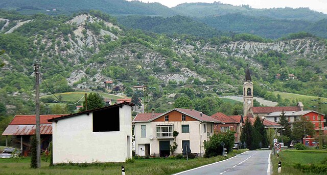
Piana Crixia (Piana Crixia)
.svg)
- Italian comune
 Hiking in Piana Crixia
Piana Crixia, located in the picturesque Piedmont region of Italy, offers a range of hiking opportunities for outdoor enthusiasts. The area is characterized by rolling hills, lush forests, and diverse wildlife, making it an ideal destination for nature lovers.
Hiking Trails
There are several hiking trails in and around Piana Crixia, suitable for various skill levels. Here are a few highlights:
-
Sentiero del Golfo: This trail offers a mix of scenic views and natural beauty. It's a moderate hike that takes you through woods and offers chances to spot local flora and fauna.
-
Cima Crixia: A more challenging hike that leads you to the summit of Cima Crixia. The panoramic views from the top are rewarding for those who make the trek.
-
Historical Routes: Some trails feature historical significance, taking you through old villages and ruins, giving you a glimpse of the region's past.
Flora and Fauna
The area is rich in biodiversity, with various species of trees, wildflowers, and animals. Keep an eye out for deer, foxes, and a variety of bird species while hiking.
Best Time to Hike
The best times for hiking in Piana Crixia are during the late spring (May to June) and early autumn (September to October). During these months, the weather is generally mild, and the landscapes are vibrant with life.
Tips for Hiking in Piana Crixia
- Preparation: Always check the weather forecast and trail conditions before heading out.
- Gear: Wear appropriate hiking boots and carry water, snacks, and a first aid kit.
- Map: It's advisable to have a map or a reliable GPS device, especially if you're exploring more remote trails.
- Local Regulations: Respect nature and local regulations. Stay on marked trails, and leave no trace.
Piana Crixia is a wonderful place for hiking, offering both the beauty of nature and a chance to explore Italy's remarkable landscapes. Enjoy your adventure!
- Country:

- Postal Code: 17058
- Local Dialing Code: 019
- Licence Plate Code: SV
- Coordinates: 44° 29' 7" N, 8° 18' 27" E


- GPS tracks (wikiloc): [Link]
- AboveSeaLevel: 267 м m
- Area: 30.45 sq km
- Population: 807
- Web site: http://www.comune.pianacrixia.sv.it/
- Wikipedia en: wiki(en)
- Wikipedia: wiki(it)
- Wikidata storage: Wikidata: Q271133
- Wikipedia Commons Gallery: [Link]
- Wikipedia Commons Category: [Link]
- Freebase ID: [/m/0gb_18]
- GeoNames ID: Alt: [6536364]
- OSM relation ID: [43233]
- WOEID: [720312]
- Digital Atlas of the Roman Empire ID: [17190]
- ISTAT ID: 009048
- Italian cadastre code: G542
Shares border with regions:
Merana
- municipality in Italy
Hiking in Merana
Merano, located in the South Tyrol region of northern Italy, is a picturesque town known for its Mediterranean climate, stunning landscapes, and access to several hiking trails that suit various skill levels. Here are some highlights and tips for hiking in the Merano area:...
- Country:
- Postal Code: 15010
- Local Dialing Code: 0144
- Licence Plate Code: AL
- Coordinates: 44° 31' 11" N, 8° 17' 57" E
- GPS tracks (wikiloc): [Link]
- AboveSeaLevel: 253 м m
- Area: 9.2 sq km
- Population: 189
- Web site: [Link]
Spigno Monferrato
- municipality in Italy
Hiking in Spigno Monferrato
Spigno Monferrato, located in the Piedmont region of northwestern Italy, is known for its beautiful landscapes, rolling hills, and rich vineyards. Hiking in this area offers a wonderful opportunity to explore both nature and local culture....
- Country:
- Postal Code: 15018
- Local Dialing Code: 0144
- Licence Plate Code: AL
- Coordinates: 44° 32' 39" N, 8° 20' 6" E
- GPS tracks (wikiloc): [Link]
- AboveSeaLevel: 217 м m
- Area: 54.86 sq km
- Population: 1015
- Web site: [Link]
Serole
- Italian comune
Hiking in Serole
Serole, a region known for its scenic beauty and diverse landscapes, offers a variety of hiking opportunities suitable for different skill levels. Here are some key details about hiking in Serole:...
- Country:
- Postal Code: 14050
- Local Dialing Code: 0144
- Licence Plate Code: AT
- Coordinates: 44° 33' 18" N, 8° 15' 39" E
- GPS tracks (wikiloc): [Link]
- AboveSeaLevel: 588 м m
- Area: 12.33 sq km
- Population: 114
- Web site: [Link]

Castelletto Uzzone
- Italian comune
Hiking in Castelletto Uzzone
Castelletto Uzzone is a beautiful area located in the Piedmont region of Italy, known for its stunning landscapes and rich natural diversity. Hiking in this region offers an excellent opportunity to explore both the scenic countryside and the local culture....
- Country:
- Postal Code: 12070
- Local Dialing Code: 0173
- Licence Plate Code: CN
- Coordinates: 44° 30' 0" N, 8° 11' 0" E
- GPS tracks (wikiloc): [Link]
- AboveSeaLevel: 425 м m
- Area: 14.86 sq km
- Population: 309
- Web site: [Link]
Pezzolo Valle Uzzone
- Italian comune
Hiking in Pezzolo Valle Uzzone
Pezzolo Valle Uzzone is a charming small village located in the Piedmont region of Italy, surrounded by picturesque landscapes and rolling hills. Hiking in this area offers a wonderful combination of scenic views, rich natural beauty, and the opportunity to explore local wildlife and flora. Here are some key points regarding hiking in Pezzolo Valle Uzzone:...
- Country:
- Postal Code: 12070
- Local Dialing Code: 0173
- Licence Plate Code: CN
- Coordinates: 44° 32' 0" N, 8° 12' 0" E
- GPS tracks (wikiloc): [Link]
- AboveSeaLevel: 321 м m
- Area: 26.57 sq km
- Population: 353
- Web site: [Link]


Dego
- Italian comune
Hiking in Dego
Dego is a charming town in the Italian region of Liguria, located near the coast and surrounded by scenic hills and valleys. It's not as well-known as some of the coastal towns, which makes it a great spot for hiking enthusiasts looking for peace and natural beauty away from the crowded trails....
- Country:
- Postal Code: 17058
- Local Dialing Code: 019
- Licence Plate Code: SV
- Coordinates: 44° 26' 58" N, 8° 18' 40" E
- GPS tracks (wikiloc): [Link]
- AboveSeaLevel: 317 м m
- Area: 66.82 sq km
- Population: 1985
- Web site: [Link]