Pierremont-sur-Amance (Pierremont-sur-Amance)

- commune in Haute-Marne, France
- Country:

- Postal Code: 52500
- Coordinates: 47° 47' 55" N, 5° 39' 31" E


- GPS tracks (wikiloc): [Link]
- Area: 16.27 sq km
- Population: 147
- Wikipedia en: wiki(en)
- Wikipedia: wiki(fr)
- Wikidata storage: Wikidata: Q1330142
- Wikipedia Commons Category: [Link]
- Freebase ID: [/m/03ntrgx]
- Freebase ID: [/m/03ntrgx]
- GeoNames ID: Alt: [6617004]
- GeoNames ID: Alt: [6617004]
- SIREN number: [215202805]
- SIREN number: [215202805]
- BnF ID: [15263633s]
- BnF ID: [15263633s]
- INSEE municipality code: 52388
- INSEE municipality code: 52388
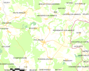
Shares border with regions:


Anrosey
- commune in Haute-Marne, France
- Country:
- Postal Code: 52500
- Coordinates: 47° 50' 10" N, 5° 40' 21" E
- GPS tracks (wikiloc): [Link]
- Area: 11.04 sq km
- Population: 126


Laferté-sur-Amance
- commune in Haute-Marne, France
- Country:
- Postal Code: 52500
- Coordinates: 47° 50' 0" N, 5° 41' 47" E
- GPS tracks (wikiloc): [Link]
- Area: 7.97 sq km
- Population: 108

Fayl-Billot
- commune in Haute-Marne, France
- Country:
- Postal Code: 52500
- Coordinates: 47° 46' 55" N, 5° 36' 3" E
- GPS tracks (wikiloc): [Link]
- AboveSeaLevel: 333 м m
- Area: 42.9 sq km
- Population: 1330


Ouge
- commune in Haute-Saône, France
- Country:
- Postal Code: 70500
- Coordinates: 47° 47' 44" N, 5° 42' 13" E
- GPS tracks (wikiloc): [Link]
- Area: 13.49 sq km
- Population: 107