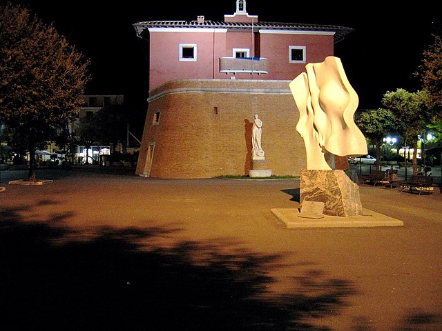
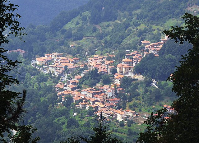
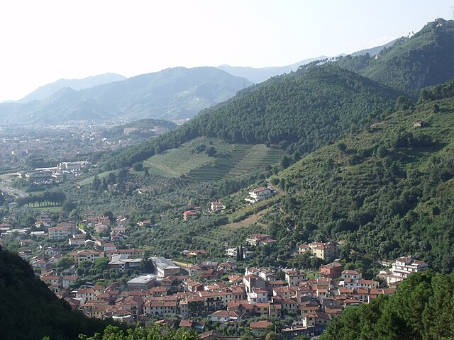
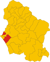
Pietrasanta (Pietrasanta)
- Italian comune
Pietrasanta, located in the Tuscany region of Italy, is well-known for its stunning landscapes and cultural heritage, making it an excellent destination for hiking enthusiasts. Here's an overview of what you can expect when hiking in and around Pietrasanta:
Scenic Trails
-
Apuan Alps: The Apuan Alps are the most notable mountain range nearby, offering a variety of trails that cater to different skill levels. You can explore paths that provide breathtaking views of the coast and surrounding mountains. Some popular spots include the Monte Forato and Monte Sagro for more experienced hikers.
-
Versilian Hills: Trails winding through the Versilian Hills around Pietrasanta offer a mix of woodland and olive groves, with routes that typically present a moderate difficulty. They also provide stunning views of the coastline.
-
Local Nature Parks: Areas like the Cinque Terre National Park are within reasonable reach, featuring hiking paths with incredible vistas of the Mediterranean Sea and the charming villages perched on the cliffs.
Trail Recommendations
- Sentiero del Viandante: A historic path running along the hills that once connected villages, providing a mixture of nature, history, and culture.
- Trail to the Marble Quarries: There are routes leading to the marble quarries of Carrara, which reveal the unique geology and history of the area.
Preparation and Tips
- Weather: Be mindful of the weather conditions, especially in winter or early spring when certain paths may be less accessible. Late spring to early fall is generally ideal for hiking.
- Footwear: Sturdy hiking boots are recommended, as some trails can be rocky or uneven.
- Navigation: While many trails are well-marked, bringing a map or using a GPS device can enhance your adventure.
- Stay Hydrated: Ensure you carry enough water, particularly on hot days, as some areas may have limited access to supplies.
Cultural Aspects
Don’t miss out on the local culture! After a long hike, explore Pietrasanta's vibrant art scene, charming piazzas, and delightful eateries. You might find local artisans showcasing marble sculpture—a nod to the area's rich history.
In summary, hiking in Pietrasanta offers a mix of natural beauty, cultural experiences, and a variety of trails suitable for different skill levels. Whether you are seeking a challenging mountain hike or a leisurely stroll through rolling hills, this region has something for everyone.
- Country:

- Postal Code: 55045
- Local Dialing Code: 0584
- Licence Plate Code: LU
- Coordinates: 43° 56' 43" N, 10° 13' 6" E


- GPS tracks (wikiloc): [Link]
- AboveSeaLevel: 14 м m
- Area: 42 sq km
- Population: 23662
- Web site: http://www.comune.pietrasanta.lu.it
- Wikipedia en: wiki(en)
- Wikipedia: wiki(it)
- Wikidata storage: Wikidata: Q219330
- Wikipedia Commons Gallery: [Link]
- Wikipedia Commons Category: [Link]
- Freebase ID: [/m/073nhx]
- GeoNames ID: Alt: [6539960]
- BnF ID: [125074123]
- VIAF ID: Alt: [122648043]
- OSM relation ID: [42756]
- GND ID: Alt: [4342562-8]
- MusicBrainz area ID: [4ac1c8b5-8ee6-4564-9f7e-e96b44286d78]
- UN/LOCODE: [ITPIE]
- Encyclopædia Britannica Online ID: [place/Pietrasanta]
- ISTAT ID: 046024
- Italian cadastre code: G628
Shares border with regions:


Camaiore
- City and comune within the province of Lucca, Tuscany, central-western Italy. It stretches from the Apuan Alps to the east, to the plains and the coast of Versilia to the west.
Camaiore, located in the Tuscany region of Italy, offers a variety of hiking opportunities that are appealing to both novice and experienced hikers. The area is characterized by beautiful landscapes, charming villages, and a rich tapestry of flora and fauna....
- Country:

- Postal Code: 55041
- Local Dialing Code: 0584
- Licence Plate Code: LU
- Coordinates: 43° 56' 0" N, 10° 18' 0" E


- GPS tracks (wikiloc): [Link]
- AboveSeaLevel: 34 м m
- Area: 85.43 sq km
- Population: 32328
- Web site: [Link]


Forte dei Marmi
- Italian comune
Forte dei Marmi, located in the Tuscany region of Italy, is primarily known for its beautiful beaches and upscale atmosphere. While it's not a typical hiking destination, there are still some wonderful outdoor opportunities nearby that hikers can enjoy....
- Country:

- Postal Code: 55042
- Local Dialing Code: 0584
- Licence Plate Code: LU
- Coordinates: 43° 57' 0" N, 10° 11' 0" E


- GPS tracks (wikiloc): [Link]
- AboveSeaLevel: 2 м m
- Area: 8.88 sq km
- Population: 7335
- Web site: [Link]


Seravezza
- Italian comune
Seravezza, located in the Tuscany region of Italy, offers a variety of hiking opportunities that allow you to explore its stunning natural landscapes, including the Apuan Alps nearby. Here are some highlights and tips for hiking in the Seravezza area:...
- Country:

- Postal Code: 55047
- Local Dialing Code: 0584
- Licence Plate Code: LU
- Coordinates: 44° 0' 0" N, 10° 14' 0" E


- GPS tracks (wikiloc): [Link]
- AboveSeaLevel: 50 м m
- Area: 39.55 sq km
- Population: 12962
- Web site: [Link]


Stazzema
- Italian comune
Stazzema, located in the Apuan Alps of Tuscany, Italy, is a wonderful destination for hiking enthusiasts. This area is known for its stunning landscapes, rich history, and diverse wildlife. Here are some key points to consider when hiking in and around Stazzema:...
- Country:

- Postal Code: 55040; 55060
- Local Dialing Code: 0584
- Licence Plate Code: LU
- Coordinates: 43° 59' 35" N, 10° 18' 38" E


- GPS tracks (wikiloc): [Link]
- AboveSeaLevel: 453 м m
- Area: 82.08 sq km
- Population: 3083
- Web site: [Link]


Montignoso
- A comune (municipality) in the Province of Massa and Carrara in the Italian region Tuscany, located about 90 kilometres (56 mi) northwest of Florence and about 3 kilometres (1.9 mi) southeast of Massa
Montignoso is a charming municipality located in Tuscany, Italy, near the beautiful coastal city of Forte dei Marmi. It offers a variety of hiking opportunities that allow you to explore its natural beauty and rich cultural heritage. Here are some aspects to consider when hiking in Montignoso:...
- Country:

- Postal Code: 54038
- Local Dialing Code: 0585
- Licence Plate Code: MS
- Coordinates: 44° 1' 0" N, 10° 10' 0" E


- GPS tracks (wikiloc): [Link]
- AboveSeaLevel: 130 м m
- Area: 16.74 sq km
- Population: 10311
- Web site: [Link]

