Placy-Montaigu (Placy-Montaigu)

- former commune in Manche, France
- Country:

- Postal Code: 50160
- Coordinates: 49° 1' 49" N, 0° 54' 21" E


- GPS tracks (wikiloc): [Link]
- Area: 8.99 sq km
- Population: 233
- Wikipedia en: wiki(en)
- Wikipedia: wiki(fr)
- Wikidata storage: Wikidata: Q636350
- Wikipedia Commons Category: [Link]
- Freebase ID: [/m/03w9m5g]
- Freebase ID: [/m/03w9m5g]
- GeoNames ID: Alt: [6435532]
- GeoNames ID: Alt: [6435532]
- BnF ID: [15262378p]
- BnF ID: [15262378p]
- INSEE municipality code: 50404
- INSEE municipality code: 50404
Shares border with regions:
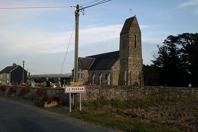

Le Perron
- commune in Manche, France
- Country:
- Postal Code: 50160
- Coordinates: 49° 3' 9" N, 0° 54' 5" E
- GPS tracks (wikiloc): [Link]
- Area: 4.66 sq km
- Population: 215


Guilberville
- former commune in Manche, France
- Country:
- Postal Code: 50160
- Coordinates: 48° 59' 18" N, 0° 56' 51" E
- GPS tracks (wikiloc): [Link]
- Area: 22.15 sq km
- Population: 1209
- Web site: [Link]


Saint-Ouen-des-Besaces
- former commune in Calvados, France
- Country:
- Postal Code: 14350
- Coordinates: 49° 1' 21" N, 0° 50' 52" E
- GPS tracks (wikiloc): [Link]
- Area: 8.48 sq km
- Population: 417

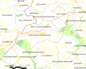
Saint-Martin-des-Besaces
- former commune in Calvados, France
- Country:
- Postal Code: 14350
- Coordinates: 49° 0' 40" N, 0° 50' 46" E
- GPS tracks (wikiloc): [Link]
- Area: 22.03 sq km
- Population: 1176
- Web site: [Link]


Saint-Amand
- former commune in Manche, France
- Country:
- Postal Code: 50160
- Coordinates: 49° 2' 34" N, 0° 57' 50" E
- GPS tracks (wikiloc): [Link]
- Area: 29.2 sq km
- Population: 2351
- Web site: [Link]


Dampierre
- former commune in Calvados, France
- Country:
- Postal Code: 14350
- Coordinates: 49° 2' 36" N, 0° 52' 9" E
- GPS tracks (wikiloc): [Link]
- Area: 5.26 sq km
- Population: 129