Planrupt (Planrupt)

- commune in Haute-Marne, France
- Country:

- Postal Code: 52220
- Coordinates: 48° 30' 30" N, 4° 47' 1" E


- GPS tracks (wikiloc): [Link]
- Area: 8.33 sq km
- Population: 305
- Wikipedia en: wiki(en)
- Wikipedia: wiki(fr)
- Wikidata storage: Wikidata: Q941257
- Wikipedia Commons Category: [Link]
- Freebase ID: [/m/03ntv7l]
- Freebase ID: [/m/03ntv7l]
- GeoNames ID: Alt: [6436295]
- GeoNames ID: Alt: [6436295]
- SIREN number: [215202813]
- SIREN number: [215202813]
- BnF ID: [15263636t]
- BnF ID: [15263636t]
- INSEE municipality code: 52391
- INSEE municipality code: 52391
Shares border with regions:

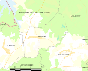
Frampas
- commune in Haute-Marne, France
- Country:
- Postal Code: 52220
- Coordinates: 48° 31' 8" N, 4° 49' 17" E
- GPS tracks (wikiloc): [Link]
- Area: 10.22 sq km
- Population: 164


Éclaron-Braucourt-Sainte-Livière
- commune in Haute-Marne, France
- Country:
- Postal Code: 52290
- Coordinates: 48° 35' 27" N, 4° 51' 58" E
- GPS tracks (wikiloc): [Link]
- AboveSeaLevel: 135 м m
- Area: 54.24 sq km
- Population: 2062
- Web site: [Link]


Giffaumont-Champaubert
- commune in Marne, France
- Country:
- Postal Code: 51290
- Coordinates: 48° 33' 18" N, 4° 45' 11" E
- GPS tracks (wikiloc): [Link]
- AboveSeaLevel: 134 м m
- Area: 28.16 sq km
- Population: 267


Droyes
- former commune in Haute-Marne, France
- Country:
- Postal Code: 52220
- Coordinates: 48° 30' 44" N, 4° 41' 53" E
- GPS tracks (wikiloc): [Link]
- Area: 25.23 sq km
- Population: 431