Pleudihen-sur-Rance (Pleudihen-sur-Rance)

- commune in Côtes-d'Armor, France
- Country:

- Postal Code: 22690
- Coordinates: 48° 31' 0" N, 1° 58' 0" E


- GPS tracks (wikiloc): [Link]
- AboveSeaLevel: 50 м m
- Area: 24.55 sq km
- Population: 2851
- Web site: http://www.pleudihen.fr
- Wikipedia en: wiki(en)
- Wikipedia: wiki(fr)
- Wikidata storage: Wikidata: Q383288
- Wikipedia Commons Category: [Link]
- Freebase ID: [/m/02w3gxg]
- GeoNames ID: Alt: [2986768]
- SIREN number: [212201974]
- BnF ID: [15251196m]
- INSEE municipality code: 22197
Shares border with regions:


La Vicomté-sur-Rance
- commune in Côtes-d'Armor, France
- Country:
- Postal Code: 22690
- Coordinates: 48° 29' 19" N, 1° 58' 56" E
- GPS tracks (wikiloc): [Link]
- Area: 4.57 sq km
- Population: 1046

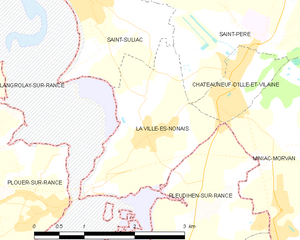
La Ville-ès-Nonais
- commune in Ille-et-Vilaine, France
- Country:
- Postal Code: 35430
- Coordinates: 48° 32' 52" N, 1° 57' 12" E
- GPS tracks (wikiloc): [Link]
- Area: 4.34 sq km
- Population: 1166


Saint-Hélen
- commune in Côtes-d'Armor, France
- Country:
- Postal Code: 22100
- Coordinates: 48° 28' 16" N, 1° 57' 32" E
- GPS tracks (wikiloc): [Link]
- Area: 17.02 sq km
- Population: 1439


Saint-Pierre-de-Plesguen
- former commune in Ille-et-Vilaine, France
- Country:
- Postal Code: 35720
- Coordinates: 48° 26' 50" N, 1° 54' 48" E
- GPS tracks (wikiloc): [Link]
- AboveSeaLevel: 82 м m
- Area: 29.49 sq km
- Population: 2846
- Web site: [Link]


Miniac-Morvan
- commune in Ille-et-Vilaine, France
- Country:
- Postal Code: 35540
- Coordinates: 48° 30' 53" N, 1° 54' 0" E
- GPS tracks (wikiloc): [Link]
- Area: 31.03 sq km
- Population: 3881
- Web site: [Link]