Saint-Pierre-de-Plesguen (Saint-Pierre-de-Plesguen)

- former commune in Ille-et-Vilaine, France
- Country:

- Postal Code: 35720
- Coordinates: 48° 26' 50" N, 1° 54' 48" E


- GPS tracks (wikiloc): [Link]
- AboveSeaLevel: 82 м m
- Area: 29.49 sq km
- Population: 2846
- Web site: http://www.saintpierredeplesguen.fr
- Wikipedia en: wiki(en)
- Wikipedia: wiki(fr)
- Wikidata storage: Wikidata: Q658532
- Wikipedia Commons Category: [Link]
- Freebase ID: [/m/06zxd9]
- Freebase ID: [/m/06zxd9]
- GeoNames ID: Alt: [2977497]
- GeoNames ID: Alt: [2977497]
- SIREN number: [213503089]
- SIREN number: [213503089]
- BnF ID: [152572501]
- BnF ID: [152572501]
- VIAF ID: Alt: [154922974]
- VIAF ID: Alt: [154922974]
- OSM relation ID: [146022]
- OSM relation ID: [146022]
- Library of Congress authority ID: Alt: [n94017661]
- Library of Congress authority ID: Alt: [n94017661]
- PACTOLS thesaurus ID: [pcrtTe8Kx8faeh]
- PACTOLS thesaurus ID: [pcrtTe8Kx8faeh]
- INSEE municipality code: 35308
- INSEE municipality code: 35308
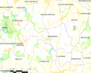
Shares border with regions:


Tressé
- former commune in Ille-et-Vilaine, France
- Country:
- Postal Code: 35720
- Coordinates: 48° 28' 52" N, 1° 53' 6" E
- GPS tracks (wikiloc): [Link]
- Area: 5.24 sq km
- Population: 381


Plesder
- commune in Ille-et-Vilaine, France
- Country:
- Postal Code: 35720
- Coordinates: 48° 24' 49" N, 1° 55' 21" E
- GPS tracks (wikiloc): [Link]
- Area: 11.03 sq km
- Population: 783


Meillac
- commune in Ille-et-Vilaine, France
- Country:
- Postal Code: 35270
- Coordinates: 48° 24' 44" N, 1° 48' 48" E
- GPS tracks (wikiloc): [Link]
- Area: 32.21 sq km
- Population: 1806
- Web site: [Link]

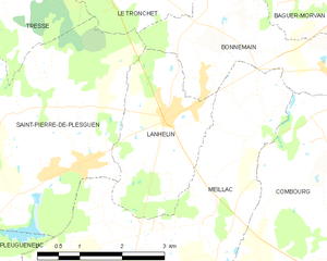
Lanhélin
- former commune in Ille-et-Vilaine, France
- Country:
- Postal Code: 35720
- Coordinates: 48° 27' 31" N, 1° 49' 41" E
- GPS tracks (wikiloc): [Link]
- Area: 6.43 sq km
- Population: 1014
- Web site: [Link]
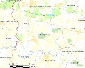
Pleugueneuc
- commune in Ille-et-Vilaine, France
- Country:
- Postal Code: 35720
- Coordinates: 48° 23' 47" N, 1° 54' 13" E
- GPS tracks (wikiloc): [Link]
- Area: 24.52 sq km
- Population: 1838
- Web site: [Link]


Pleudihen-sur-Rance
- commune in Côtes-d'Armor, France
- Country:
- Postal Code: 22690
- Coordinates: 48° 31' 0" N, 1° 58' 0" E
- GPS tracks (wikiloc): [Link]
- AboveSeaLevel: 50 м m
- Area: 24.55 sq km
- Population: 2851
- Web site: [Link]


Saint-Hélen
- commune in Côtes-d'Armor, France
- Country:
- Postal Code: 22100
- Coordinates: 48° 28' 16" N, 1° 57' 32" E
- GPS tracks (wikiloc): [Link]
- Area: 17.02 sq km
- Population: 1439


Le Tronchet
- commune in Ille-et-Vilaine, France
- Country:
- Postal Code: 35540
- Coordinates: 48° 29' 10" N, 1° 50' 11" E
- GPS tracks (wikiloc): [Link]
- Area: 11.35 sq km
- Population: 1156
- Web site: [Link]


Miniac-Morvan
- commune in Ille-et-Vilaine, France
- Country:
- Postal Code: 35540
- Coordinates: 48° 30' 53" N, 1° 54' 0" E
- GPS tracks (wikiloc): [Link]
- Area: 31.03 sq km
- Population: 3881
- Web site: [Link]
Bonnemain
- commune in Ille-et-Vilaine, France
- Country:
- Postal Code: 35270
- Coordinates: 48° 27' 59" N, 1° 46' 4" E
- GPS tracks (wikiloc): [Link]
- Area: 23.77 sq km
- Population: 1509
- Web site: [Link]