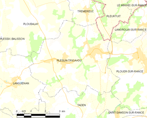
Plouër-sur-Rance (Plouër-sur-Rance)

- commune in Côtes-d'Armor, France
- Country:

- Postal Code: 22490
- Coordinates: 48° 31' 40" N, 2° 0' 12" E


- GPS tracks (wikiloc): [Link]
- Area: 19.89 sq km
- Population: 3484
- Web site: http://www.rance-fremur.com/plouer/index.html
- Wikipedia en: wiki(en)
- Wikipedia: wiki(fr)
- Wikidata storage: Wikidata: Q665309
- Wikipedia Commons Category: [Link]
- Freebase ID: [/m/03hln10]
- GeoNames ID: Alt: [2986683]
- SIREN number: [212202139]
- BnF ID: [152512121]
- VIAF ID: Alt: [157196411]
- archINFORM location ID: [7257]
- Library of Congress authority ID: Alt: [nr97005477]
- PACTOLS thesaurus ID: [pcrtIJAXKPy8OR]
- SUDOC authorities ID: [067092950]
- INSEE municipality code: 22213
Shares border with regions:


Saint-Samson-sur-Rance
- commune in Côtes-d'Armor, France
- Country:
- Postal Code: 22100
- Coordinates: 48° 29' 29" N, 2° 1' 51" E
- GPS tracks (wikiloc): [Link]
- Area: 6.27 sq km
- Population: 1567
- Web site: [Link]


Langrolay-sur-Rance
- commune in Côtes-d'Armor, France
- Country:
- Postal Code: 22490
- Coordinates: 48° 33' 15" N, 2° 0' 9" E
- GPS tracks (wikiloc): [Link]
- AboveSeaLevel: 63 м m
- Area: 5.28 sq km
- Population: 909
- Web site: [Link]


Taden
- commune in Côtes-d'Armor, France
- Country:
- Postal Code: 22100
- Coordinates: 48° 28' 32" N, 2° 1' 4" E
- GPS tracks (wikiloc): [Link]
- Area: 20.13 sq km
- Population: 2349
- Web site: [Link]

Pleslin-Trigavou
- commune in Côtes-d'Armor, France
- Country:
- Postal Code: 22490
- Coordinates: 48° 32' 0" N, 2° 4' 0" E
- GPS tracks (wikiloc): [Link]
- AboveSeaLevel: 50 м m
- Area: 21.8 sq km
- Population: 3524
- Web site: [Link]


Pleurtuit
- commune in Ille-et-Vilaine, France
- Country:
- Postal Code: 35730
- Coordinates: 48° 34' 43" N, 2° 3' 29" E
- GPS tracks (wikiloc): [Link]
- AboveSeaLevel: 83 м m
- Area: 29.67 sq km
- Population: 6628
- Web site: [Link]