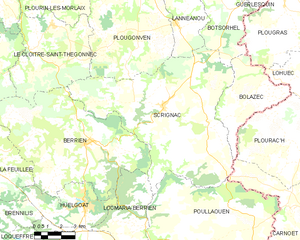
Plougonven (Plougonven)
- commune in Finistère, France
- Country:

- Postal Code: 29640
- Coordinates: 48° 31' 15" N, 3° 42' 47" E


- GPS tracks (wikiloc): [Link]
- Area: 69.32 sq km
- Population: 3439
- Web site: http://www.plougonven.fr
- Wikipedia en: wiki(en)
- Wikipedia: wiki(fr)
- Wikidata storage: Wikidata: Q634057
- Wikipedia Commons Gallery: [Link]
- Wikipedia Commons Category: [Link]
- Freebase ID: [/m/03gyqb1]
- GeoNames ID: Alt: [6431002]
- SIREN number: [212901912]
- BnF ID: [15254537x]
- VIAF ID: Alt: [136168091]
- GND ID: Alt: [4733787-4]
- Library of Congress authority ID: Alt: [n89615694]
- TGN ID: [4008722]
- INSEE municipality code: 29191
- GNS Unique Feature ID: -1458771
Shares border with regions:


Morlaix
- commune in Finistère, France
- Country:

- Postal Code: 29600
- Coordinates: 48° 34' 39" N, 3° 49' 40" E


- GPS tracks (wikiloc): [Link]
- AboveSeaLevel: 61 м m
- Area: 24.82 sq km
- Population: 14830
- Web site: [Link]


Plouigneau
- commune in Finistère, France
- Country:

- Postal Code: 29650; 29610
- Coordinates: 48° 34' 3" N, 3° 42' 5" E


- GPS tracks (wikiloc): [Link]
- Area: 63.48 sq km
- Population: 4901
- Web site: [Link]


Scrignac
- commune in Finistère, France
- Country:

- Postal Code: 29640
- Coordinates: 48° 26' 1" N, 3° 40' 42" E


- GPS tracks (wikiloc): [Link]
- Area: 70.94 sq km
- Population: 801


Plourin-lès-Morlaix
- commune in Finistère, France
- Country:

- Postal Code: 29600
- Coordinates: 48° 32' 6" N, 3° 47' 23" E


- GPS tracks (wikiloc): [Link]
- Area: 40.92 sq km
- Population: 4368
- Web site: [Link]


Lannéanou
- commune in Finistère, France
- Country:

- Postal Code: 29640
- Coordinates: 48° 29' 21" N, 3° 40' 19" E


- GPS tracks (wikiloc): [Link]
- Area: 16.17 sq km
- Population: 381


Le Cloître-Saint-Thégonnec
- commune in Finistère, France
- Country:

- Postal Code: 29410
- Coordinates: 48° 28' 48" N, 3° 47' 41" E


- GPS tracks (wikiloc): [Link]
- Area: 28.48 sq km
- Population: 663
