Pompertuzat (Pompertuzat)

- commune in Haute-Garonne, France
- Country:

- Postal Code: 31450
- Coordinates: 43° 29' 26" N, 1° 31' 1" E


- GPS tracks (wikiloc): [Link]
- Area: 5.44 sq km
- Population: 2200
- Web site: http://www.pompertuzat.fr
- Wikipedia en: wiki(en)
- Wikipedia: wiki(fr)
- Wikidata storage: Wikidata: Q1428645
- Wikipedia Commons Category: [Link]
- Freebase ID: [/m/03nt5c8]
- Freebase ID: [/m/03nt5c8]
- GeoNames ID: Alt: [6431757]
- GeoNames ID: Alt: [6431757]
- SIREN number: [213104292]
- SIREN number: [213104292]
- BnF ID: [15255424j]
- BnF ID: [15255424j]
- INSEE municipality code: 31429
- INSEE municipality code: 31429
Shares border with regions:


Castanet-Tolosan
- commune in Haute-Garonne, France
- Country:
- Postal Code: 31320
- Coordinates: 43° 30' 56" N, 1° 29' 53" E
- GPS tracks (wikiloc): [Link]
- Area: 8.22 sq km
- Population: 12833
- Web site: [Link]


Deyme
- commune in Haute-Garonne, France
- Country:
- Postal Code: 31450
- Coordinates: 43° 28' 46" N, 1° 31' 37" E
- GPS tracks (wikiloc): [Link]
- Area: 7.05 sq km
- Population: 1046
- Web site: [Link]

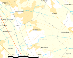
Belberaud
- commune in Haute-Garonne, France
- Country:
- Postal Code: 31450
- Coordinates: 43° 30' 28" N, 1° 34' 10" E
- GPS tracks (wikiloc): [Link]
- Area: 7.47 sq km
- Population: 1385
- Web site: [Link]


Corronsac
- commune in Haute-Garonne, France
- Country:
- Postal Code: 31450
- Coordinates: 43° 28' 24" N, 1° 29' 53" E
- GPS tracks (wikiloc): [Link]
- Area: 6.34 sq km
- Population: 781
- Web site: [Link]


Escalquens
- commune in Haute-Garonne, France
- Country:
- Postal Code: 31750
- Coordinates: 43° 31' 4" N, 1° 33' 39" E
- GPS tracks (wikiloc): [Link]
- Area: 8.42 sq km
- Population: 6415
- Web site: [Link]


Rebigue
- commune in Haute-Garonne, France
- Country:
- Postal Code: 31320
- Coordinates: 43° 29' 20" N, 1° 28' 52" E
- GPS tracks (wikiloc): [Link]
- Area: 5.16 sq km
- Population: 499
- Web site: [Link]


Péchabou
- commune in Haute-Garonne, France
- Country:
- Postal Code: 31320
- Coordinates: 43° 30' 4" N, 1° 30' 30" E
- GPS tracks (wikiloc): [Link]
- Area: 3.57 sq km
- Population: 2140
- Web site: [Link]