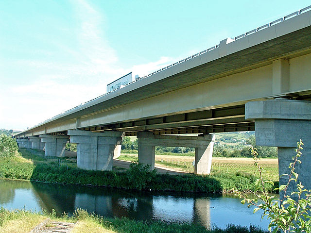
Pont-de-l'Arche (Pont-de-l'Arche)
- commune in Eure, France
- Country:

- Postal Code: 27340
- Coordinates: 49° 18' 10" N, 1° 9' 14" E


- GPS tracks (wikiloc): [Link]
- Area: 9.35 sq km
- Population: 4166
- Web site: http://www.pontdelarche.fr/
- Wikipedia en: wiki(en)
- Wikipedia: wiki(fr)
- Wikidata storage: Wikidata: Q202561
- Wikipedia Commons Category: [Link]
- Freebase ID: [/m/0cqcqd]
- Freebase ID: [/m/0cqcqd]
- SIREN number: [212704696]
- SIREN number: [212704696]
- BnF ID: [152537048]
- BnF ID: [152537048]
- VIAF ID: Alt: [158193044]
- VIAF ID: Alt: [158193044]
- Library of Congress authority ID: Alt: [nb2007015491]
- Library of Congress authority ID: Alt: [nb2007015491]
- PACTOLS thesaurus ID: [pcrteHi1qpSOIH]
- PACTOLS thesaurus ID: [pcrteHi1qpSOIH]
- MusicBrainz area ID: [5846144f-2218-40ab-81d3-50e2aaae83a9]
- MusicBrainz area ID: [5846144f-2218-40ab-81d3-50e2aaae83a9]
- WOEID: [617343]
- WOEID: [617343]
- SUDOC authorities ID: [034177493]
- SUDOC authorities ID: [034177493]
- INSEE municipality code: 27469
- INSEE municipality code: 27469
Shares border with regions:


Criquebeuf-sur-Seine
- commune in Eure, France
- Country:

- Postal Code: 27340
- Coordinates: 49° 18' 21" N, 1° 5' 51" E


- GPS tracks (wikiloc): [Link]
- Area: 14.74 sq km
- Population: 1375


Alizay
- commune in Eure, France
- Country:

- Postal Code: 27460
- Coordinates: 49° 19' 15" N, 1° 10' 32" E


- GPS tracks (wikiloc): [Link]
- Area: 8.62 sq km
- Population: 1476
Igoville
- commune in Eure, France
- Country:

- Postal Code: 27460
- Coordinates: 49° 19' 10" N, 1° 8' 58" E


- GPS tracks (wikiloc): [Link]
- Area: 5.61 sq km
- Population: 1720
- Web site: [Link]


Léry
- commune in Eure, France
- Country:

- Postal Code: 27690
- Coordinates: 49° 17' 7" N, 1° 12' 24" E


- GPS tracks (wikiloc): [Link]
- Area: 14.51 sq km
- Population: 2049
- Web site: [Link]
Sotteville-sous-le-Val
- commune in Seine-Maritime, France
- Country:

- Postal Code: 76410
- Coordinates: 49° 19' 14" N, 1° 7' 30" E


- GPS tracks (wikiloc): [Link]
- Area: 5.27 sq km
- Population: 801
Les Damps
- commune in Eure, France
- Country:

- Postal Code: 27340
- Coordinates: 49° 18' 5" N, 1° 10' 20" E


- GPS tracks (wikiloc): [Link]
- Area: 4.74 sq km
- Population: 1332
