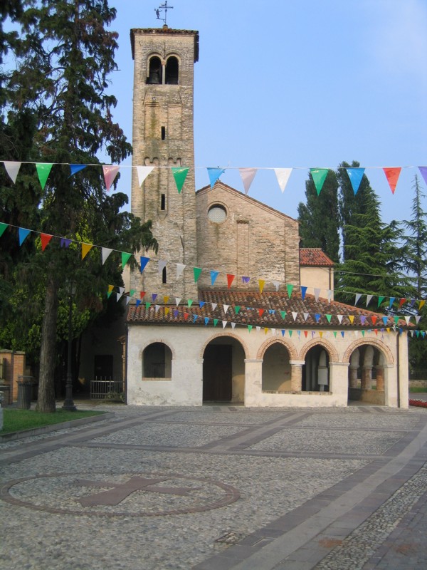
Ponte di Piave (Ponte di Piave)
.svg)
- Italian comune
 Hiking in Ponte di Piave
Ponte di Piave, located in the Veneto region of Italy, offers a lovely setting for hiking enthusiasts. While the town itself is small, it provides a wonderful base for exploring the surrounding countryside, which is characterized by picturesque vineyards, rolling hills, and rivers.
Hiking Trails and Areas
-
River Piave: The nearby banks of the Piave River offer scenic walking paths. The river is known for its beauty, and you'll find trails that provide opportunities for leisurely walks where you can enjoy nature and possibly spot local wildlife.
-
Vineyard Trails: The surrounding landscape is dotted with vineyards, particularly famous for Prosecco. Hiking through these areas can be quite enjoyable, allowing you to appreciate the regional agriculture and possibly even take part in wine tours or tastings after a hike.
-
Montello Hill: Just a short drive away, Montello offers hiking trails with varying levels of difficulty. The hill is known for its natural beauty and historical significance, with paths that lead through forests and provide fantastic views of the surrounding plains and mountains.
-
Treviso: Not far from Ponte di Piave is the city of Treviso, which offers hiking opportunities along its historic canals and green areas. You can combine cultural exploration with outdoor activity.
Best Times to Hike
- Spring (March to June): Ideal for moderate temperatures and blooming flowers.
- Fall (September to November): Offers beautiful autumn colors, making hikes particularly scenic as the foliage changes.
Tips for Hiking in the Area
- Wear Appropriate Gear: Depending on the trails you choose, ensure you have sturdy hiking boots and weather-appropriate clothing.
- Stay Hydrated: Carry enough water, especially during warmer months.
- Respect Nature: Stay on marked trails and be mindful of the local flora and fauna.
- Local Maps: It's a good idea to have a detailed map or a hiking app to navigate the trails easily.
- Look for Guided Hikes: If you're unsure about the trails or prefer a more structured experience, look for local hiking clubs or guides that offer organized hikes in the area.
Ponte di Piave may be small, but with its beautiful surrounding landscape and access to various hiking trails, it's a great destination for outdoor enthusiasts looking to combine nature with a bit of Italian culture and charm. Enjoy your hiking adventure!
- Country:

- Postal Code: 31047
- Local Dialing Code: 0422
- Licence Plate Code: TV
- Coordinates: 45° 43' 0" N, 12° 28' 0" E


- GPS tracks (wikiloc): [Link]
- AboveSeaLevel: 12 м m
- Area: 32.44 sq km
- Population: 8352
- Web site: http://www.pontedipiave.com/
- Wikipedia en: wiki(en)
- Wikipedia: wiki(it)
- Wikidata storage: Wikidata: Q46503
- Wikipedia Commons Category: [Link]
- Freebase ID: [/m/0gk34b]
- GeoNames ID: Alt: [6536283]
- VIAF ID: Alt: [157286152]
- OSM relation ID: [45877]
- archINFORM location ID: [6376]
- MusicBrainz area ID: [a8067cd3-98c4-442a-af8e-3601f859c23f]
- UN/LOCODE: [ITPPV]
- ISTAT ID: 026058
- Italian cadastre code: G846
Shares border with regions:
Chiarano
- Italian comune
Hiking in Chiarano
Chiarano, located in the province of Treviso in Italy, may not be as widely recognized as some other hiking destinations, but it offers some opportunities for outdoor enthusiasts to explore the beautiful landscape of the Veneto region....
- Country:
- Postal Code: 31040
- Local Dialing Code: 0422
- Licence Plate Code: TV
- Coordinates: 45° 43' 47" N, 12° 34' 18" E
- GPS tracks (wikiloc): [Link]
- AboveSeaLevel: 6 м m
- Area: 19.92 sq km
- Population: 3723
- Web site: [Link]
Breda di Piave
- Italian comune
Hiking in Breda di Piave
Breda di Piave, a town located in the Veneto region of northeastern Italy, offers a charming environment for hiking enthusiasts. While it may not be as renowned for its dramatic landscapes as some other Italian destinations, it features a variety of scenic routes and opportunities for exploration in the surrounding countryside....
- Country:
- Postal Code: 31030
- Local Dialing Code: 0422
- Licence Plate Code: TV
- Coordinates: 45° 43' 21" N, 12° 19' 51" E
- GPS tracks (wikiloc): [Link]
- AboveSeaLevel: 23 м m
- Area: 25.76 sq km
- Population: 7835
- Web site: [Link]
Maserada sul Piave
- Italian comune
Hiking in Maserada sul Piave
Maserada sul Piave, located in the Veneto region of Italy, is a charming area that offers various hiking opportunities. Nestled near the Piave River and surrounded by beautiful landscapes, it provides a scenic backdrop for outdoor enthusiasts....
- Country:
- Postal Code: 31052
- Local Dialing Code: 0422
- Licence Plate Code: TV
- Coordinates: 45° 45' 0" N, 12° 19' 0" E
- GPS tracks (wikiloc): [Link]
- AboveSeaLevel: 34 м m
- Area: 28.77 sq km
- Population: 9361
- Web site: [Link]

Ormelle
- Italian comune
Hiking in Ormelle
Ormelle is a beautiful area located in the Veneto region of Italy, known for its picturesque landscapes and charming countryside. While it may not be as famous for hiking as some other parts of Italy, it offers some nice opportunities for those looking to explore the natural beauty and serene environments of the region....
- Country:
- Postal Code: 31024
- Local Dialing Code: 0422
- Licence Plate Code: TV
- Coordinates: 45° 46' 49" N, 12° 25' 11" E
- GPS tracks (wikiloc): [Link]
- AboveSeaLevel: 50 м m
- Area: 18.83 sq km
- Population: 4486
- Web site: [Link]
San Biagio di Callalta
- Italian comune
Hiking in San Biagio di Callalta
San Biagio di Callalta is located in the Treviso province of the Veneto region in Italy. While it may not be as famous for hiking as some of the larger national parks or mountainous areas, there are several opportunities for outdoor enthusiasts to enjoy the natural beauty of the area. Here are a few highlights and suggestions for hiking in and around San Biagio di Callalta:...
- Country:
- Postal Code: 31042; 31048
- Local Dialing Code: 0422
- Licence Plate Code: TV
- Coordinates: 45° 41' 0" N, 12° 23' 0" E
- GPS tracks (wikiloc): [Link]
- AboveSeaLevel: 10 м m
- Area: 48.51 sq km
- Population: 12996
- Web site: [Link]


Salgareda
- Italian comune
Hiking in Salgareda
Salgareda, located in the Veneto region of Italy, offers a peaceful and scenic environment suitable for hiking enthusiasts. While it may not be as widely known as other Italian hiking destinations, the surrounding countryside provides several opportunities to explore nature, experience local flora and fauna, and enjoy breathtaking views....
- Country:
- Postal Code: 31040
- Local Dialing Code: 0422
- Licence Plate Code: TV
- Coordinates: 45° 42' 22" N, 12° 29' 29" E
- GPS tracks (wikiloc): [Link]
- AboveSeaLevel: 8 м m
- Area: 27.55 sq km
- Population: 6681
- Web site: [Link]


Oderzo
- Italian comune
Hiking in Oderzo
Oderzo, located in the Veneto region of Italy, is not as widely recognized for hiking as some of the surrounding areas, but it still offers opportunities for outdoor enthusiasts to explore its scenic landscapes and historical sites. Here are a few highlights for hiking and outdoor activities in and around Oderzo:...
- Country:
- Postal Code: 31046
- Local Dialing Code: 0422
- Licence Plate Code: TV
- Coordinates: 45° 46' 51" N, 12° 29' 34" E
- GPS tracks (wikiloc): [Link]
- AboveSeaLevel: 14 м m
- Area: 42.35 sq km
- Population: 20466
- Web site: [Link]