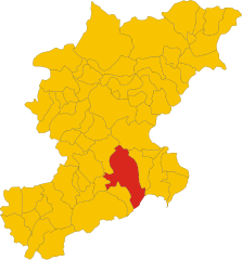
Ponte nelle Alpi (Ponte nelle Alpi)
.svg)
- Italian comune
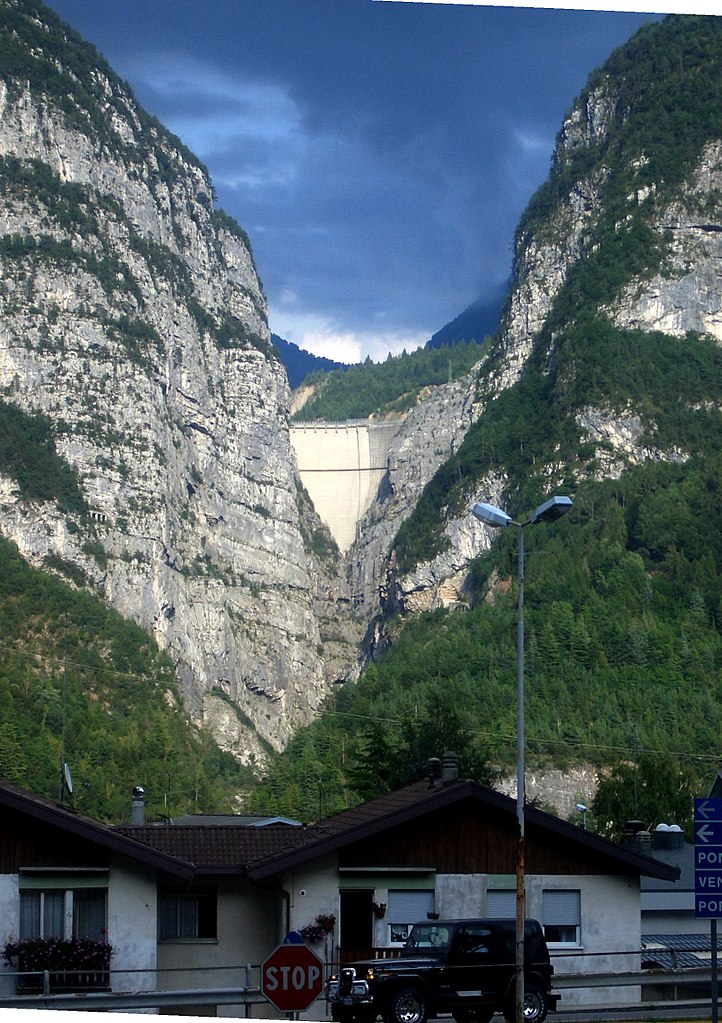
 Hiking in Ponte nelle Alpi
Ponte nelle Alpi, located in the Dolomites region of northern Italy, offers a fantastic environment for hiking enthusiasts. With its breathtaking landscapes, diverse trails, and proximity to nature, it is an ideal destination for both beginner and experienced hikers.
Trails and Terrain:
- Varied Difficulty Levels: The hiking trails in Ponte nelle Alpi range from easy strolls to more challenging treks, making them accessible for all skill levels.
- Themed Trails: Some trails are themed or guided, focusing on local flora and fauna, historical sites, or geological features of the Dolomites.
- Scenic Views: Many trails offer stunning views of the surrounding mountains, valleys, and lakes, including the famous Lake Cadore nearby.
Notable Hikes:
- Sentiero del Cansiglio: A renowned trail that provides a glimpse into the rich nature and wildlife of the region. It’s a moderate trail well-marked and suitable for various skill levels.
- Cerro Lago delle Buse: A hiking route leading to a picturesque lake, ideal for a day trip. It’s perfect for picnic breaks amid beautiful landscapes.
Other Attractions:
- Natural Parks: The area is close to several natural parks, such as the Belluno Dolomites National Park, which boasts a range of hiking routes and protected wildlife.
- Cultural Sites: Along your hikes, you may also encounter historical landmarks, old churches, and traditional alpine villages.
Best Time to Visit:
- Spring (April to June): Ideal for wildflower viewings and milder weather.
- Autumn (September to October): Known for the stunning fall colors in the forested areas.
Preparation Tips:
- Proper Gear: Dress in layers, wear sturdy hiking boots, and bring necessary gear like trekking poles, water, and snacks.
- Weather Awareness: Check the weather forecast before heading out as conditions can change rapidly in the mountains.
- Maps and Guides: It’s advisable to have a physical map or a reliable GPS device since some trails may not be well signposted.
Local Services:
- Guides and Tours: Consider hiring a local guide for specialized tours or if you're unfamiliar with the area.
- Accommodation: There are various accommodation options ranging from hotels to mountain huts, allowing for multi-day hikes in the region.
Conclusion:
Hiking in Ponte nelle Alpi can be a rewarding experience with its stunning natural beauty and rich cultural heritage. Whether you're looking for a leisurely walk or a rigorous hike, the area has something to offer for everyone. Remember to respect the environment and leave no trace during your outdoor adventures!
- Country:

- Postal Code: 32014
- Local Dialing Code: 0437
- Licence Plate Code: BL
- Coordinates: 46° 10' 59" N, 12° 16' 45" E


- GPS tracks (wikiloc): [Link]
- AboveSeaLevel: 397 м m
- Area: 58.14 sq km
- Population: 8250
- Web site: http://www.comune.pontebba.ud.it
- Wikipedia en: wiki(en)
- Wikipedia: wiki(it)
- Wikidata storage: Wikidata: Q41013
- Wikipedia Commons Category: [Link]
- Freebase ID: [/m/0gk21q]
- GeoNames ID: Alt: [6536383]
- VIAF ID: Alt: [127622639]
- OSM relation ID: [46895]
- Library of Congress authority ID: Alt: [n98007631]
- UN/LOCODE: [ITZQP]
- Digital Atlas of the Roman Empire ID: [26544]
- Pleiades ID: [187520]
- ISTAT ID: 025040
- Italian cadastre code: B662
Shares border with regions:

Longarone
- Italian comune
Hiking in Longarone
Longarone, located in the Dolomite region of northern Italy, offers spectacular hiking opportunities amidst stunning landscapes characterized by dramatic mountains, lush valleys, and flowing rivers. Here are some highlights and tips for hiking in and around Longarone:...
- Country:
- Postal Code: 32013
- Local Dialing Code: 0437
- Licence Plate Code: BL
- Coordinates: 46° 16' 0" N, 12° 18' 0" E
- GPS tracks (wikiloc): [Link]
- AboveSeaLevel: 473 м m
- Area: 122.36 sq km
- Population: 5254
- Web site: [Link]


Soverzene
- Italian comune
Hiking in Soverzene
Soverzene, located in the Friuli Venezia Giulia region of Italy, offers stunning landscapes and a variety of hiking opportunities. Situated in the foothills of the Julian Alps, this area is known for its beautiful natural scenery, including dense forests, pristine rivers, and panoramic views of the surrounding mountains....
- Country:
- Postal Code: 32010
- Local Dialing Code: 0437
- Licence Plate Code: BL
- Coordinates: 46° 12' 15" N, 12° 18' 11" E
- GPS tracks (wikiloc): [Link]
- AboveSeaLevel: 424 м m
- Area: 14.79 sq km
- Population: 380
- Web site: [Link]

Belluno
- Italian comune
Hiking in Belluno
Belluno, located in the northeastern Italian Alps, is a fantastic destination for hiking enthusiasts. This province is known for its breathtaking landscapes, diverse ecosystems, and a range of trails suitable for all levels of hikers. Here are some key highlights about hiking in Belluno:...
- Country:
- Postal Code: 32100
- Local Dialing Code: 0437
- Licence Plate Code: BL
- Coordinates: 46° 8' 27" N, 12° 12' 56" E
- GPS tracks (wikiloc): [Link]
- AboveSeaLevel: 390 м m
- Area: 147.22 sq km
- Population: 35710
- Web site: [Link]