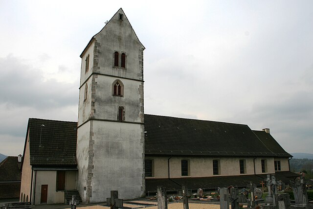
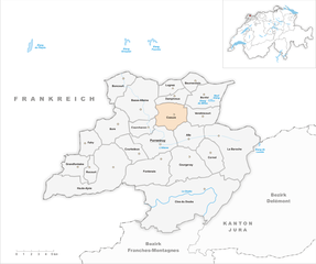
Porrentruy (Pruntrut)

- municipality in Switzerland
 Hiking in Porrentruy
Porrentruy, located in the Ajoie region of Switzerland, is a charming town surrounded by beautiful natural landscapes, making it an excellent destination for hiking enthusiasts. Here’s what you need to know about hiking in and around Porrentruy:
Hiking Trails
-
Local Trails: There are several marked hiking trails in the vicinity of Porrentruy. The region offers a range of paths that vary in difficulty and length, making it suitable for both beginners and experienced hikers.
-
Gorges de Porrentruy: This area features stunning landscapes with rocky cliffs and scenic views. The trail through the gorges allows hikers to experience the natural beauty of the region up close.
-
Les Franches-Montagnes: Just a short distance from Porrentruy, this plateau offers diverse trails through forests, open meadows, and rolling hills. The panoramic views of the Jura mountains are a highlight.
-
La Douce River: Along the river, there are flat, easy trails perfect for a leisurely hike or a family outing. The area is rich in flora and fauna, providing excellent opportunities for nature observation.
Tips for Hiking in Porrentruy
- Trail Maps: It's a good idea to pick up trail maps from local tourist information centers. These will help you navigate the area and discover different routes.
- Weather: Switzerland's weather can change rapidly, so it's essential to check the forecast before heading out and dress in layers.
- Footwear: Wear sturdy hiking shoes, as some trails can be rocky or uneven.
- Hydration and Snacks: Carry enough water and snacks, especially if you plan on spending several hours on the trail.
- Respect Nature: Follow Leave No Trace principles by staying on marked trails, packing out your trash, and respecting wildlife.
Additional Activities
Besides hiking, Porrentruy offers various outdoor activities, including cycling, birdwatching, and exploring historical sites such as the Porrentruy Castle. You can also experience local culture by visiting farms or enjoying regional cuisine in nearby restaurants.
Overall, hiking in Porrentruy is a wonderful way to enjoy the natural beauty of Switzerland while engaging in physical activity. Whether you're looking for a quick day hike or a more extended trekking adventure, the area has plenty to offer.
- Country:

- Postal Code: 2900
- Local Dialing Code: 032
- Licence Plate Code: JU
- Coordinates: 47° 25' 0" N, 7° 5' 0" E


- GPS tracks (wikiloc): [Link]
- AboveSeaLevel: 423 м m
- Area: 14.8 sq km
- Population: 6809
- Web site: http://www.porrentruy.ch
- Wikipedia en: wiki(en)
- Wikipedia: wiki(de)
- Wikidata storage: Wikidata: Q68256
- Wikipedia Commons Category: [Link]
- Freebase ID: [/m/04k6g3]
- GeoNames ID: Alt: [7286819]
- BnF ID: [11957283n]
- VIAF ID: Alt: [246486575]
- OSM relation ID: [1685622]
- GND ID: Alt: [4103223-8]
- archINFORM location ID: [18199]
- PACTOLS thesaurus ID: [pcrtxl24eyjmih]
- MusicBrainz area ID: [2c557956-62a7-4178-b7cd-8d6a685807c0]
- Quora topic ID: [Porrentruy-Switzerland]
- HDS ID: [3003]
- Swiss municipality code: [6800]
Shares border with regions:

Alle
- municipality in the canton of Jura, Switzerland
Hiking in Alle
Hiking in Alle, Switzerland is a wonderful experience thanks to its stunning natural beauty and the diverse landscapes of the Jura Mountains. Here are some highlights and tips for hiking in this area:...
- Country:
- Local Dialing Code: 032
- Licence Plate Code: JU
- Coordinates: 47° 25' 33" N, 7° 7' 45" E
- GPS tracks (wikiloc): [Link]
- AboveSeaLevel: 469 м m
- Area: 10.66 sq km
- Population: 1832
- Web site: [Link]


Courgenay
- municipality in the canton of Jura, Switzerland
Hiking in Courgenay
Courgenay is a charming village located in the Jura region of Switzerland, known for its picturesque landscapes and outdoor activities. Hiking in and around Courgenay offers a wonderful opportunity to experience the natural beauty of the Jura mountains, with its lush forests, rolling hills, and panoramic views....
- Country:
- Postal Code: 2950
- Local Dialing Code: 032
- Licence Plate Code: JU
- Coordinates: 47° 24' 0" N, 7° 8' 0" E
- GPS tracks (wikiloc): [Link]
- AboveSeaLevel: 487 м m
- Area: 18.42 sq km
- Population: 2302
- Web site: [Link]


Fontenais
- municipality in Switzerland
Hiking in Fontenais
Fontenais, while not one of the most widely recognized hiking destinations, offers various scenic trails that cater to different experience levels. The natural beauty of the area, characterized by rolling hills, forests, and possibly nearby waterways, provides a tranquil environment for outdoor enthusiasts....
- Country:
- Postal Code: 2902
- Local Dialing Code: 032
- Licence Plate Code: JU
- Coordinates: 47° 24' 0" N, 7° 5' 0" E
- GPS tracks (wikiloc): [Link]
- AboveSeaLevel: 449 м m
- Area: 10.48 sq km
- Population: 1678
- Web site: [Link]

Coeuve
- municipality in Switzerland
Hiking in Coeuve
Coeuve is a picturesque location in the Jura region of Switzerland, often known for its serene landscapes and beautiful hiking trails. While specific trails may vary depending on the exact area of Coeuve you're referring to, here's an overview of what you can generally expect while hiking in this region:...
- Country:
- Postal Code: 2932
- Local Dialing Code: 032
- Licence Plate Code: JU
- Coordinates: 47° 27' 15" N, 7° 5' 51" E
- GPS tracks (wikiloc): [Link]
- AboveSeaLevel: 457 м m
- Area: 1.59 sq km
- Population: 733
- Web site: [Link]

Courtedoux
- municipality in Switzerland
Hiking in Courtedoux
Courtedoux is a charming village located in the Jura region of Switzerland, known for its beautiful landscapes and outdoor activities, including hiking. Here are some key points about hiking in and around Courtedoux:...
- Country:
- Postal Code: 2905
- Local Dialing Code: 032
- Licence Plate Code: JU
- Coordinates: 47° 24' 46" N, 7° 1' 41" E
- GPS tracks (wikiloc): [Link]
- AboveSeaLevel: 494 м m
- Area: 8.13 sq km
- Population: 782
- Web site: [Link]


Courchavon
- municipality in Switzerland
Hiking in Courchavon
Courchavon is a charming area located in the region of the Jura Mountains in Switzerland. It's a place that offers beautiful scenery and various outdoor activities, making it a great destination for hiking enthusiasts. Here are some aspects to consider if you plan to hike in Courchavon:...
- Country:
- Postal Code: 2922
- Local Dialing Code: 032
- Licence Plate Code: JU
- Coordinates: 47° 26' 0" N, 7° 3' 0" E
- GPS tracks (wikiloc): [Link]
- AboveSeaLevel: 407 м m
- Area: 6.23 sq km
- Population: 293
- Web site: [Link]