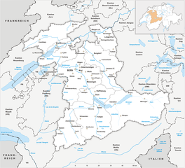
Canton of Jura (Kanton Jura)


- canton of Switzerland
 Hiking in Canton of Jura
Hiking in the Canton of Jura, Switzerland, is a fantastic experience for outdoor enthusiasts. This region is known for its stunning landscapes, rolling hills, dense forests, and picturesque Jura mountains. Here are some key points to consider if you're planning to hike in the Canton of Jura:
Trails and Routes:
-
Variety of Trails: The Canton of Jura has a wide range of hiking trails suitable for all levels, from easy walks to more challenging hikes. Popular trails often lead through scenic forests, along ridges, or to panoramic viewpoints.
-
Marked Routes: The trails are generally well-marked with signs and way markers, making navigation straightforward. You can find numerous hiking maps that detail the trails and highlight points of interest.
-
Jura Crest Trail (Jura-Höhenweg): This is one of the most famous long-distance hiking trails in the region, stretching approximately 300 kilometers from the Swiss border with France to the city of Basel. It offers breathtaking views and a diverse range of landscapes.
Highlights:
-
Scenic Views: The trail system provides stunning views of the surrounding mountains and valleys, particularly from higher elevations. Don’t miss viewpoints like Mont Tendre, which is the highest peak in the Swiss Jura.
-
Natural Parks: The Jura region is home to several natural parks and reserves, such as the Parc Jurassien Vaudois, where you can experience diverse flora and fauna.
-
Cultural Sites: While hiking, you can also explore charming villages, historical sites, and local farms, which adds a cultural aspect to your outdoor adventure.
Practical Tips:
-
Best Season: The best time to go hiking is typically from spring to early autumn (May to October), when the weather is milder and the trails are accessible.
-
Weather Preparedness: Always check the weather conditions before heading out, as mountain weather can change rapidly. Dressing in layers and carrying rain gear is advisable.
-
Safety: Keep in mind to bring plenty of water, snacks, and a first-aid kit. Inform someone of your hiking plans and expected return time.
-
Respect Nature: Stay on marked trails and follow local guidelines to help preserve the natural environment.
Additional Activities:
In addition to hiking, the Canton of Jura offers opportunities for cycling, climbing, and wildlife observation. You may also encounter local events and festivals celebrating the region's culture and traditions.
With its stunning landscapes and well-maintained trails, the Canton of Jura is a lovely destination for both experienced hikers and beginners seeking a memorable outdoor experience.
- Country:

- Capital: Delémont
- Licence Plate Code: JU
- Coordinates: 47° 22' 0" N, 7° 9' 0" E


- GPS tracks (wikiloc): [Link]
- AboveSeaLevel: 435 м m
- Area: 838.51 sq km
- Population: 69100
- Web site: http://www.jura.ch/
- Wikipedia en: wiki(en)
- Wikipedia: wiki(de)
- Wikidata storage: Wikidata: Q12755
- Wikipedia Commons Gallery: [Link]
- Wikipedia Commons Category: [Link]
- Freebase ID: [/m/01l8hj]
- GeoNames ID: Alt: [2660207]
- BnF ID: [119476408]
- VIAF ID: Alt: [155481782]
- OSM relation ID: [1697347]
- GND ID: Alt: [4029043-8]
- archINFORM location ID: [2936]
- Library of Congress authority ID: Alt: [n81033965]
- MusicBrainz area ID: [9d813baa-b047-4ca6-b9a0-1645963e679c]
- Quora topic ID: [Canton-of-Jura]
- TGN ID: [7003749]
- SUDOC authorities ID: [180678418]
- Encyclopædia Britannica Online ID: [place/Jura-canton-Switzerland]
- Gran Enciclopèdia Catalana ID: [0035141]
- HDS ID: [7399]
- ISNI: Alt: [0000 0001 2190 2634]
- NUTS code: [CH025]
- Klexikon article ID: [Jura_(Kanton)]
- BabelNet ID: [01857430n]
- NE.se ID: [jura-(kanton-schweiz)]
- STW Thesaurus for Economics ID: [16964-0]
- ISO 3166-2 code: CH-JU
- FIPS 10-4 (countries and regions): SZ26
Includes regions:


Franches-Montagnes District
- district in Switzerland
Hiking in Franches-Montagnes District
The Franches-Montagnes District, located in the Jura Mountains of Switzerland, is a hidden gem for hiking enthusiasts. This beautiful region offers a variety of trails that showcase stunning natural landscapes, charming villages, and rich cultural heritage. Here are some highlights about hiking in the area:...
- Country:
- Capital: Saignelégier
- Licence Plate Code: JU
- Coordinates: 47° 15' 0" N, 6° 59' 0" E
- GPS tracks (wikiloc): [Link]
- AboveSeaLevel: 1036 м m
- Area: 200.18 sq km

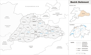
Delémont District
- district in Switzerland
Hiking in Delémont District
Delémont District, located in the Jura region of Switzerland, offers a variety of hiking opportunities that highlight its stunning landscapes, unique geology, and rich cultural heritage. Here are some highlights and tips for hiking in this beautiful area:...
- Country:
- Capital: Delémont
- Licence Plate Code: JU
- Coordinates: 47° 21' 0" N, 7° 20' 0" E
- GPS tracks (wikiloc): [Link]
- AboveSeaLevel: 424 м m
- Area: 303.10 sq km


Porrentruy District
- district in Switzerland
Hiking in Porrentruy District
Porrentruy District, located in the Swiss Jura region, offers a fantastic array of hiking opportunities, showcasing stunning landscapes, rich history, and diverse ecosystems. Here are some highlights for hiking in this area:...
- Country:
- Capital: Porrentruy
- Licence Plate Code: JU
- Coordinates: 47° 25' 0" N, 7° 4' 0" E
- GPS tracks (wikiloc): [Link]
- AboveSeaLevel: 440 м m
- Area: 335.12 sq km
Shares border with regions:

canton of Bern
- canton of Switzerland
Hiking in canton of Bern
The Canton of Bern, located in Switzerland, offers some of the most stunning landscapes and diverse trails for hiking enthusiasts. This region boasts a mix of alpine scenery, picturesque villages, and lush valleys, making it an excellent destination for all levels of hikers. Here are some highlights you can expect when hiking in the Canton of Bern:...
- Country:
- Capital: Bern
- Licence Plate Code: BE
- Coordinates: 46° 50' 0" N, 7° 37' 0" E
- GPS tracks (wikiloc): [Link]
- AboveSeaLevel: 542 м m
- Area: 5959 sq km
- Population: 1031126
- Web site: [Link]

Canton of Solothurn
- canton of Switzerland
Hiking in Canton of Solothurn
Hiking in the Canton of Solothurn offers a fantastic blend of natural beauty, historical sites, and picturesque villages. Located in Switzerland, Solothurn is known for its picturesque landscapes, ranging from rolling hills to stunning valleys and the scenic banks of the River Aare....
- Country:
- Capital: Solothurn
- Licence Plate Code: SO
- Coordinates: 47° 9' 0" N, 7° 38' 0" E
- GPS tracks (wikiloc): [Link]
- AboveSeaLevel: 432 м m
- Area: 790.45 sq km
- Web site: [Link]


Basel-Landschaft
- canton of Switzerland
Hiking in Basel-Landschaft
Hiking in the Canton of Basel-Landschaft, located in Switzerland, offers an excellent opportunity to explore the region's beautiful landscapes, charming villages, and diverse ecosystems. Here are some key points to consider when planning your hike in this area:...
- Country:
- Capital: Liestal
- Licence Plate Code: BL
- Coordinates: 47° 27' 47" N, 7° 45' 21" E
- GPS tracks (wikiloc): [Link]
- AboveSeaLevel: 327 м m
- Area: 517.67 sq km
- Web site: [Link]

Haut-Rhin
- French department
Hiking in Haut-Rhin
Haut-Rhin, located in the Alsace region of France, offers some stunning hiking opportunities. The region is characterized by its picturesque landscapes, charming villages, and a rich cultural heritage, making it an excellent destination for hikers of all levels. Here are some highlights and tips for hiking in Haut-Rhin:...
- Country:

- Capital: Colmar
- Coordinates: 47° 57' 51" N, 7° 19' 11" E
- GPS tracks (wikiloc): [Link]
- Area: 3525 sq km
- Population: 762743
- Web site: [Link]

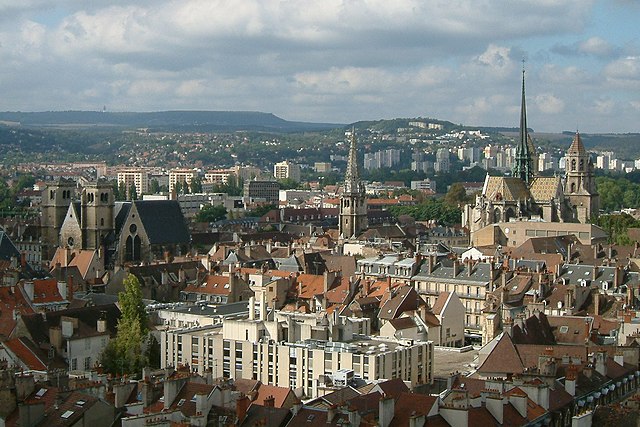
Canton of Neuchâtel
- canton of Switzerland
Hiking in Canton of Neuchâtel
The Canton of Neuchâtel, located in western Switzerland, is a stunning area for hiking, featuring a diverse landscape that ranges from rolling hills and deep forests to beautiful lakes and mountainous areas. Here are some highlights and tips for hiking in this picturesque region:...
- Country:
- Capital: Neuchâtel
- Licence Plate Code: NE
- Coordinates: 46° 59' 0" N, 6° 47' 0" E
- GPS tracks (wikiloc): [Link]
- AboveSeaLevel: 430 м m
- Area: 802.24 sq km
- Web site: [Link]
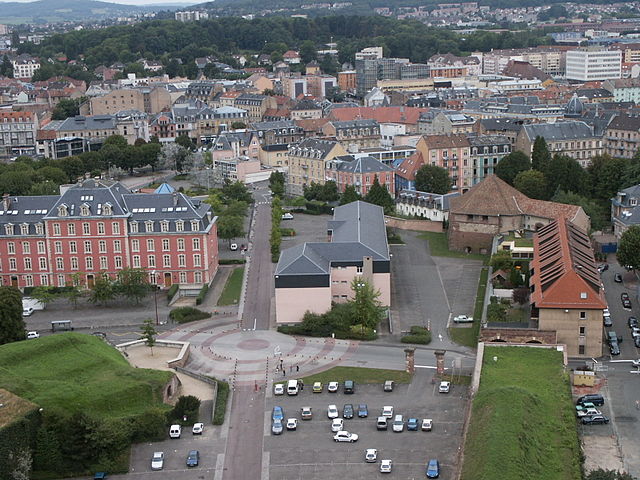

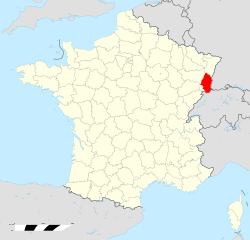
Territoire de Belfort
- French department
Hiking in Territoire de Belfort
The Territoire de Belfort, located in the Bourgogne-Franche-Comté region of eastern France, offers a variety of hiking opportunities amidst its diverse landscapes. Here are some key aspects of hiking in this area:...
- Country:
- Capital: Belfort
- Coordinates: 47° 45' 0" N, 7° 0' 0" E
- GPS tracks (wikiloc): [Link]
- Area: 609.4 sq km
- Population: 144483
- Web site: [Link]
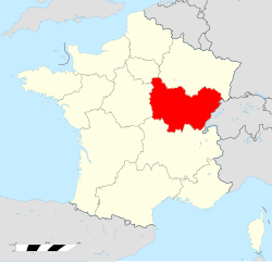
Bourgogne-Franche-Comté
- region of France
Hiking in Bourgogne-Franche-Comté
Bourgogne-Franche-Comté, located in east-central France, is a region rich in natural beauty, history, and diverse landscapes, making it an excellent destination for hiking enthusiasts. Here are some highlights to consider when planning your hiking adventures in the area:...
- Country:
- Capital: Dijon
- Coordinates: 47° 14' 4" N, 6° 1' 50" E
- GPS tracks (wikiloc): [Link]
- Area: 47784 sq km
- Population: 2820940
- Web site: [Link]
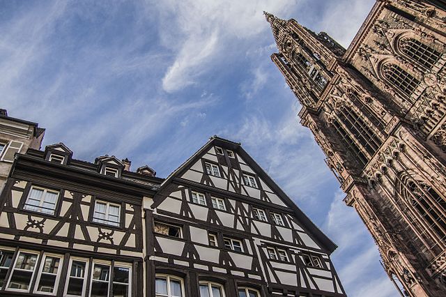

Grand Est
- administrative region of France
Hiking in Grand Est
Grand Est, a beautiful region in northeastern France, offers a diverse array of hiking opportunities. The region is characterized by a mix of picturesque landscapes, including rolling hills, vineyards, dense forests, and the stunning Vosges Mountains. Here are some key points about hiking in Grand Est:...
- Country:
- Capital: Strasbourg
- Coordinates: 48° 35' 56" N, 7° 45' 36" E
- GPS tracks (wikiloc): [Link]
- Area: 57433 sq km
- Population: 5555186
- Web site: [Link]

Doubs
- French department with 3 arrondissements
Hiking in Doubs
Hiking in the Doubs region, located in eastern France, offers stunning landscapes and a rich natural heritage. The Doubs department is known for its rugged terrain, deep valleys, and diverse ecosystems, making it a wonderful destination for outdoor enthusiasts. Here are some highlights and recommendations for hiking in the area:...
- Country:
- Capital: Besançon
- Coordinates: 47° 10' 0" N, 6° 25' 0" E
- GPS tracks (wikiloc): [Link]
- Area: 5234 sq km
- Population: 536959
- Web site: [Link]