Port-Villez (Port-Villez)

- commune in Yvelines, France
- Country:

- Postal Code: 78270
- Coordinates: 49° 3' 44" N, 1° 31' 21" E


- GPS tracks (wikiloc): [Link]
- Area: 5.35 sq km
- Population: 244
- Wikipedia en: wiki(en)
- Wikipedia: wiki(fr)
- Wikidata storage: Wikidata: Q954176
- Wikipedia Commons Category: [Link]
- Freebase ID: [/m/03qg35h]
- Freebase ID: [/m/03qg35h]
- GeoNames ID: Alt: [2985923]
- GeoNames ID: Alt: [2985923]
- SIREN number: [217805035]
- SIREN number: [217805035]
- BnF ID: [15276071m]
- BnF ID: [15276071m]
- INSEE municipality code: 78503
- INSEE municipality code: 78503
Shares border with regions:

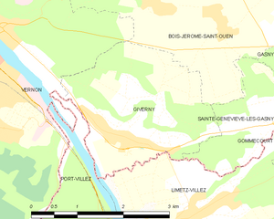
Giverny
- commune in Eure, France
- Country:
- Postal Code: 27620
- Coordinates: 49° 4' 34" N, 1° 31' 45" E
- GPS tracks (wikiloc): [Link]
- AboveSeaLevel: 17 м m
- Area: 6.46 sq km
- Population: 509
- Web site: [Link]


Vernon
- commune in Eure, France
- Country:
- Postal Code: 27200
- Coordinates: 49° 5' 30" N, 1° 29' 6" E
- GPS tracks (wikiloc): [Link]
- Area: 34.92 sq km
- Population: 23797
- Web site: [Link]

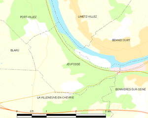
Jeufosse
- commune in Yvelines, France
- Country:
- Postal Code: 78270
- Coordinates: 49° 2' 16" N, 1° 31' 43" E
- GPS tracks (wikiloc): [Link]
- Area: 3.57 sq km
- Population: 415
- Web site: [Link]

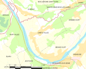
Limetz-Villez
- commune in Yvelines, France
- Country:
- Postal Code: 78270
- Coordinates: 49° 3' 40" N, 1° 32' 55" E
- GPS tracks (wikiloc): [Link]
- AboveSeaLevel: 20 м m
- Area: 9.35 sq km
- Population: 1938


Blaru
- commune in Yvelines, France
- Country:
- Postal Code: 78270
- Coordinates: 49° 2' 56" N, 1° 28' 42" E
- GPS tracks (wikiloc): [Link]
- Area: 14.84 sq km
- Population: 899

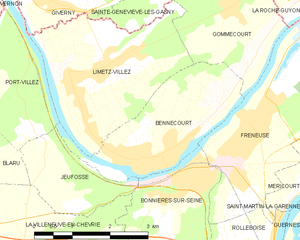
Bennecourt
- commune in Yvelines, France
- Country:
- Postal Code: 78270
- Coordinates: 49° 2' 25" N, 1° 33' 44" E
- GPS tracks (wikiloc): [Link]
- Area: 6.95 sq km
- Population: 1832