Pottenstein (Pottenstein)
- municipality in Austria
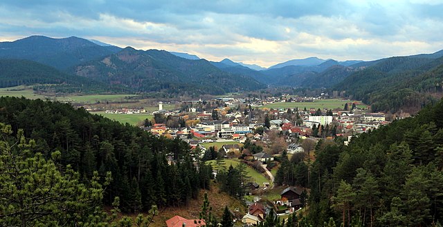
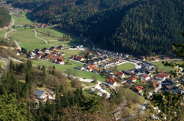
Pottenstein, located in the picturesque Upper Austria region, is a fantastic destination for hiking enthusiasts. This charming village is nestled in a scenic valley surrounded by lush forests, rolling hills, and stunning limestone formations, making it an ideal spot for outdoor adventures.
Hiking Trails:
-
The Gaflenz Valley: This area offers a variety of trails, both easy and challenging. The trails weave through beautiful landscapes, past waterfalls, and along the Gaflenz River.
-
Holzweg Trail: A popular route that allows hikers to immerse themselves in the natural beauty of the region. The trail features wooden information boards that educate about local flora and fauna.
-
Kletterschule Pottenstein: For those looking to combine hiking with climbing, the nearby climbing school offers guided tours in a stunning natural environment.
-
Caves and Summits: Don’t miss the nearby caves, like the “Teufelshöhle” (Devil’s Cave), which can be explored with short hikes. For panoramic views, hike up to the surrounding hills and summits.
Tips for Hiking in Pottenstein:
-
Seasonal Considerations: Spring and fall generally provide the most pleasant weather for hiking. Summer can be quite warm, while winter may offer unique opportunities for snowshoeing.
-
Navigation: While many trails are well-marked, it’s advisable to have a map or use a GPS app, especially on more remote paths.
-
Safety: Ensure that you wear sturdy footwear and carry enough water and snacks. Check local weather conditions before heading out.
-
Wildlife: Be aware of local wildlife and follow guidelines to ensure both your safety and that of the animals.
Conclusion:
Pottenstein is a hidden gem for hikers looking for stunning natural beauty, diverse trails, and a peaceful atmosphere. Whether you’re a beginner or an experienced hiker, the area has something to offer everyone. Enjoy your hike and the breathtaking scenery that Upper Austria has to provide!
- Country:

- Local Dialing Code: 02672
- Licence Plate Code: BN
- Coordinates: 47° 57' 0" N, 16° 5' 0" E


- GPS tracks (wikiloc): [Link]
- AboveSeaLevel: 324 м m
- Area: 33.4 sq km
- Population: 2909
- Web site: http://www.pottenstein.at
- Wikipedia en: wiki(en)
- Wikipedia: wiki(de)
- Wikidata storage: Wikidata: Q693530
- Wikipedia Commons Category: [Link]
- Freebase ID: [/m/02qssvc]
- GeoNames ID: Alt: [7871714]
- archINFORM location ID: [6465]
- MusicBrainz area ID: [ab68bf25-d2b4-45be-b5fe-886737ff2d0e]
- Austrian municipality key: [30627]
Shares border with regions:
Weissenbach an der Triesting
- municipality in Austria
 Hiking in Weissenbach an der Triesting
Weissenbach an der Triesting is a picturesque village in Lower Austria, situated along the Triesting River, surrounded by beautiful landscapes that make it an attractive destination for hiking enthusiasts. The region offers a variety of trails, each catering to different skill levels, allowing hikers to immerse themselves in nature while enjoying the scenic beauty of the area....
- Country:

- Local Dialing Code: 02674
- Licence Plate Code: BN
- Coordinates: 47° 58' 54" N, 16° 2' 17" E


- GPS tracks (wikiloc): [Link]
- AboveSeaLevel: 362 м m
- Area: 15.93 sq km
- Population: 1727
- Web site: [Link]

Berndorf, Lower Austria
- municipality in Austria
 Hiking in Berndorf, Lower Austria
Berndorf, located in Lower Austria, is a picturesque town that offers various hiking opportunities amidst beautiful natural scenery. The area is characterized by rolling hills, forests, and stunning views of the surrounding landscapes....
- Country:

- Postal Code: 2560
- Local Dialing Code: 02672
- Licence Plate Code: BN
- Coordinates: 47° 56' 34" N, 16° 6' 13" E


- GPS tracks (wikiloc): [Link]
- AboveSeaLevel: 314 м m
- Area: 17.57 sq km
- Population: 9064
- Web site: [Link]

Pernitz
- municipality in Austria
Pernitz is a charming village located in the Lower Austria region of Austria, surrounded by the picturesque landscapes of the Wienerwald (Vienna Woods). Hiking in Pernitz offers hikers a fantastic opportunity to explore stunning natural scenery, rich biodiversity, and historical sites, making it an excellent destination for outdoor enthusiasts....
- Country:

- Local Dialing Code: 02632
- Licence Plate Code: WB
- Coordinates: 47° 54' 0" N, 15° 58' 0" E


- GPS tracks (wikiloc): [Link]
- AboveSeaLevel: 430 м m
- Area: 16.59 sq km
- Population: 2473
- Web site: [Link]


Muggendorf
- municipality in Austria
Muggendorf, located in the scenic region of Lower Austria, is known for its beautiful landscapes and rich natural diversity, making it a fantastic destination for hikers. Situated near the Vienna Woods, the area offers a variety of trails suitable for different skill levels. Here are some highlights of hiking in Muggendorf:...
- Country:

- Postal Code: 2763
- Local Dialing Code: 02632
- Licence Plate Code: WB
- Coordinates: 47° 54' 0" N, 15° 56' 0" E


- GPS tracks (wikiloc): [Link]
- AboveSeaLevel: 450 м m
- Area: 50.93 sq km
- Population: 528
- Web site: [Link]
Furth an der Triesting
- municipality in Austria
 Hiking in Furth an der Triesting
Furth an der Triesting is a picturesque village located in Lower Austria, surrounded by beautiful landscapes and outdoor activities, making it an excellent destination for hiking enthusiasts. The area is characterized by rolling hills, lush forests, and the serene Triesting River, which adds to the scenic beauty of the region....
- Country:

- Postal Code: 2564
- Local Dialing Code: 0 26 74
- Licence Plate Code: BN
- Coordinates: 47° 58' 22" N, 15° 58' 24" E


- GPS tracks (wikiloc): [Link]
- AboveSeaLevel: 422 м m
- Area: 64.20 sq km
- Population: 862
- Web site: [Link]

Hernstein
- municipality in Austria
Hernstein is a village in Austria, located in the state of Lower Austria. It's situated near the rolling hills and picturesque landscapes typical of this region, which makes it an attractive spot for hiking enthusiasts....
- Country:

- Postal Code: 2560
- Local Dialing Code: 02672; 02633
- Licence Plate Code: BN
- Coordinates: 47° 53' 40" N, 16° 6' 21" E


- GPS tracks (wikiloc): [Link]
- AboveSeaLevel: 438 м m
- Area: 46.58 sq km
- Population: 1540
- Web site: [Link]


Bad Vöslau
- municipality in Austria
Bad Vöslau, located in the Lower Austria region, is a charming destination for hiking enthusiasts. Surrounded by picturesque landscapes and vineyards, it offers a range of trails suitable for various skill levels. Here are some highlights and recommendations for hiking in the area:...
- Country:

- Postal Code: 2540
- Local Dialing Code: 02252
- Licence Plate Code: BN
- Coordinates: 47° 58' 1" N, 16° 12' 52" E


- GPS tracks (wikiloc): [Link]
- AboveSeaLevel: 276 м m
- Area: 39.11 sq km
- Population: 11844
- Web site: [Link]
