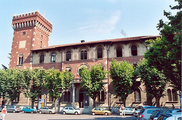
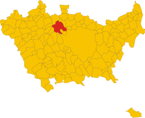
Pregnana Milanese (Pregnana Milanese)
.svg)
- Italian comune
 Hiking in Pregnana Milanese
Pregnana Milanese is a small town located in the Lombardy region of Italy, just northwest of Milan. While it may not be as widely recognized for hiking as some of the larger national parks or mountainous areas in Italy, it can still offer some opportunities for outdoor activities and hikes, particularly in its surrounding areas.
Hiking Options:
-
Local Parks and Green Spaces:
- Explore local parks in and around Pregnana Milanese, such as Parco di Villa Litta. It may not be a traditional hiking area, but it offers walking paths and beautiful scenery, ideal for easy strolls in nature.
-
Surrounding Trails:
- The vicinity around Pregnana offers various trails. You can head towards the nearby Parco dei Fontanili or Parco della Valle del Lambro, where you can find more substantial walking and biking paths amidst nature.
-
Day Trips:
- Consider venturing a bit further to regions like the Ticino Natural Park or the pre-Alps in the Varese area. These areas have more extensive hiking trails and are reachable within a short drive or train ride.
-
Cultural Hikes:
- Since the region has a rich cultural heritage, you can plan hikes that incorporate visits to historical sites and towns, blending nature with local history and architecture.
Tips for Hiking in the Area:
- Check Maps and Trails: Always consult local maps or hiking apps to find detailed routes and ensure you're on well-marked trails.
- Weather Preparation: Check the weather before heading out, as conditions can change quickly, particularly in the spring and fall.
- Safety First: Carry enough water, snacks, a first aid kit, and appropriate gear for varying terrain and conditions.
- Respect Nature: Follow Leave No Trace principles to preserve the beauty of the natural environment.
Conclusion
While Pregnana Milanese itself may not have extensive hiking opportunities, it serves as a good starting point to access nature in the surrounding areas and experience the blend of picturesque Italian culture and outdoor activities. Happy hiking!
- Country:

- Postal Code: 20010
- Local Dialing Code: 02
- Licence Plate Code: MI
- Coordinates: 45° 31' 0" N, 9° 1' 0" E


- GPS tracks (wikiloc): [Link]
- AboveSeaLevel: 154 м m
- Area: 5.07 sq km
- Population: 7306
- Web site: http://www.comune.pregnana.mi.it/
- Wikipedia en: wiki(en)
- Wikipedia: wiki(it)
- Wikidata storage: Wikidata: Q42457
- Wikipedia Commons Category: [Link]
- Freebase ID: [/m/032fyw]
- GeoNames ID: Alt: [6543744]
- VIAF ID: Alt: [161019177]
- OSM relation ID: [45174]
- UN/LOCODE: [ITPRM]
- ISTAT ID: 015179
- Italian cadastre code: H026
Shares border with regions:


Cornaredo
- Italian comune
Hiking in Cornaredo
Cornaredo is a municipality located in the province of Milan, Italy. While it's not primarily known for hiking like some more mountainous areas in Italy, there are still opportunities for outdoor activities and walks in the surrounding landscape....
- Country:
- Postal Code: 20010
- Local Dialing Code: 02
- Licence Plate Code: MI
- Coordinates: 45° 30' 0" N, 9° 2' 0" E
- GPS tracks (wikiloc): [Link]
- AboveSeaLevel: 145 м m
- Area: 11.07 sq km
- Population: 20499
- Web site: [Link]


Pogliano Milanese
- Italian comune
Hiking in Pogliano Milanese
Pogliano Milanese, located just outside of Milan, is not primarily known for extensive hiking trails like you might find in more mountainous areas, but it does offer some pleasant walking and nature opportunities. Here are a few aspects to consider when hiking around Pogliano Milanese:...
- Country:
- Postal Code: 20010
- Local Dialing Code: 02
- Licence Plate Code: MI
- Coordinates: 45° 32' 0" N, 9° 0' 0" E
- GPS tracks (wikiloc): [Link]
- AboveSeaLevel: 127 м m
- Area: 4.78 sq km
- Population: 8379
- Web site: [Link]
Rho
- municipality in the metropolitan city of Milan
Hiking in Rho
Rho, located in the Lombardy region of Italy, is primarily known for its urban environment and proximity to Milan, but it also offers access to some beautiful natural areas and hiking opportunities in the surrounding surroundings. While Rho itself may not have extensive hiking trails, it serves as a great starting point to explore nearby parks and nature reserves....
- Country:
- Postal Code: 20017
- Local Dialing Code: 02
- Licence Plate Code: MI
- Coordinates: 45° 32' 0" N, 9° 2' 0" E
- GPS tracks (wikiloc): [Link]
- AboveSeaLevel: 156 м m
- Area: 22.24 sq km
- Population: 50767
- Web site: [Link]
Bareggio
- Italian comune
Hiking in Bareggio
Bareggio, located in the Lombardy region of Italy, is primarily known for its charming landscapes, historical sites, and green spaces rather than extensive hiking trails. However, it can serve as a good starting point for exploring the surrounding natural areas....
- Country:
- Postal Code: 20010
- Local Dialing Code: 02
- Licence Plate Code: MI
- Coordinates: 45° 28' 0" N, 8° 59' 0" E
- GPS tracks (wikiloc): [Link]
- AboveSeaLevel: 138 м m
- Area: 11.38 sq km
- Population: 17364
- Web site: [Link]


Sedriano
- Italian comune
Hiking in Sedriano
Sedriano is a charming town located in the Lombardy region of Italy, near Milan. While Sedriano itself may not be primarily known as a hiking destination, there are several nearby areas and trails that outdoor enthusiasts can explore....
- Country:
- Postal Code: 20018
- Local Dialing Code: 02
- Licence Plate Code: MI
- Coordinates: 45° 29' 0" N, 8° 58' 0" E
- GPS tracks (wikiloc): [Link]
- AboveSeaLevel: 145 м m
- Area: 7.75 sq km
- Population: 12099
- Web site: [Link]
Vanzago
- Italian comune
Hiking in Vanzago
Vanzago, located in the Lombardy region of Italy, is primarily known as a small town near Milan. While it may not be as famous for hiking as some of the more mountainous regions of Italy, there are still opportunities for outdoor activities and walking trails in and around the area. Here’s a brief overview:...
- Country:
- Postal Code: 20010
- Local Dialing Code: 02
- Licence Plate Code: MI
- Coordinates: 45° 32' 0" N, 9° 0' 0" E
- GPS tracks (wikiloc): [Link]
- AboveSeaLevel: 154 м m
- Area: 6.05 sq km
- Population: 9175
- Web site: [Link]